


Nagurumi Castle Ruins in Minakami: The Sanada Outpost Behind the 1590 Odawara Campaign — What to See, Free Guides and Access
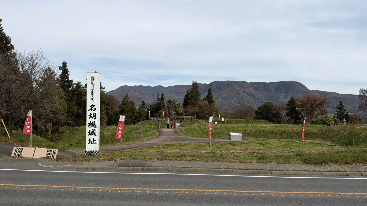
Nagurumi Castle (sometimes spelled Nakurumi) stood at the tip of a river terrace in Minakami, a mountain town in Gunma Prefecture north of Tokyo. In 1589 a Hojo commander seized it from the Sanada clan, and Toyotomi Hideyoshi used the incident as his reason to attack the Hojo at Odawara the next year. What remains is a line of earthwork enclosures divided by dry moats; there was never a castle tower here. I drove up on the morning of November 14, 2026, and toured it with a volunteer guide.
Japanese castles of the 16th century were mostly not the white towers seen in Himeji or Osaka. Many were yamajiro, “mountain castles”: strongpoints made by cutting the ground into flat enclosures (kuruwa) separated by moats and banks. Nagurumi is one of these. Its enclosures run in a line along the tip of the terrace, divided by dry moats that you cross on wooden bridges. At the far end, Sasa-kuruwa, fields and villages open out below.
I expected to climb a mountain, but the castle sits on a high, flat terrace. From the parking lot you walk straight in without any hill path.
In this guide
What you can see at Nagurumi Castle: enclosures, moats, gates, bridges and Sasa-kuruwa
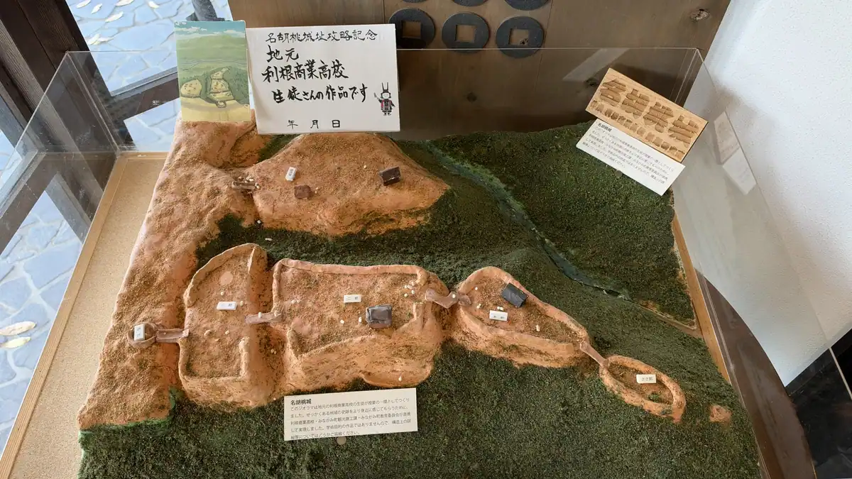
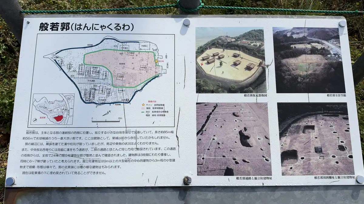
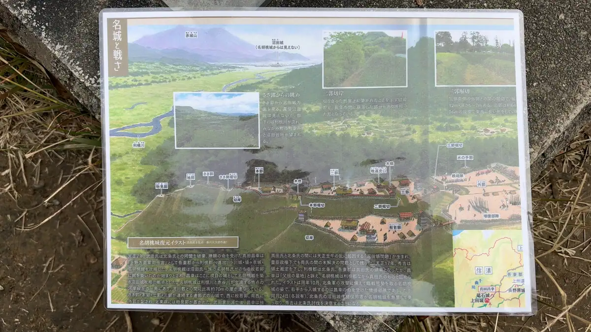
Nagurumi was built on a terrace near where the Akaya River meets the Tone River, with cliffs on three sides (Minakami Tourism Association). From the entrance side, the main chain of enclosures runs from the third enclosure to the second enclosure, the main enclosure and Sasa-kuruwa; Hannya-kuruwa, a separate plateau to the west, is now the parking lot (boards at the site). On the layout map at the information center they form a long, narrow chain.
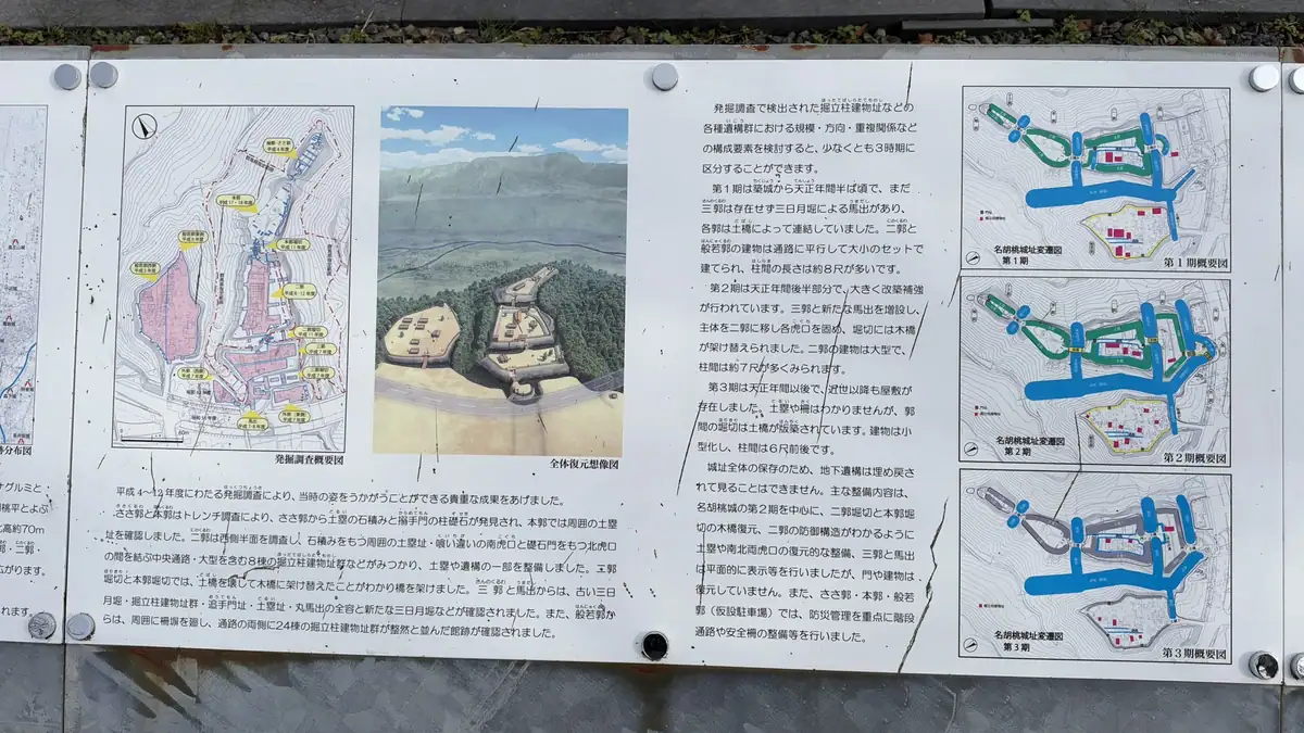
| Original landforms | The enclosures along the tip of the terrace, the dry moats and the banks |
|---|---|
| Rebuilt from excavations | Outlines of buildings marked on the ground in the second and third enclosures, and the earthen banks and entrances (koguchi) of the second enclosure, reshaped from the excavation results. No gate or building was rebuilt (board at the site). The tourism association says these were laid out in 2015 |
| Reburied | The remains found in Hannya-kuruwa (now the parking lot) and Sasa-kuruwa, covered over to protect them |
| Added later | The monument, stone posts, and the wooden bridges (built where excavations found the castle's own bridges), stairs, handrails, fences and boards for visitors. None of these are from the Sengoku period |
| Not there | A castle tower. The board in the main enclosure says the castle never had one |
Hannya-kuruwa: the enclosure that is now the parking lot
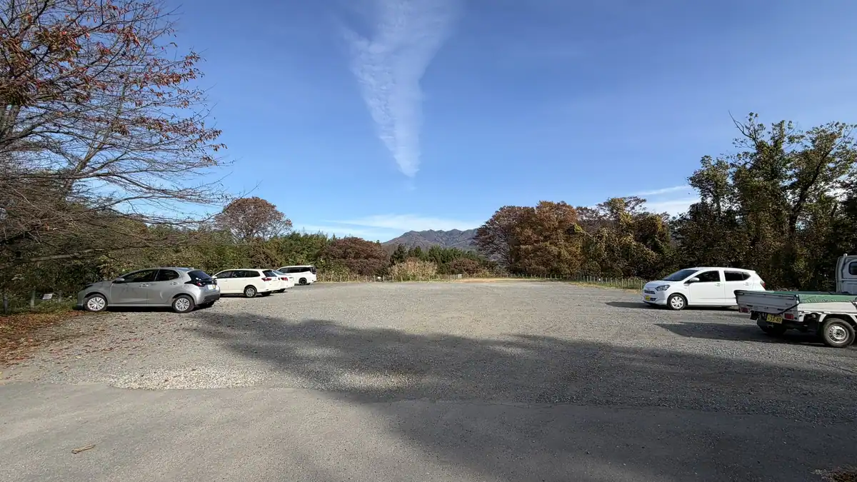
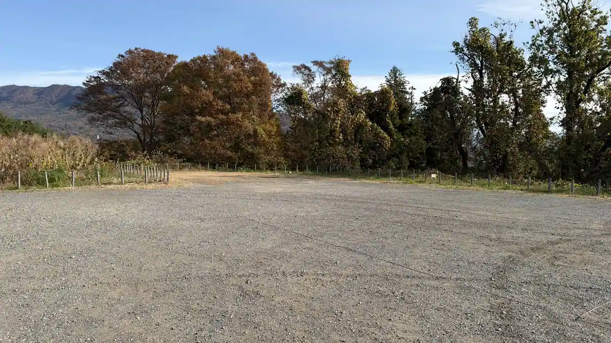
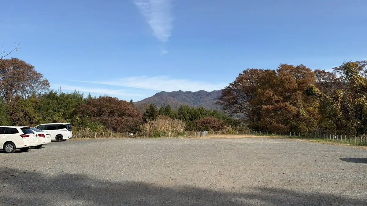
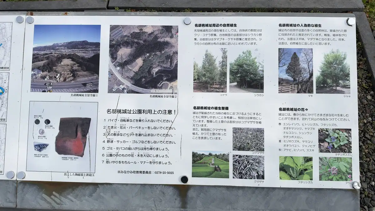
Hannya-kuruwa is now the site's parking lot. Excavations found building remains and ditches, and it is thought to have held the castle's residence. The finds were reburied to protect them, so nothing shows on the surface; a board shows where the buildings stood.
Tap a photo to enlarge
The third enclosure and the umadashi
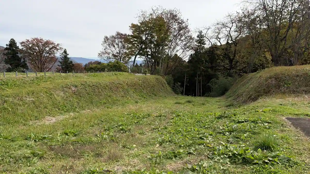
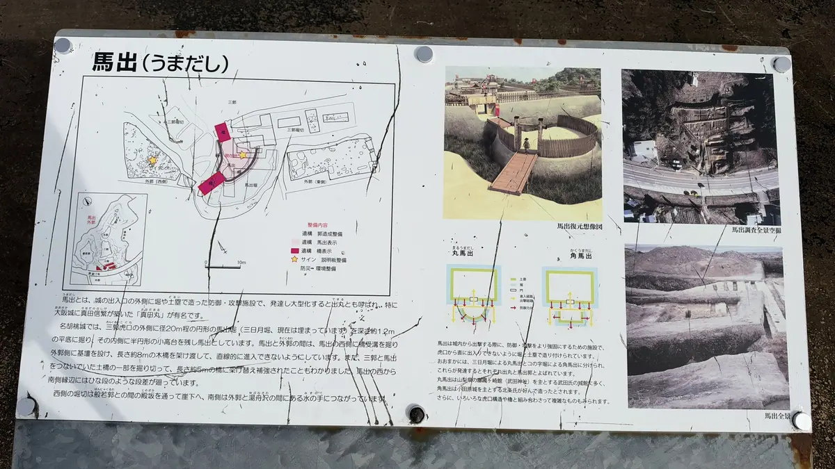
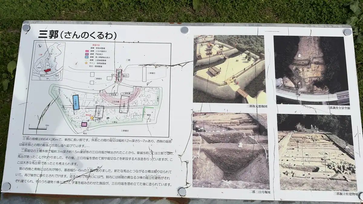
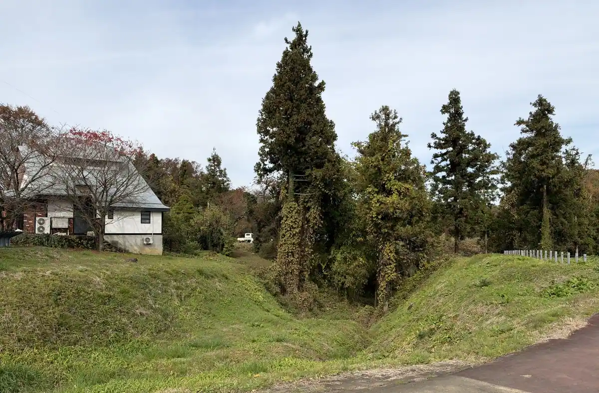
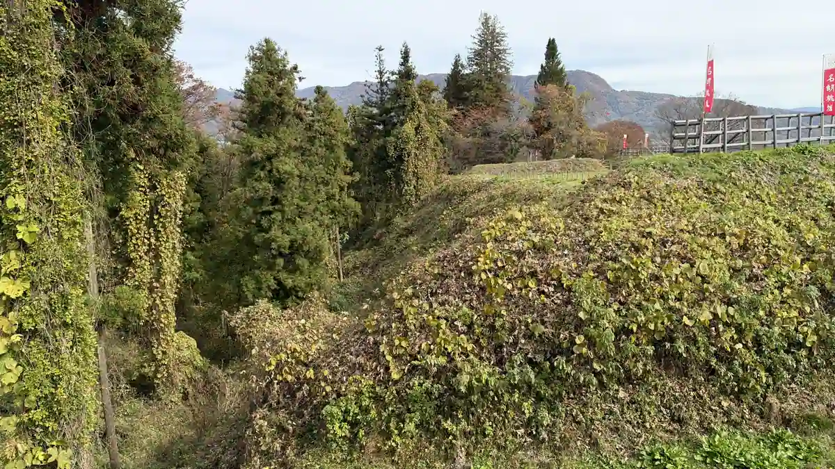
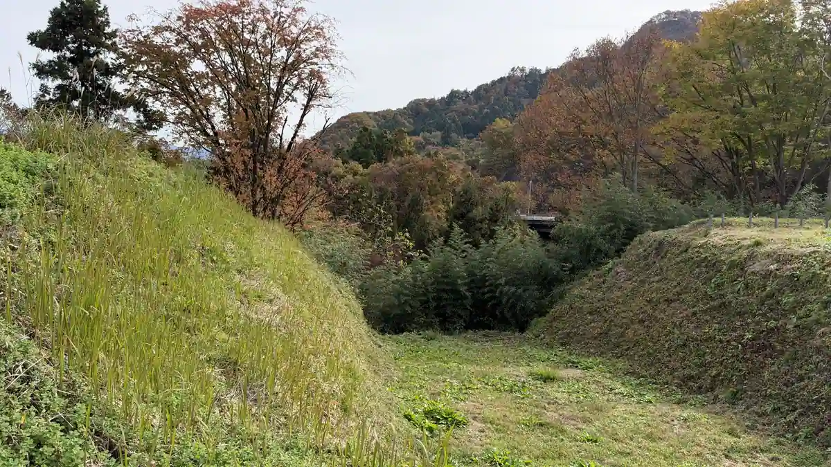
The third enclosure, nearest the road entrance, is a wide flat area with low banks on both sides. Its board explains the umadashi, a small outwork that protected a gate, and shows building remains and crescent-shaped moats from different periods. The moats are grassed over, but they drop away steeply right beside the path.
Tap a photo to enlarge
The second enclosure: wooden bridge, south gate and building outlines
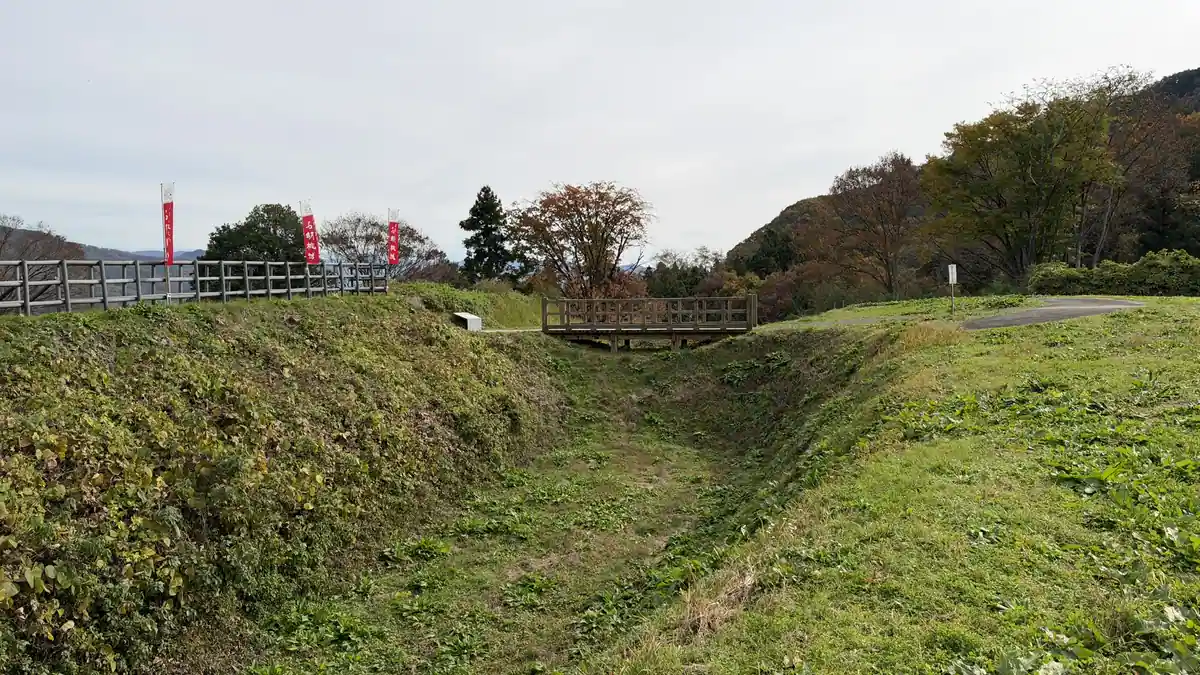
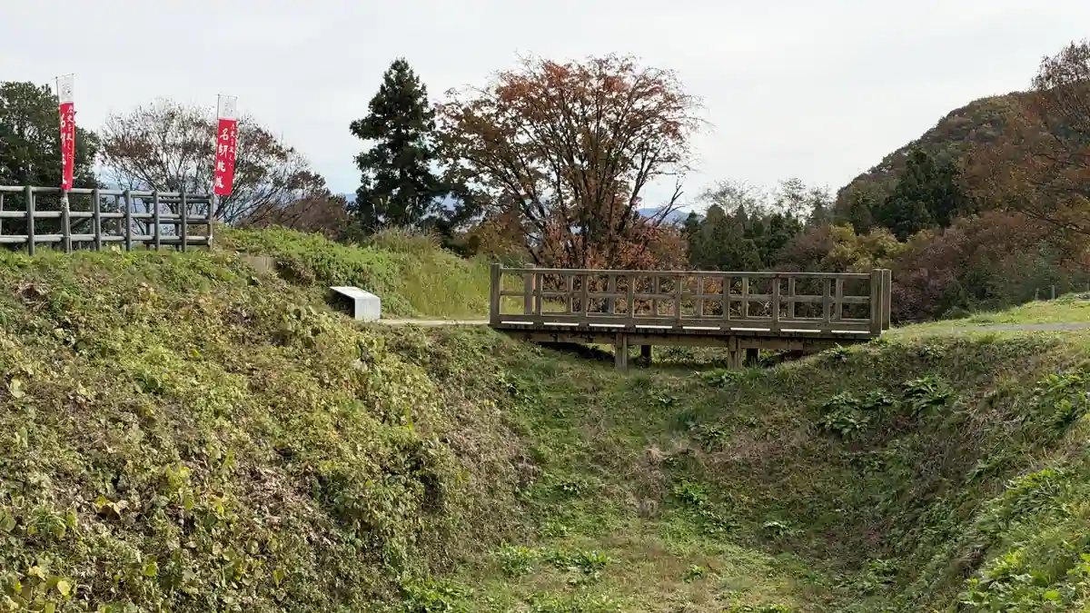
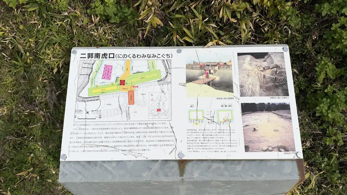
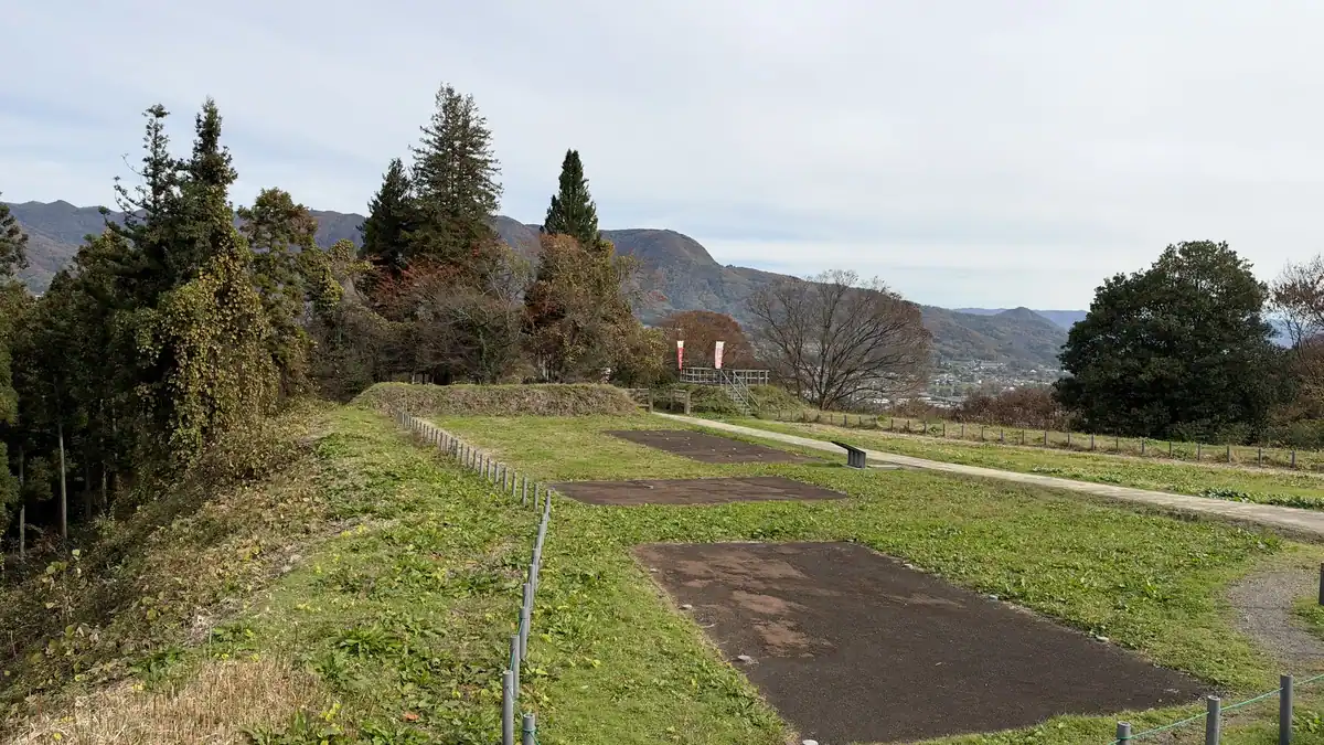
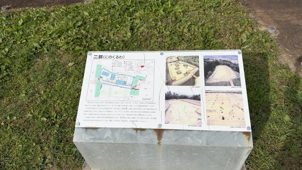
From the third enclosure you cross a moat on a wooden bridge into the second. The bridge was built for visitors; it is not a Sengoku-period bridge. The south gate of the second enclosure is offset, so you cannot walk straight in, a common defensive design. On the ground, color-coded markers show the buildings found by excavation, on both sides of a central passage.
Tap a photo to enlarge
From the north gate to the main enclosure
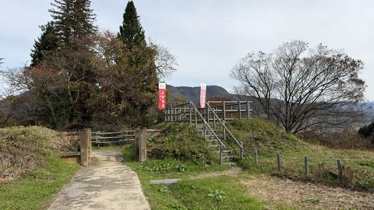
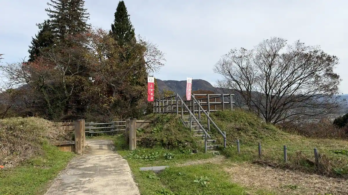
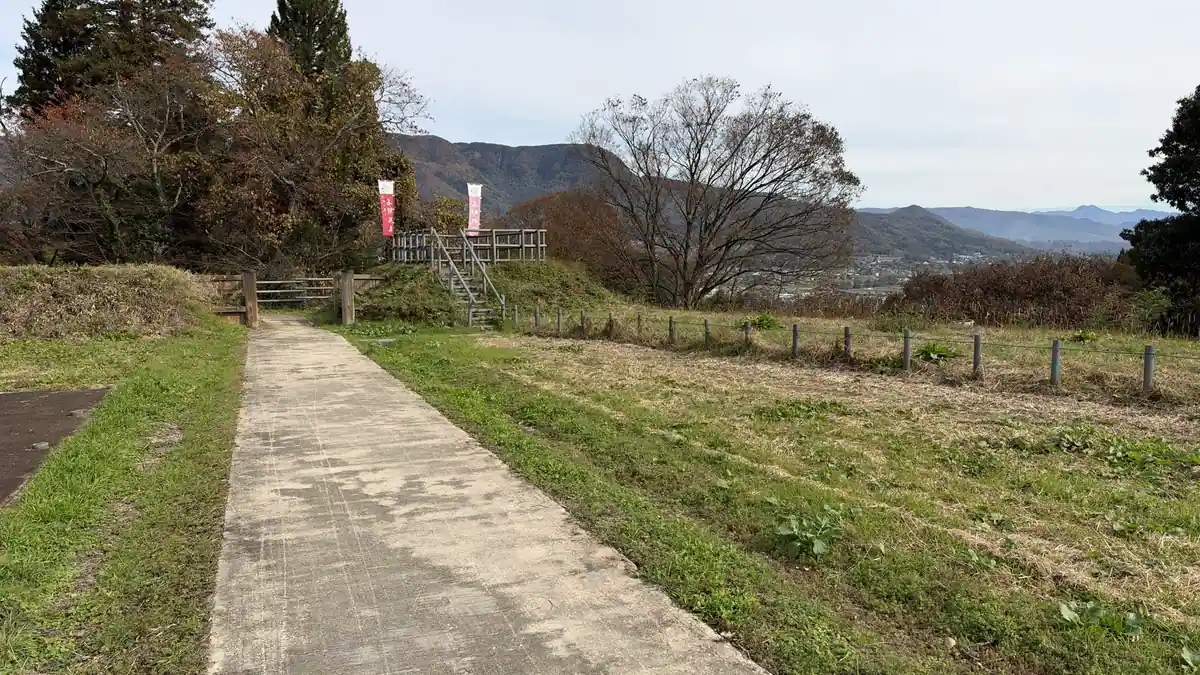
The north end of the second enclosure is the north gate. Its board shows photos of the gate's foundation stones and a ditch found there. Beyond the gate, a wooden bridge crosses the moat to the main enclosure, with steps up the rise beside it.
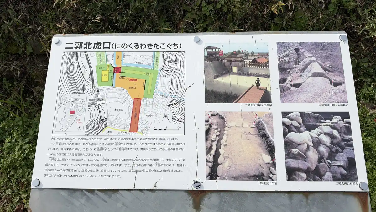
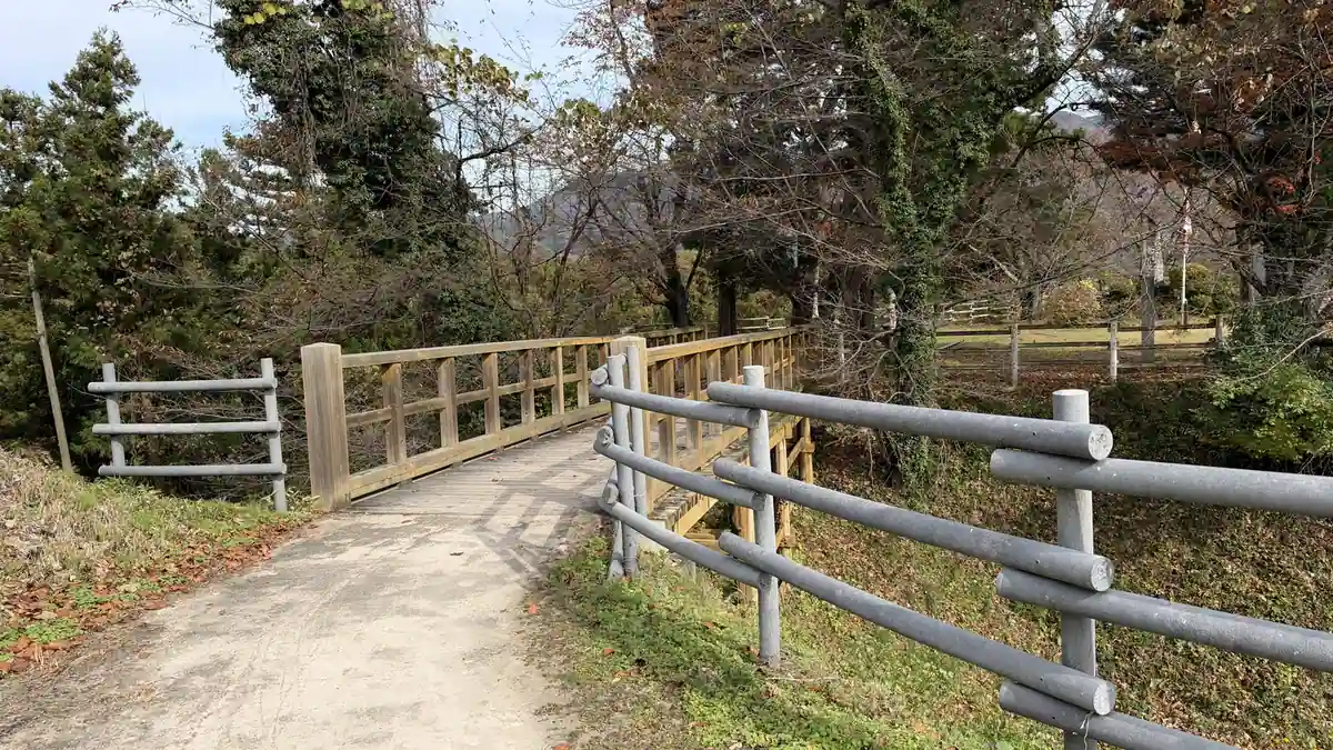
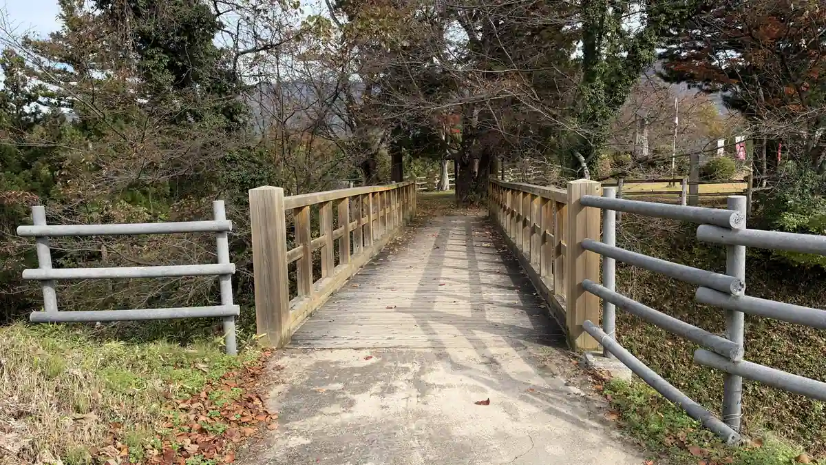
Tap a photo to enlarge
The main enclosure and the castle monument
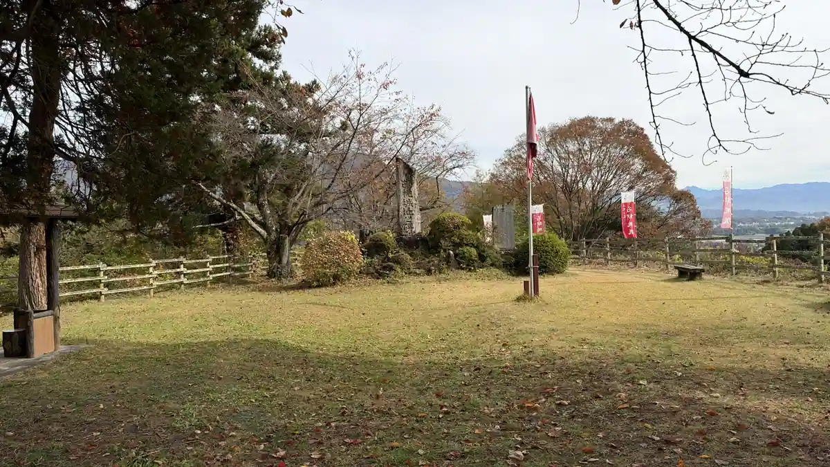
The main enclosure is a wide area at the far end of the castle. Its board says the castle had no tower and that the layout of its buildings is not known. In the middle of the grass stands the large Nagurumi Castle Site monument, with a stone post and benches. The monument was put up by a local preservation society, and its title is said to be written by the journalist and historian Tokutomi Soho.
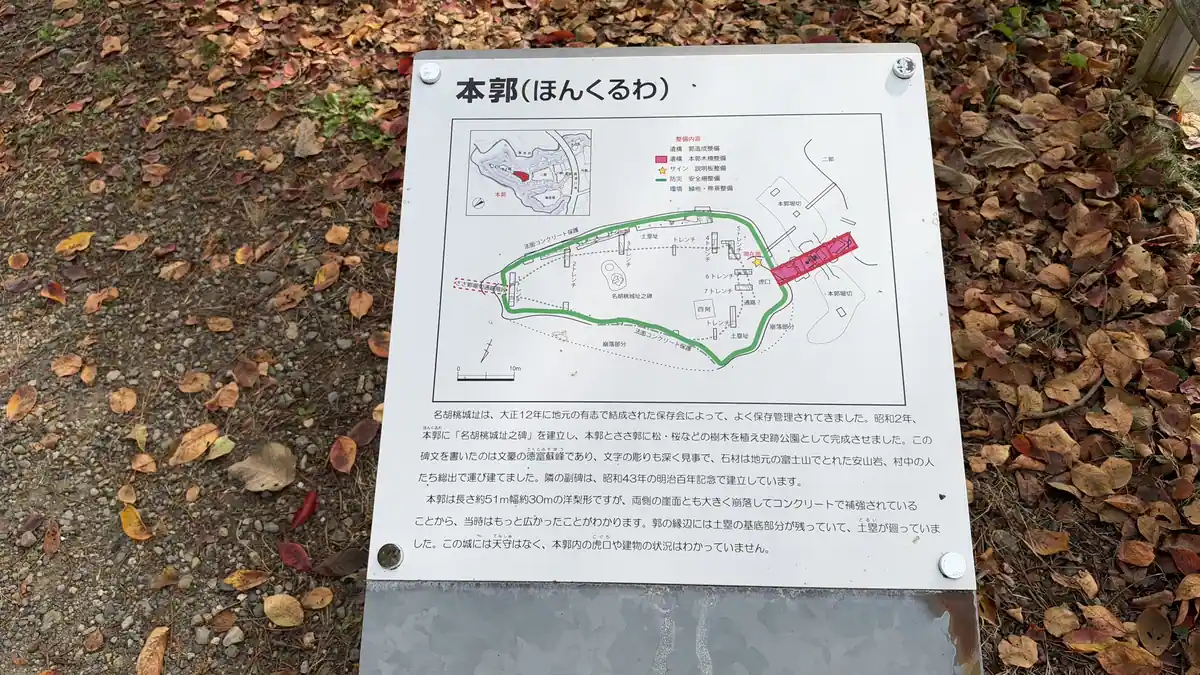
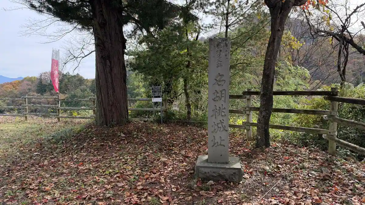
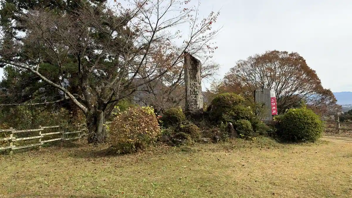
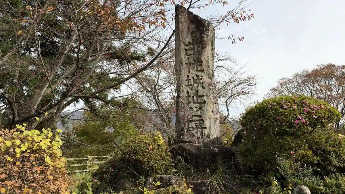
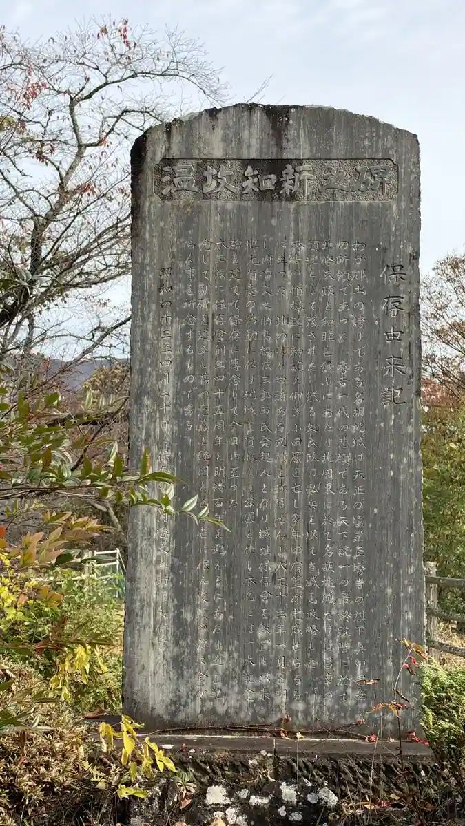
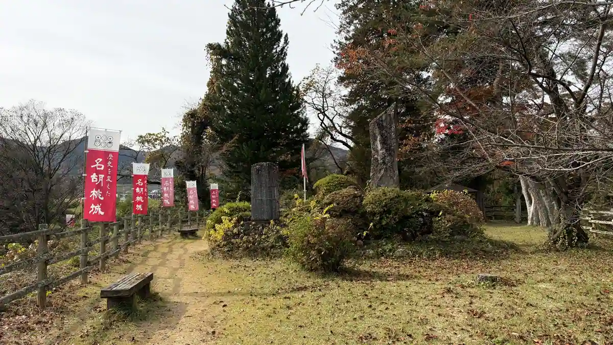
Tap a photo to enlarge
Sasa-kuruwa: the view from the end of the terrace
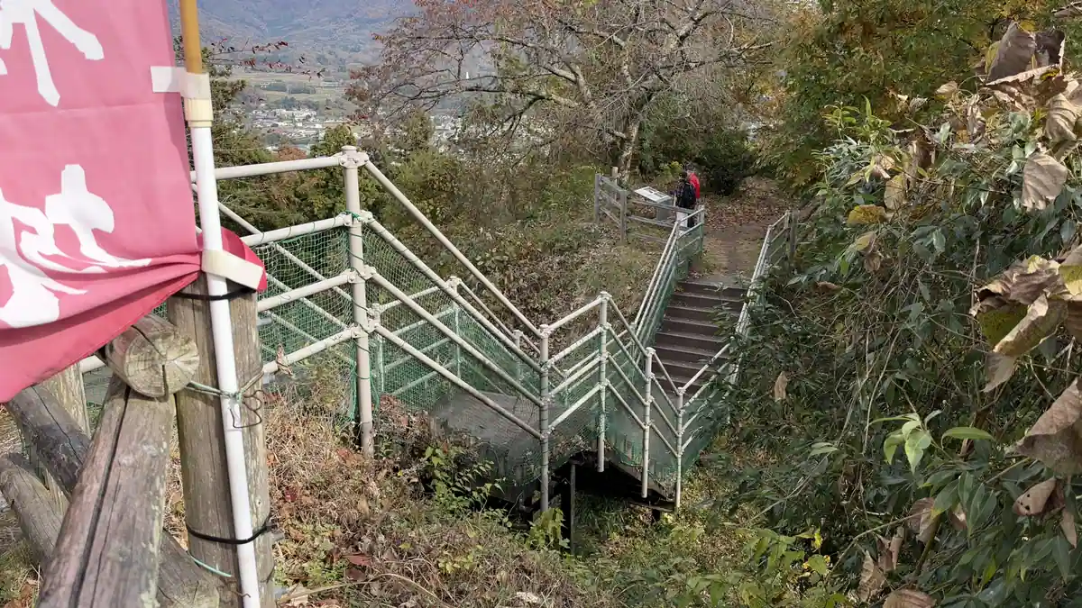
From the back of the main enclosure, stairs lead down to Sasa-kuruwa. The board notes that the stairs and handrails are modern, for visitors, not a reconstruction of an old path. Through the trees at the bottom, the view opens out over fields and villages to a long line of mountains, including the direction of Numata. Excavations here found gate foundation stones and stone-faced earthen walls, which were reburied.
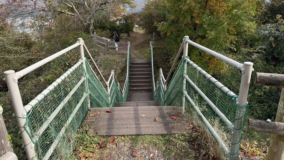
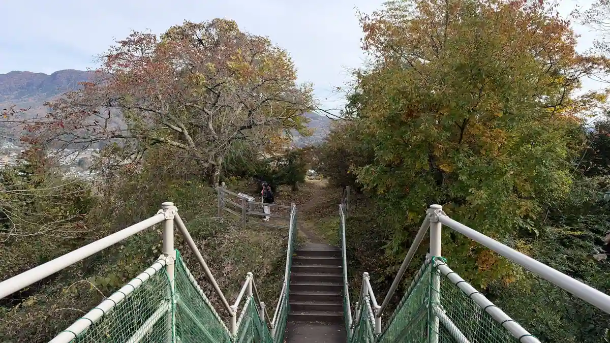
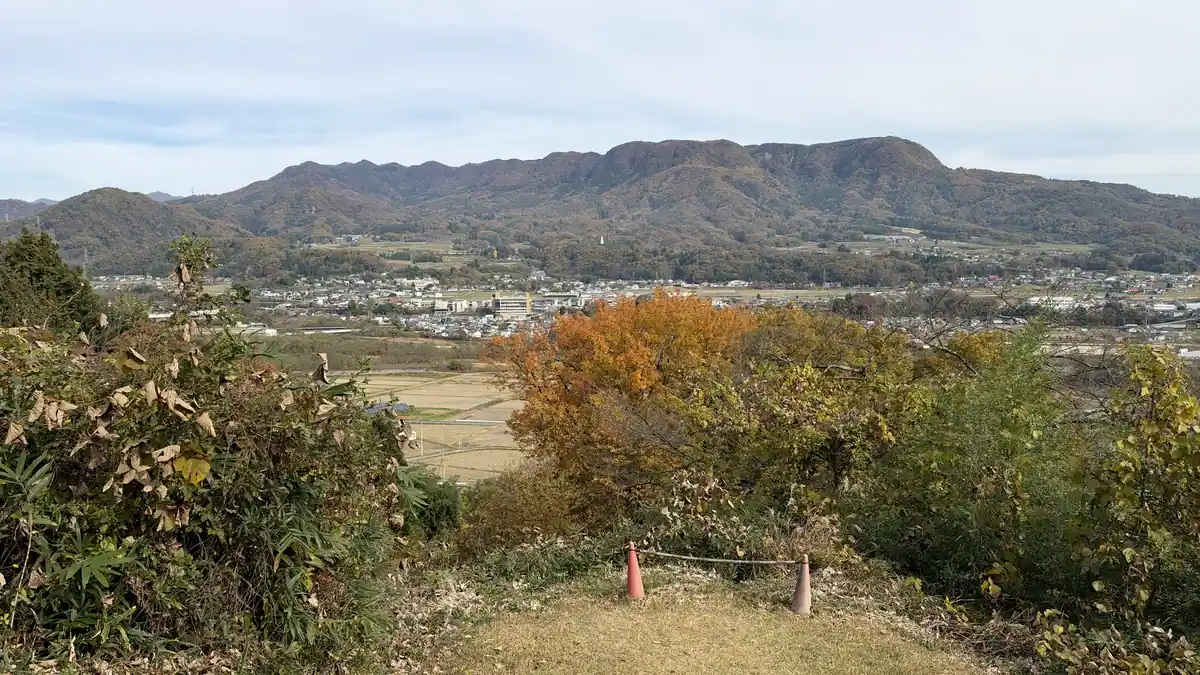
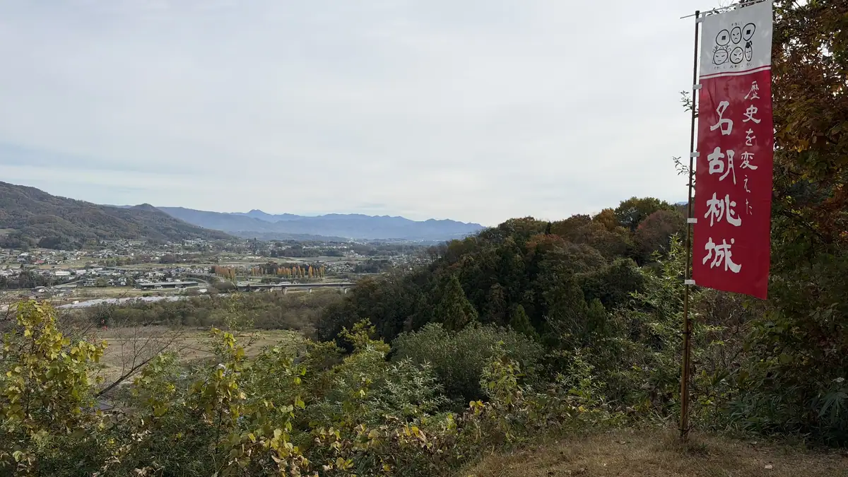
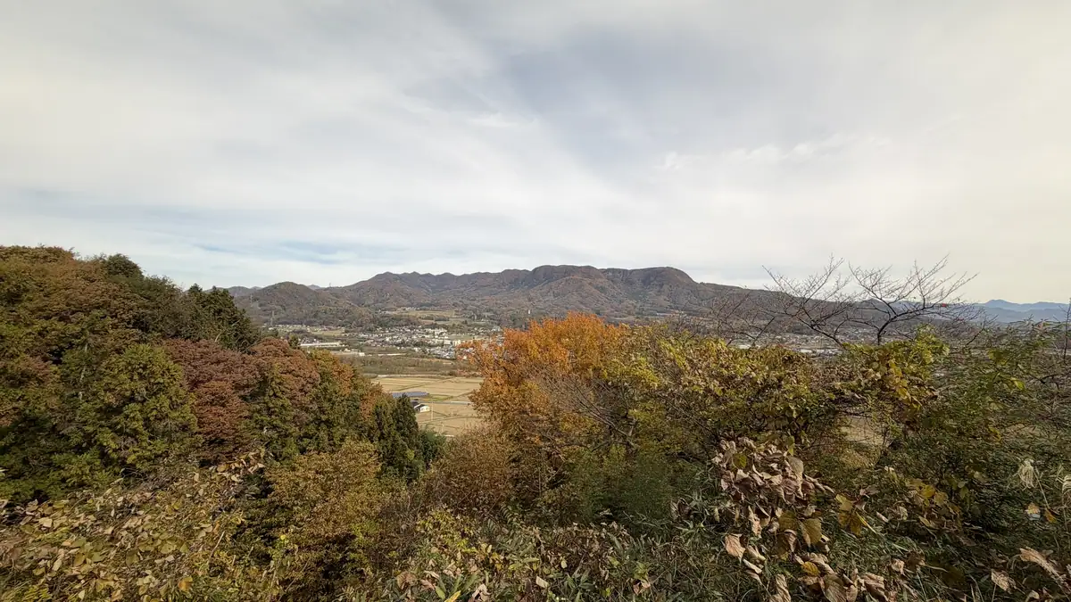
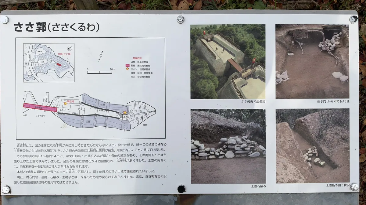
Tap a photo to enlarge
Time needed and the route
The Gunma tourism website suggests about 60 minutes. On my visit I spent about 40 minutes with a guide (from about 9:50 to 10:30), in the information center and on the site, then walked the site on my own to take photos.
The site is more compact than I expected, and the distances are short. The ground is earth, so wear shoes you do not mind getting dirty. The stairs down from the main enclosure to Sasa-kuruwa have handrails.
Park in Hannya-kuruwa and look at the exhibits and the video in the information center.
Enter from the roadside entrance and look at the wide third enclosure and its moats.
Cross the moat on the wooden bridge and walk north along the central passage.
Cross the bridge beyond the north gate and see the castle monument.
Go down the stairs at the back of the main enclosure for the view, then return the same way.
The information center, free volunteer guides and castle stamps
Nagurumi Castle Site Information Center: models and documents
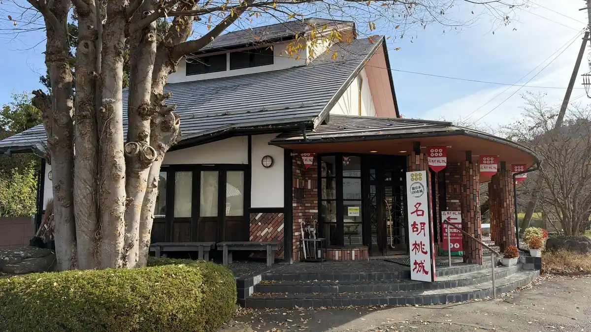
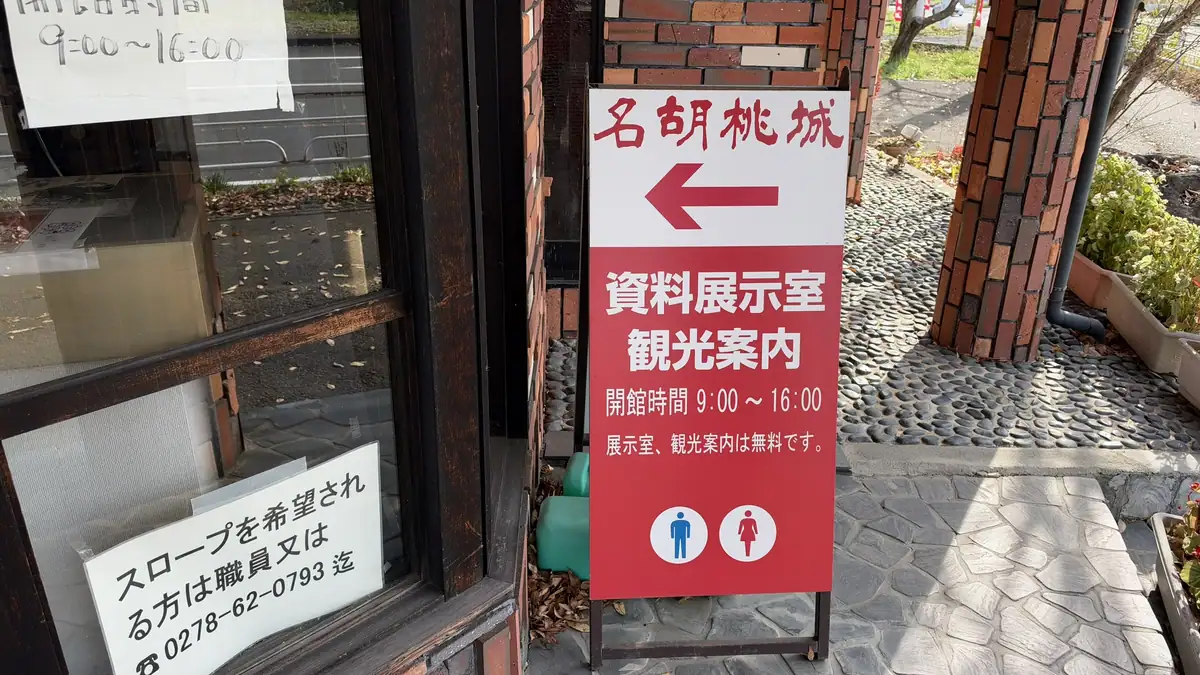
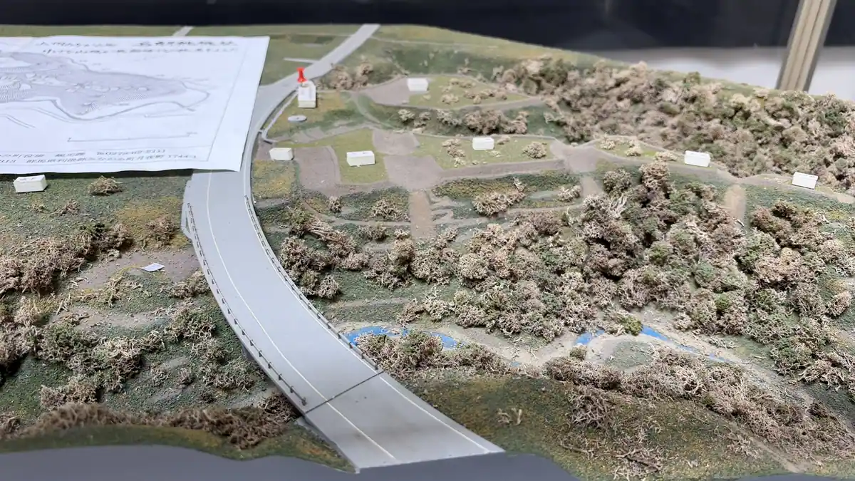
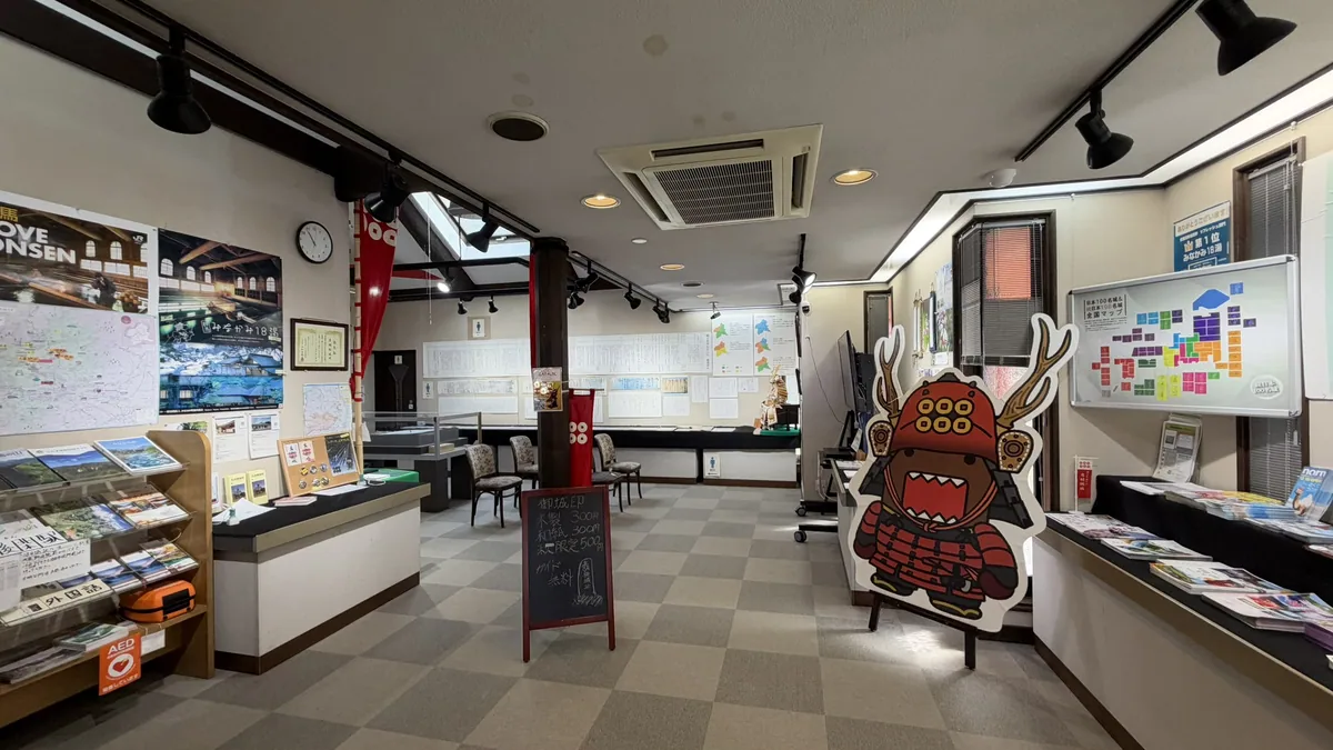
The information center is next to the Hannya-kuruwa parking lot. The archive room and tourist information are free (sign at the center, November 14, 2026). Inside are a terrain model of the enclosures and moats, excavation plans and photos for each enclosure, and a map of the powers that fought over this region in the Sengoku period.
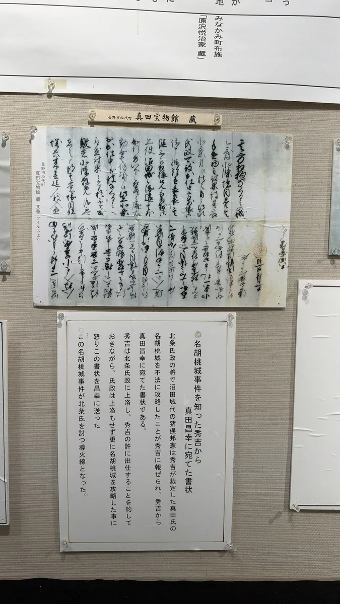
Documents from the incident, including a letter from Hideyoshi to Sanada Masayuki, are shown as images with explanations; the letter image is credited to the Sanada Treasure Museum. An 8-minute video is also shown, and I found it a clear summary. The displays are in Japanese, so a camera-translation app helps.
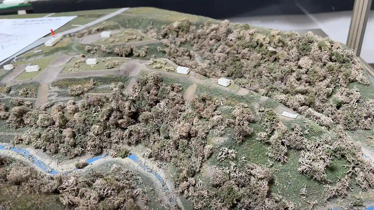
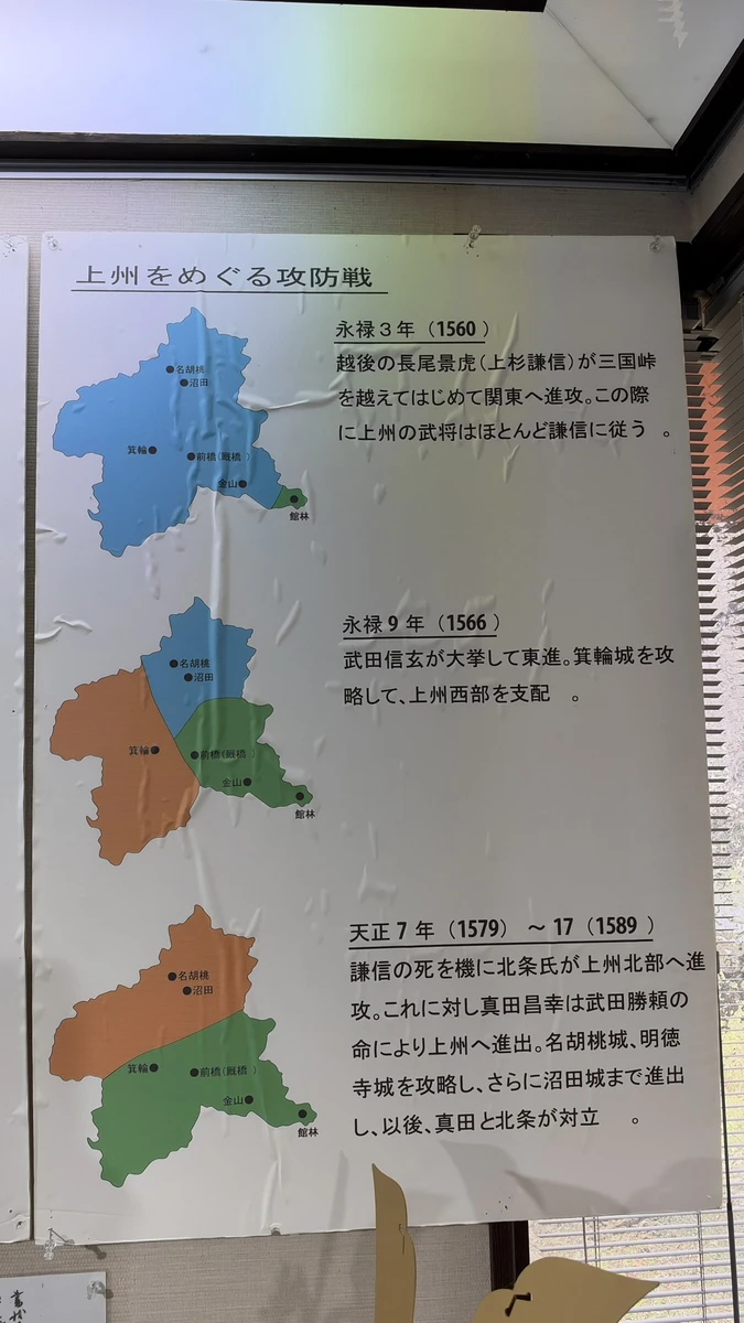
Tap a photo to enlarge
Free guided tours are given by local history volunteers. They usually run from 9:30 to 15:30 (to 14:00 from July 20 to September 30), except on Tuesdays and Thursdays, and there are no tours from mid-December to mid-March; the guides may also be off on other days. You can apply by the online form, by an application sheet (fax or mail), or by phone to the center (+81-278-62-0793) (Minakami History Guide Association). I could not find whether tours are offered in English, so ask when you apply.
| Information center | 9:00–16:00, closed over New Year. Exhibits and tourist information are free. 3462-2 Shimotsu, Minakami. +81-278-62-0793 |
|---|---|
| Free guides | Usually 9:30–15:30 (to 14:00 from July 20 to September 30). No tours on Tuesdays and Thursdays, or from mid-December to mid-March. Ask the center about applying and same-day tours |
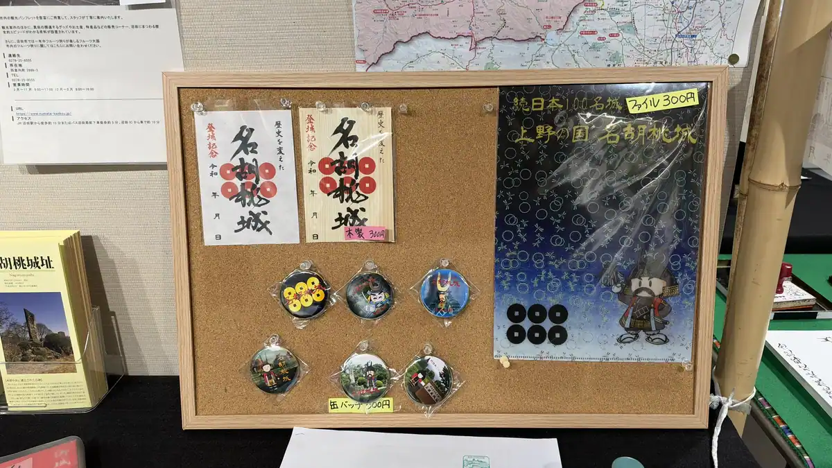
| Castle stamps (gojoin) | Two designs, washi paper and wood, 300 yen each (tax included). Sold only at the center, not by mail |
A gojoin is a castle stamp, a printed and inked card that castle visitors collect, much like the goshuin seals of temples and shrines. I bought a castle stamp here. The wooden design has the same lettering as the paper one; only the material differs (Minakami Tourism Association). Nagurumi is also No. 115 on the Continued Top 100 Japanese Castles list run by the Japan Castle Foundation, which has its own stamp rally; ask the center (+81-278-62-0793) about that stamp.
Getting there: Shinkansen to Jomo-Kogen, then taxi or car
| Option 1: Shinkansen + taxi or car | Joetsu Shinkansen from Tokyo to Jomo-Kogen Station, 62 minutes at the fastest (Minakami Tourism Association). Then about 7 minutes by taxi, or rent a car at the station |
|---|---|
| Option 2: Local train + walk | JR Joetsu Line to Gokan Station, then about 2.8 km (about 45 minutes) on foot along the sidewalk of National Route 17, crossing the Tsukiyono Bridge (Minakami History Guide Association) |
Jomo-Kogen is the shinkansen station for the Minakami area; Gokan is a small station on the slower JR Joetsu Line. Both are JR stations, and Japan-Guide lists the shinkansen to Jomo-Kogen as covered by the Japan Rail Pass. On the Joetsu Shinkansen, not every train called Toki stops at Jomo-Kogen; some pass straight through. I only noticed from an announcement on board, and it was in Japanese, so check that your train stops at Jomo-Kogen before you get on (the Tanigawa trains normally stop there).
Taxis are few in the town, and there may be none after 16:00, so the tourism association advises booking one ahead. I drove and found the way easily with Google Maps navigation, parking in the Hannya-kuruwa lot.
Getting to Nagurumi Castle Ruins
| Address | Castle site: 3437 Shimotsu, Minakami. Information center: 3462-2 Shimotsu, near the roadside entrance |
|---|---|
| Nearest stations | Jomo-Kogen (Joetsu Shinkansen) or Gokan (Joetsu Line). About 7 minutes by taxi from either |
| On foot | About 2.8 km (about 45 minutes) from Gokan Station along the sidewalk of National Route 17, crossing the Tsukiyono Bridge. The guide association and the tourism association describe the walk only from Gokan Station, not from Jomo-Kogen |
| By car | About 6 minutes from Tsukiyono IC on the Kan-Etsu Expressway |
| Parking | Free, about 20 cars and 2 buses (Gunma tourism website) |
| Admission and booking | Free, no booking needed (Gunma tourism website) |
| Rules | Signs at the site (November 14, 2026) ban pets and cycling. The site has stairs and earth paths; a notice at the center asks visitors who need a ramp to ask the staff or call |
| Inquiries | Nagurumi Castle Site Information Center, +81-278-62-0793 |
Driving in Japan with a foreign license
| What you need | An International Driving Permit issued under the 1949 Geneva Convention, plus your home license and passport. Permits issued under other conventions, such as the 1968 Vienna Convention, are not accepted. Licenses from Switzerland, Germany, France, Belgium, Monaco and Taiwan need an official Japanese translation instead (JAF, Eki Rent-A-Car) |
|---|---|
| Time limit | Up to one year from your entry into Japan (JAF) |
| Rental at Jomo-Kogen | Eki Rent-A-Car's Jomo-Kogen office is in the parking area under the elevated tracks in front of the station, open 8:00–19:00 (checked November 15, 2026). Eki Rent-A-Car has an English booking site |
| Car sharing | I used a Times Car car-share car from Jomo-Kogen Station. Times Car does not accept foreign or international driving licenses for membership, so visitors from abroad should book a rental car instead |
| Other rentals | You can also search rental cars on Rakuten Travel (Rakuten Travel car rental, PR; Japanese-language site) |
| On the road | Japan drives on the left |
Location of the Nagurumi Castle Site Information Center (3462-2 Shimotsu, Minakami)
Map: Google Maps, showing the information center's address.
History: from Sanada Maru to the Nagurumi incident
Episode 22 of Sanada Maru, NHK's 2016 historical drama about the Sanada family, shows the ruling over who should hold the Numata region. In the drama, Sanada Masayuki refuses to hand over Nagurumi, saying his ancestors' graves are there, and Nagurumi is later seized by the Hojo. The story that Masayuki said this has been handed down, but whether his ancestors were really buried at Nagurumi is not established history.
The history as told locally is this. Nagurumi is said to have begun as a residence built by the Nagurumi family, a branch of the Numata clan, in the Muromachi period. After the death of the warlord Uesugi Kenshin, Sanada Masayuki attacked it and built a castle here as a forward base for taking Numata Castle (Minakami Tourism Association). Minakami Town dates the castle to the Tensho era (late 16th century).
In 1589, Toyotomi Hideyoshi, who was then unifying Japan, divided the Numata region between the Hojo and the Sanada: about two-thirds is said to have gone to the Hojo, and about one-third, including Nagurumi, to have stayed with the Sanada. That autumn, Inomata Kuninori, the Hojo commander of Numata Castle, seized Nagurumi. This was the Nagurumi incident, and Hideyoshi used it as his pretext to attack the Hojo at Odawara in 1590 (Minakami Town).
After the Odawara campaign, the Numata region returned to the Sanada, and Nagurumi was abandoned; it served as a castle for only about ten years. It was designated a prefectural historic site on December 20, 1949.
The Odawara campaign is covered in our Odawara Castle guide, and the Sanada family in our guide to the Sanada Maru taiga drama.
Combining Nagurumi with Ogawa and Numata Castles
Nagurumi is No. 115 on the Continued Top 100 Japanese Castles list; No. 116 is Numata Castle in Numata City, and No. 117 is Iwabitsu Castle in Higashiagatsuma (Japan Castle Foundation).
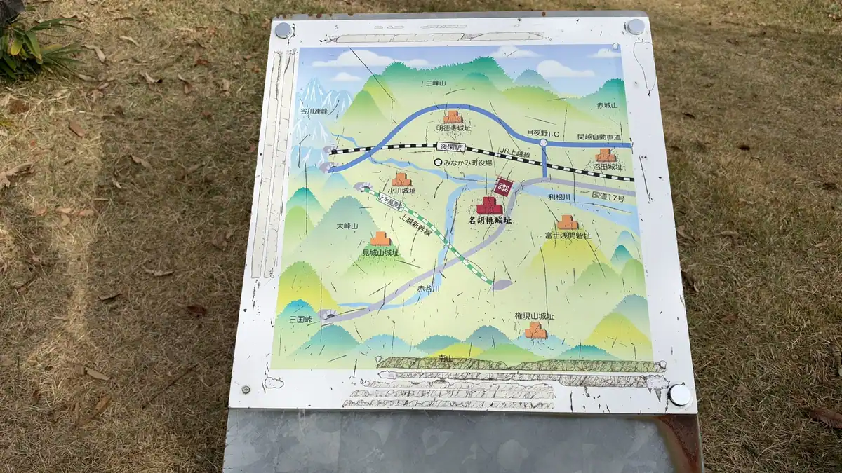
Ogawa Castle is in the same town. Masayuki is said to have attacked the Nagurumi residence together with Ogawa Kayusai, lord of Ogawa Castle; Nagurumi then became his forward base against Numata Castle, which stands in Numata Park in Numata City. Ogawa Castle is covered in our Ogawa Castle guide.
If you want to stand where the Odawara campaign began, Nagurumi is the place. On the site you can also see how steep the drop is from the river terraces to the valley below.
Guides to the Numata and Minakami sites
The other places I visited on the same day, November 14, 2026, each have their own guide.
Day-trip routeA day by car around Numata and Minakami8 stops from Jomo-Kogen Station: the order, the timings, and the train and car costsSee the route →
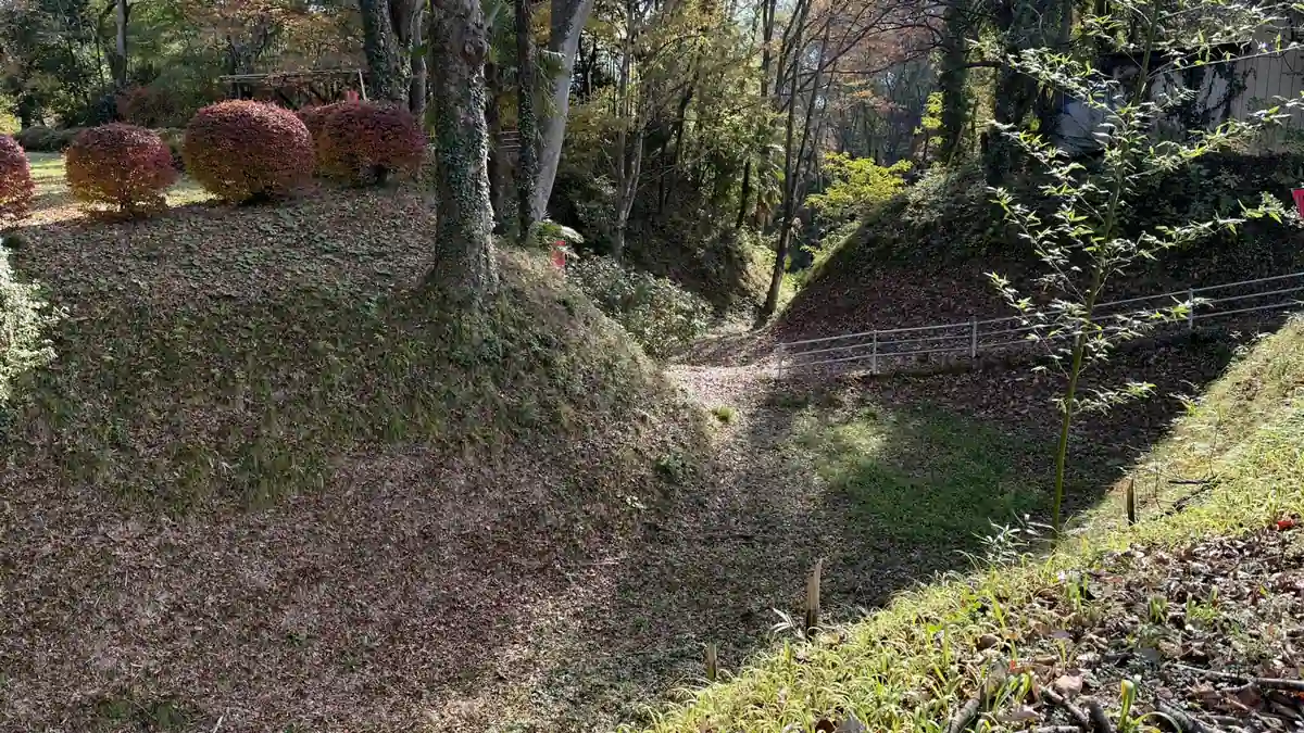 Castle ruins | MinakamiOgawa Castle RuinsThe dry moat, the main enclosure and how to get thereSee the guide →
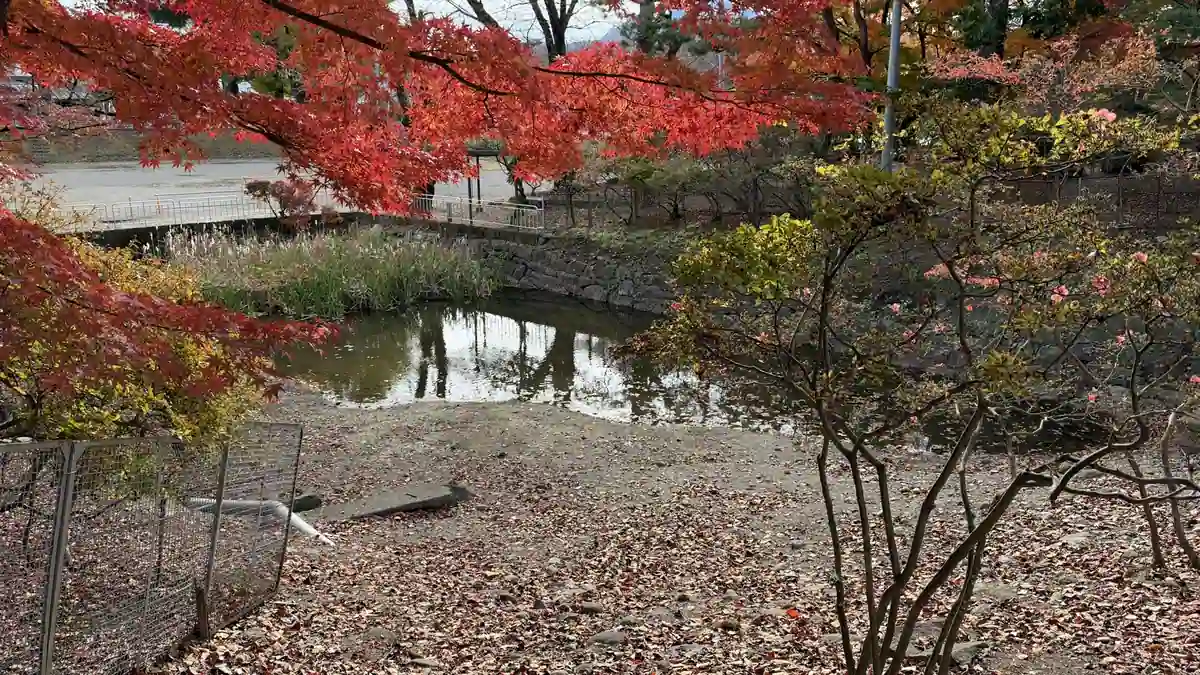 Castle ruins | NumataNumata Castle Ruins (Numata Park)The main-enclosure moat, the west turret's stone wall and the rebuilt bell tower. The history museum and the multi-site passSee the guide →
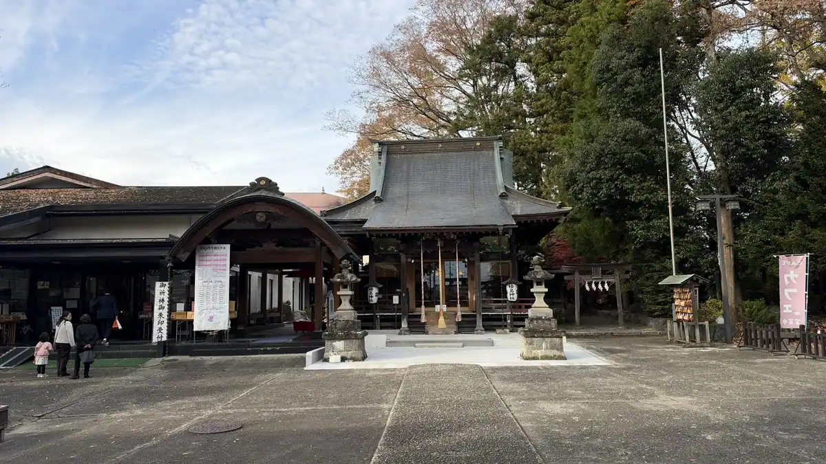 Temple and shrine | NumataShogakuji Temple and Haruna ShrineKomatsuhime's grave, a shrine tied to Sanada Nobuyuki, and goshuinSee the guide →
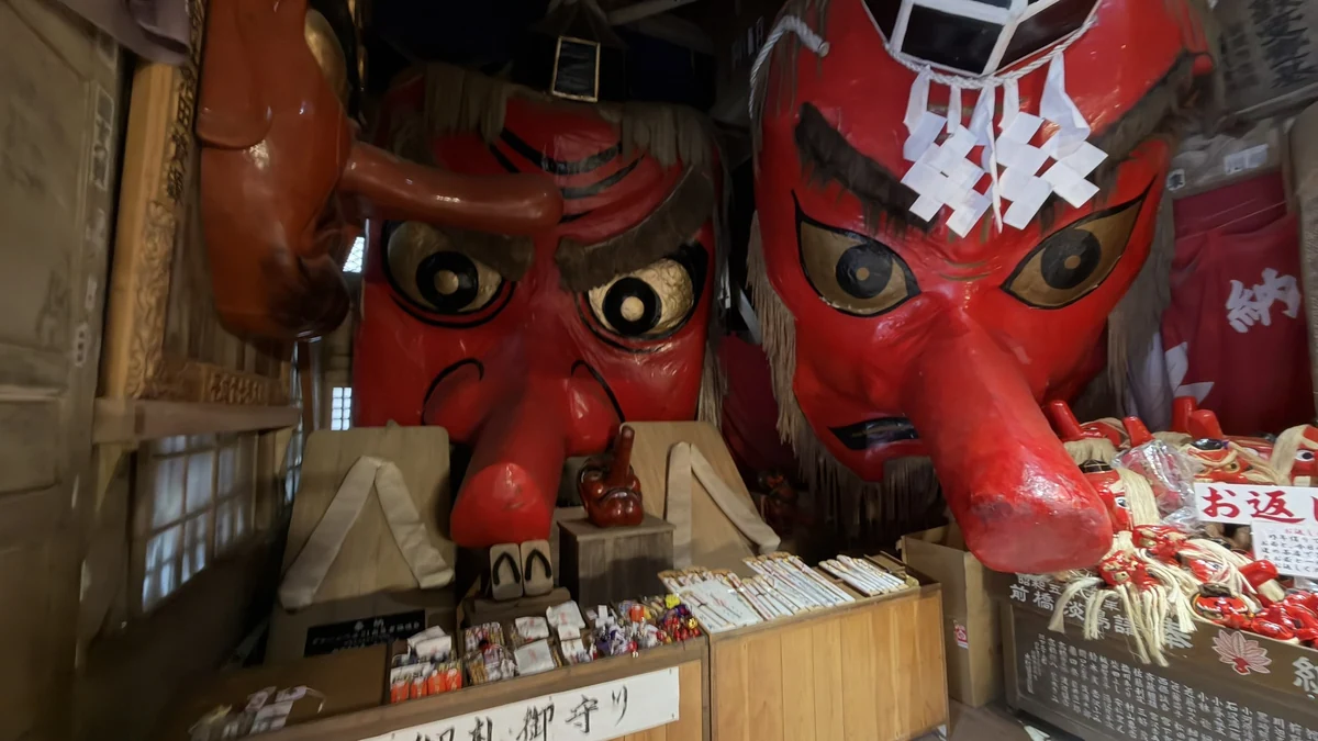 Temple | NumataKashozan Mirokuji TempleThe giant tengu masks, and the hollyhock and paulownia crests on the main hall. Notes on the mountain road and busesSee the guide →
Things to do in Minakami
PRThis section contains affiliate links to Asoview and KKday. If you book through them, this site earns a commission.
If you want to add something besides castles, Minakami is known for rafting, canyoning and hot springs. Check the contents, prices and seasons on each page.
Asoview
Activities in Minakami
Asoview's list of activity plans in Minakami, Gunma. (Japanese-language site; your browser's translation feature can help.)
See on AsoviewKKday
Minakami travel guide
KKday's page for Minakami, Gunma, in English, where you can browse tours and activities.
See on KKdayWhere to stay before or after Nagurumi Castle
PRThis section contains affiliate links to Agoda, Jalan, Rakuten Travel and Yahoo! Travel Japan. If you book through them, this site earns a commission.
Where you stay depends on whether you head on to Numata Castle or to the hot springs of Minakami. Check prices and availability for your dates on each site.
Search the town
Hotels in Minakami
In the same town as Nagurumi Castle
Nagurumi is in Shimotsu, Minakami. The hot-spring areas are scattered around the town, so check the distance from the castle on a map before you book.
Agoda searches all of Minakami; Jalan and Rakuten Travel search Minakami Onsen; Yahoo! Travel covers the Minakami, Oze and Numata area. None of them is limited to Shimotsu. Jalan, Rakuten Travel and Yahoo! Travel are Japanese-language sites; your browser's translation feature can help.
Browse Minakami hotels on AgodaBrowse Minakami hotels on JalanBrowse Minakami hotels on Rakuten TravelBrowse Minakami, Oze & Numata hotels on Yahoo! Travel JapanStay toward Numata
Hotel Route-Inn Numata
Nishikurauchi-machi, Numata. About 8 minutes by car from Numata IC (Jalan listing)
A business hotel in the same district as the Numata Castle site (Numata Park), with a large bath, free parking and a free breakfast buffet (Jalan listing).
Check the distance and time from Nagurumi on a map. Jalan, Rakuten Travel and Yahoo! Travel are Japanese-language sites; your browser's translation feature can help.
Check rates on AgodaCheck rates on JalanCheck rates on Rakuten TravelCheck rates on Yahoo! Travel JapanStay at Minakami Onsen
Zazan Minakami (formerly Minakamikan)
573 Obinata, Minakami. A ryokan (traditional inn) at Minakami Onsen
A 15-minute walk from Minakami Station, with a free shuttle. Plans include access to 15 baths (Rakuten Travel listing).
The free shuttle from Jomo-Kogen Station must be booked ahead and runs twice a day (Rakuten Travel listing). Check times and conditions with the inn. Jalan, Rakuten Travel and Yahoo! Travel are Japanese-language sites; your browser's translation feature can help.
Check rates on AgodaCheck rates on JalanCheck rates on Rakuten TravelCheck rates on Yahoo! Travel JapanBefore booking, check the dates, number of guests, total price and cancellation terms.
FAQ
In Shimotsu, Minakami, Tone District, Gunma Prefecture, north of Tokyo. The castle site is at 3437 Shimotsu and the information center at 3462-2 Shimotsu. It is a prefectural historic site and No. 115 on the Continued Top 100 Japanese Castles list.
In 1589, the Hojo commander of Numata Castle seized Nagurumi from the Sanada, breaking Toyotomi Hideyoshi's ruling on the Numata region. Hideyoshi used this Nagurumi incident as his pretext to attack the Hojo at Odawara in 1590.
The Gunma tourism website suggests about 60 minutes. I had about 40 minutes with a guide, then walked the site on my own to take photos.
No. The board in the main enclosure says the castle never had one. What you can see are the enclosures and dry moats, earthen banks, entrances and wooden bridges reshaped from the excavation results, and building outlines marked on the ground. No gate or building was rebuilt.
No. Entry is free and no booking is needed (Gunma tourism website). For the free guided tours, contact the information center (+81-278-62-0793).
Free tours are given by local history volunteers, usually 9:30–15:30 (to 14:00 from July 20 to September 30), except Tuesdays and Thursdays and from mid-December to mid-March. I could not find whether English tours are offered, so ask when you apply. The center's displays are in Japanese.
About 7 minutes by taxi from Jomo-Kogen or Gokan station. On foot it is about 2.8 km (45 minutes) from Gokan Station; the guide association and the tourism association describe the walk only from Gokan Station. Taxis are few, so book one ahead.
You need an International Driving Permit issued under the 1949 Geneva Convention, with your home license and passport; licenses from Switzerland, Germany, France, Belgium, Monaco and Taiwan need an official Japanese translation instead (JAF). Times Car car-sharing does not accept foreign licenses, so book a rental car, for example at Eki Rent-A-Car's Jomo-Kogen office (8:00–19:00). Parking at the site is free.
At the Nagurumi Castle Site Information Center. There are two designs, washi paper and wood, at 300 yen each (tax included), and they cannot be mailed. For the Continued Top 100 Castles stamp, ask the center (+81-278-62-0793).
The ground is earth, and there are stairs down from the main enclosure to Sasa-kuruwa. The distances are short, but wear shoes you do not mind getting dirty. Pets and cycling are not allowed.
Sources
The facts on this page were checked on the pages below on November 15, 2026, and the driving-license rules on November 16, 2026. Hours and fares can change, so check them before you go.
- Gunma tourism website: Nagurumi Castle Site (Japanese)
- Minakami Town: designated cultural properties of Tsukiyono (Japanese)
- Minakami Tourism Association: Nagurumi Castle Site (Japanese)
- Minakami Tourism Association: access (Japanese)
- Minakami Tourism Association: information offices (Japanese)
- Minakami History Guide Association: guides (Japanese)
- Minakami History Guide Association: access (Japanese)
- Japan Castle Foundation: Continued Top 100 Japanese Castles (Japanese)
- NHK On Demand: Sanada Maru (Japanese)
- Japan-Guide: Getting to Minakami
- JAF: Driving in Japan with a foreign license
- Eki Rent-A-Car: Driver's license (English)
- Eki Rent-A-Car: Jomo-Kogen office (Japanese)
- Times Car: Membership (Japanese)


comment