


Jurakudai, Kyoto: A 4.2 km Walking Route Through the Markers, Excavated Gold Tiles and Castle Stamps
Jurakudai was the palace Toyotomi Hideyoshi completed in 1587 and demolished in 1595. Nothing of it stands today. What you can actually visit is a scattering of stone markers and information boards in a quiet residential district of Kyoto, plus the gold-leaf roof tiles excavated from the site and displayed a short walk away. This guide sets out what remains, where each marker is, a 4.2 km route that links them in order, and whether the walk is worth adding to a Kyoto itinerary.
- Visiting Jurakudai today: what to expect
- How to get there and how to walk it
- A suggested route: 4.2 km on foot around the Jurakudai site
- Completed in 1587, dismantled in 1595: Hideyoshi, Hidetsugu and Jurakudai
- ① Palace grounds and moat markers: locating Jurakudai
- ② Residence markers: tracing the samurai district
- ③ Markers not covered on this visit
- ④ Excavated objects: understanding Jurakudai through its tiles
- Castle stamps: the Jurakudai gojoin at the Archaeological Museum
- ⑤ Relocation traditions: gates said to come from Jurakudai
- What markers, archaeology and temple traditions can actually tell us
- Frequently asked questions
Visiting Jurakudai today: what to expect
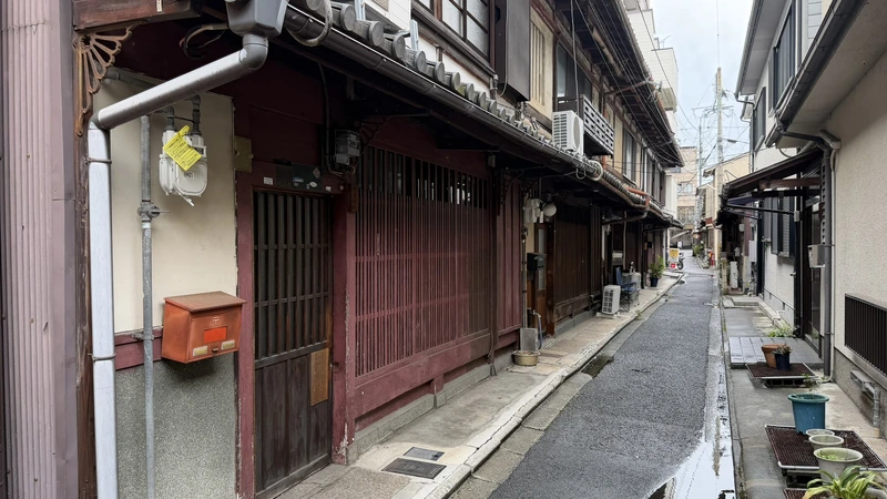
The most important thing to know before you set out: there is no palace here. No keep, no gate, no hall. Jurakudai stood for eight years and was then taken apart so thoroughly that the ground it occupied was absorbed back into the city. What you walk to today are stone posts set into pavements and garden edges, a handful of explanatory boards, and the slope of the land itself.
That said, the markers are not arbitrary. They sit on the lines of the palace's moats. Stand at the marker for the eastern moat, then walk west to the marker for the inner bailey's western moat, and the distance you have covered is the width of the main enclosure. Visiting Jurakudai means tracing a vanished floor plan with your feet. Pair that walk with the Kyoto City Archaeological Museum, a few minutes away, where you can see the gold-leaf tiles that came out of the ground beneath it (as of a September 2026 visit, shown as part of a special exhibition; displays change once it closes).
Stone markers for the palace grounds and moats, markers for the surrounding samurai residences, and excavated objects at the Kyoto City Archaeological Museum. All are within walking distance of one another.
No building from Jurakudai survives. Gates and structures said to have been moved from Jurakudai all stand elsewhere in Kyoto or beyond. The markers indicate approximate locations, not the exact footprint of any building.
How to get there and how to walk it
Because the markers are scattered through a residential grid, there is no single entrance to "Jurakudai." The approach that worked best was to visit the Kyoto City Archaeological Museum first, then work from north to south. Seeing the reconstruction plan and the excavated tiles before you look at the markers turns each stone post from a name into a position.
| Practical starting point | JR Kyoto Station, or Nijojo-mae Station on the Tozai subway line. Neither is beside the markers. On foot from Nijojo-mae, the nearest marker (the Tokugawa Ieyasu residence site) is about 1.2 km away, roughly 16 minutes. From JR Kyoto Station a city bus is the practical option |
|---|---|
| From Kyoto Station | To reach the Kyoto City Archaeological Museum: City Bus route 9 to "Horikawa-Imadegawa," then 2 minutes west on foot |
| From the subway | To reach the Kyoto City Archaeological Museum: from Imadegawa Station, City Bus 51, 59, 201 or 203 to "Imadegawa-Omiya," directly at the stop |
| Official tourism guidance | Kyoto City Official Travel Guide lists the Jurakudai site as about 300 m from the "Senbon-Demizu" bus stop. Your nearest stop depends on which marker you start from |
| Terrain | Flat urban streets overall, but the area is not level throughout; there are slopes near the western outer moat site |
| Recommended transport | City bus plus walking. The markers sit along narrow residential lanes, so the walking is unavoidable |
| Time needed | For the suggested route below, Google Maps gives about 2.2 km and 31 minutes for the first half and about 2.0 km and 27 minutes for the second (roughly 4.2 km and 58 minutes in total). Add time for photographs and reading boards and it works out to 1.5–2 hours, not counting the museum. This is a routing estimate, not a measured time |
| Parking | Not confirmed. The markers stand on public streets and property edges with no dedicated parking |
| Please note | Many markers stand at the edge of private homes and workshops. Do not step onto private property to photograph them. There is little shade in places, so bring sun protection if walking in midsummer |
A suggested route: 4.2 km on foot around the Jurakudai site
Jurakudai is not a castle site where a keep and its walls survive together, so the route below starts at the Kyoto City Archaeological Museum and then works through the excavation points, moat lines and residence sites in order. The first half runs from the north of the palace around the inner bailey and out to the west; the second half follows the southern outer moat and the samurai district down to Horikawa-Marutamachi.
| First half | Archaeological Museum to the Toyotomi Hidekatsu site. About 2.2 km, 31 minutes on Google Maps |
|---|---|
| Second half | Toyotomi Hidekatsu site to Horikawa-Marutamachi bus stop. About 2.0 km, 27 minutes on Google Maps |
| Total | About 4.2 km and 58 minutes of walking time alone |
| Realistic allowance | 1.5–2 hours if you stop at each marker, read the boards and take photographs. The museum needs a further 40–60 minutes |
| Stops not yet visited | The western outer moat, the Tsuyu no I well, the Kasasagi Bridge marker, and the Naoe Kanetsugu / Uesugi Kagekatsu site. Their positions were checked on Google Maps but not on the ground |
First half: Archaeological Museum to the Toyotomi Hidekatsu site
Start at the museum, where the excavation results are laid out, then head for the streets. The route takes in the residence sites of Sen no Rikyu, Kato Kiyomasa, Kuroda Josui and Uesugi Kagekatsu — men who served Hideyoshi — before reaching the moat markers around the inner bailey and turning south along the western edge of the palace.
Seeing the reconstruction plan and the excavated gold-leafed tiles first gives the markers ahead a position to sit in.
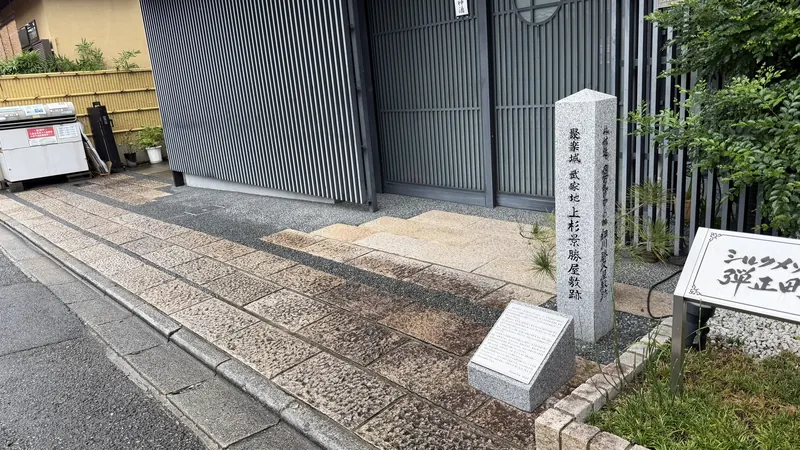
Near Seimei Shrine. A tea master’s house immediately beside the seat of government.
An illustrated panel stands beside the marker, whose faces span the Heian, Muromachi and Momoyama periods.
The neighbourhood name, Josui-cho, still carries the memory. Easy to walk past, at the mouth of a lane.
Danjo-cho, at the gate of a Nishijin weaving workshop.
The eastern edge. The ground between here and the next stop is the width of the main enclosure.
A marker, a wooden board and a hand-lettered panel together: the richest stop on the walk.
Not visited. The position was checked on Google Maps; there are slopes nearby.
The Jurakudai inscription is on the side face, so walk around the stone.
What this half gives you is both halves of the picture: Jurakudai itself, and the samurai district that surrounded it. Walking the present-day streets while holding the moat lines and the mansion plots in mind is what makes the scale of the palace legible.
Map: first halfSecond half: Toyotomi Hidekatsu site to Horikawa-Marutamachi
The second half restarts at the Toyotomi Hidekatsu site and swings round to the south of the palace: the southern moat of the inner bailey, the Tsuyu no I well, the southern outer moat, and then the samurai district that lay south of Jurakudai, taking in points connected with Tokugawa Ieyasu and with Naoe Kanetsugu and Uesugi Kagekatsu before finishing at the bus stop.
Picking up where the first half ended.
Where a stone wall about 32 m long was recorded in 2012. It was reburied and cannot be seen.
Not visited. A traditional site rather than a marker; public access is not confirmed.
Not visited. A marker erected in 1932; the bridge itself does not survive.
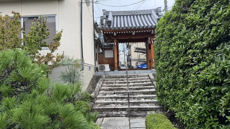
At the gate of Shorin-ji, whose precinct sits a step lower — the trace of the moat.
Kita-Iseya-cho, on the north side of the Sasaki Shuzo brewery. Erected in 2023.
Not visited. In Kodo-cho, one stone inscribed on two faces with both names.
City buses run back towards Kyoto Station from here.
This ordering follows the one used on the "Around Jurakudai" heritage walk run by the Kyoto City Archaeological Research Institute, which links the Toyotomi Hidekatsu site, the southern outer moat, the Kasasagi Bridge, the Tokugawa Ieyasu site and the Naoe Kanetsugu / Uesugi Kagekatsu site in the same sequence.
Map: second halfCompleted in 1587, dismantled in 1595: Hideyoshi, Hidetsugu and Jurakudai
Construction began in 1586 and the palace was finished in 1587. Hideyoshi, by then kampaku (imperial regent, the highest civil office a subject could hold), built it as his residence and seat of government in Kyoto. Excavation and contemporary screen paintings show a compound ringed by moats and stone walls, with buildings roofed in gold-leafed tiles.
In 1588 Emperor Go-Yozei visited. Receiving the emperor at one's own residence was a political act as much as a ceremonial one: it made Hideyoshi's standing visible to the assembled lords. The folding screen depicting that visit was painted later and is not a record of the scene itself, but it remains one of the few visual clues to the scale and arrangement of the buildings.
At the end of 1591 both the regency and Jurakudai passed to Hideyoshi's nephew, Toyotomi Hidetsugu. In 1595 Hidetsugu fell from favour and took his own life, and Jurakudai was pulled down. Eight years after completion, seven after the imperial visit, it was gone. Why the demolition was so complete is not settled: the contemporary record is thin. One of the handwritten boards at the site says as much, in Kyoto dialect and with disarming honesty — there is not much written down from the time, so we do not really know how it went.
① Palace grounds and moat markers: locating Jurakudai
Start with the markers that define the palace itself. These stand on the lines of the moats and the edges of the main enclosure, and together they sketch the outline of the compound. All of them are modern signposts, erected in the twentieth and twenty-first centuries. None is a surviving structure from Hideyoshi's time.
Site of Jurakudai: Eastern Moat Marker
Northwest corner of Nakadachiuri-dori and Omiya-dori
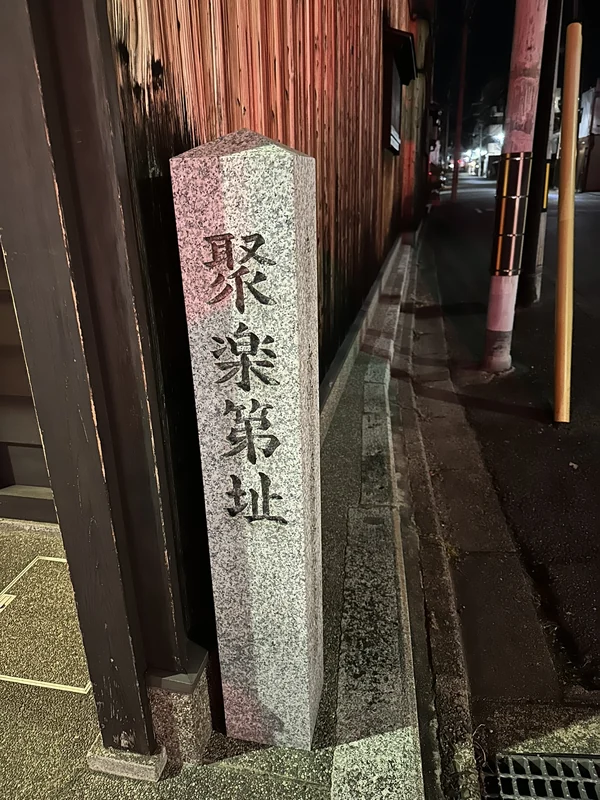
This post stands at the corner where Nakadachiuri-dori meets Omiya-dori and marks the eastern edge of the compound, on the line of the eastern moat. It was erected in 2009. According to a board nearby, it commemorates roof tiles from a Jurakudai residence that came to light when the employment office on this block was built.
The front face reads simply "Site of Jurakudai." A side face carries a longer inscription noting that this is also the area of the Heian-period palace enclosure and of Jurakudai's eastern moat. It is one stone with more than one inscribed face — worth noting, because it is easy to count it as two separate markers.
- Compare the front inscription with the longer text on the side face
- The distance from here west to the inner-bailey marker is roughly the width of the main enclosure
- The side inscription places this spot inside the Heian-period palace precinct as well
Tap an image to enlarge
Time needed: about 5 minutes. The marker faces the pavement, so no detour is required.
| Location | Kamigyo Ward, northwest corner of Nakadachiuri-dori and Omiya-dori |
|---|---|
| Erected | 2009 |
| Marks | The line of Jurakudai's eastern moat |
| Admission | Free, outdoors, always accessible |
Western Moat of the Inner Bailey
Uramon-dori, northeast of Seishin Elementary School
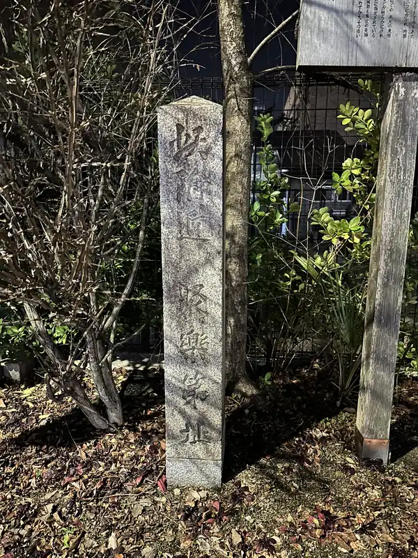
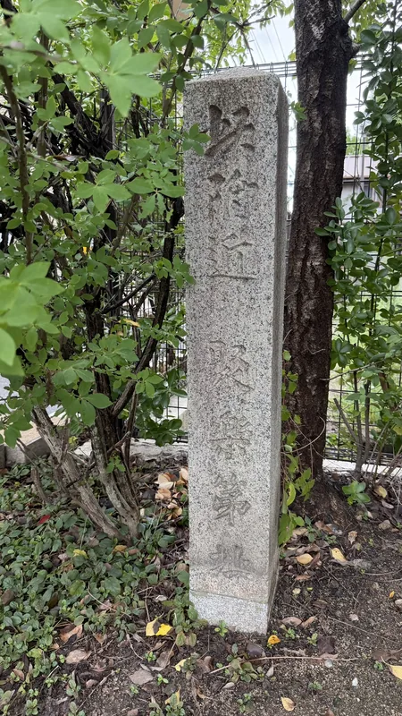
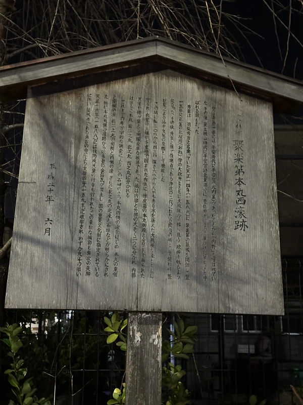
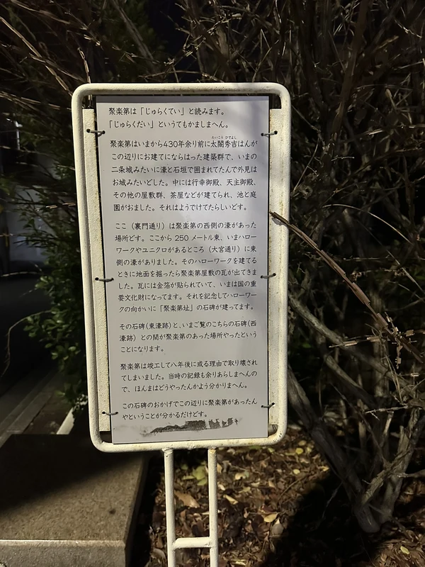
This corner, northeast of Seishin Elementary School on Uramon-dori, is the richest single stop on the walk. A stone marker, a wooden board in the traditional Kyoto style, and a hand-lettered explanatory panel all stand within a few paces of each other.
The wooden board is headed "Site of the Western Moat of the Inner Bailey of Jurakudai." The ground between this marker and the eastern moat marker is the east–west span of the main enclosure. Note also how the stone is worded: "in this vicinity." These markers record an approximate location, not a surveyed building footprint.
- The wooden board summarising excavation results, including the division of the inner bailey
- The white hand-lettered panel, written in Kyoto dialect, which gives the distance east to the opposite moat as about 250 metres
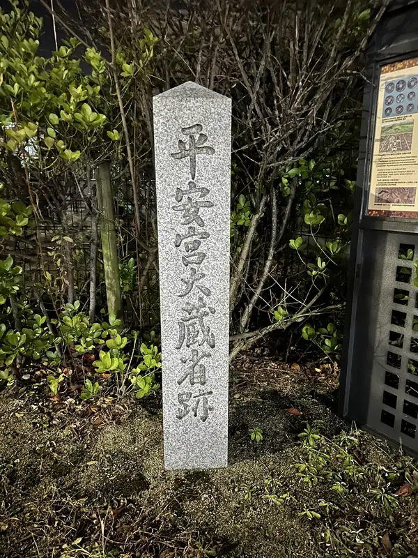
- The Heian-period marker and board for the Ministry of the Treasury site, standing at the same spot: two different eras meeting on one patch of ground
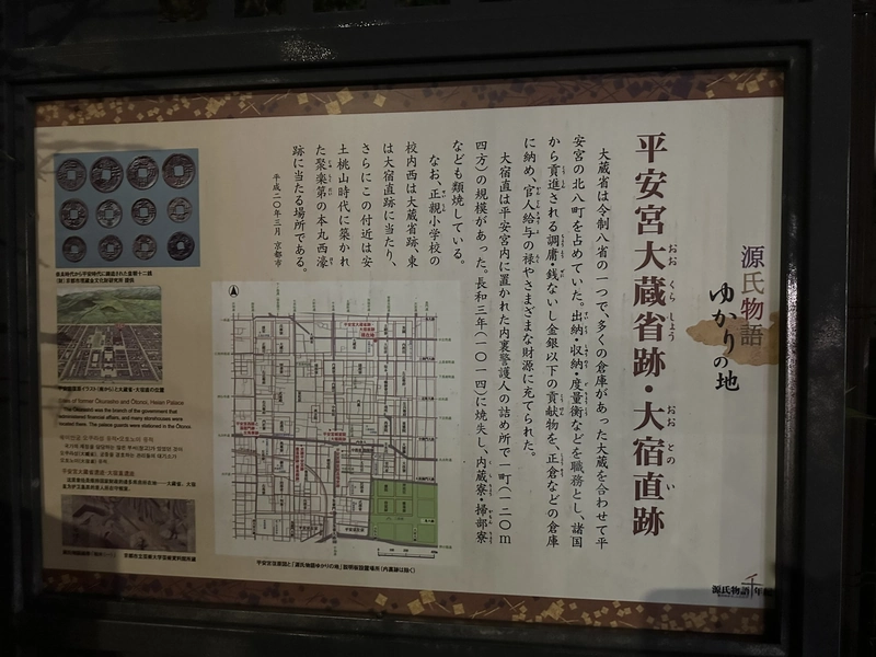
Tap an image to enlarge
Time needed: about 15 minutes, longer if you work through the boards. All text on site is in Japanese.
| Location | Kamigyo Ward, Uramon-dori, northeast of Seishin Elementary School |
|---|---|
| Marks | The western moat of Jurakudai's inner bailey |
| Also here | Marker and board for the Heian palace Ministry of the Treasury |
| Admission | Free, outdoors, always accessible |
Southern Outer Moat Marker
In front of Shorin-ji Temple
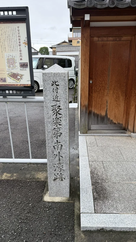
This marker stands at the gate of Shorin-ji Temple and records the line of Jurakudai's southern outer moat. It was erected in 2007.
What makes this stop worthwhile is that the ground itself is the evidence. The Kyoto City board beside the marker notes that the temple precinct sits a step lower than its surroundings, and that this depression corresponds to the southern outer moat. Read the inscription, then look through the gate at the level of the ground inside.
- The temple grounds sitting lower than the street: the surviving trace of the moat
- The adjacent board on the eastern limit of the Heian palace inner enclosure and the Kenshunmon gate site
- The contrast between the inscribed marker and the physical dip in the land
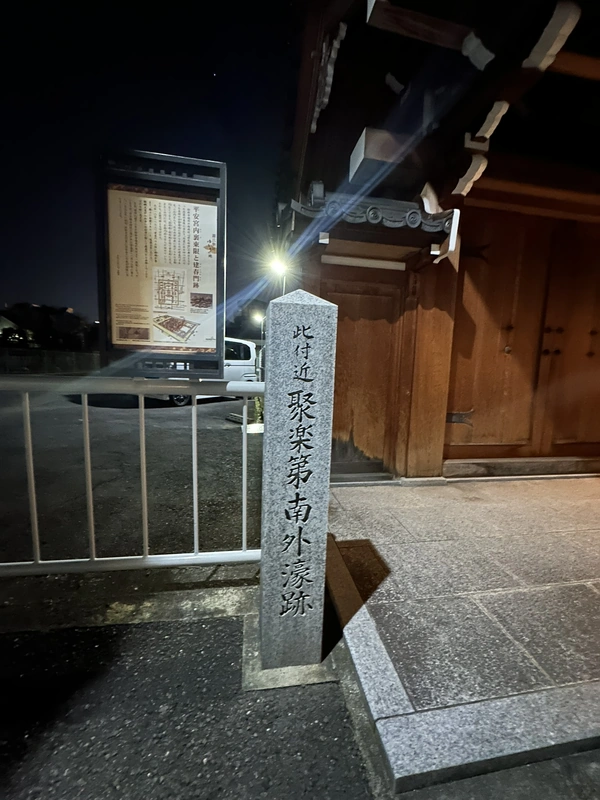
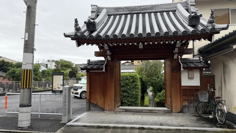
Tap an image to enlarge
Time needed: about 10 minutes.
| Location | Kamigyo Ward, south side of Demizu east of Jofukuji-dori, at Shorin-ji Temple |
|---|---|
| Erected | 2007 |
| Marks | The southern outer moat of Jurakudai |
| Admission | Free; the marker stands outside the temple gate |
Excavated Stone Wall of the Southern Inner Moat (Panel)
At the edge of the Kyoto Prefectural Police Headquarters
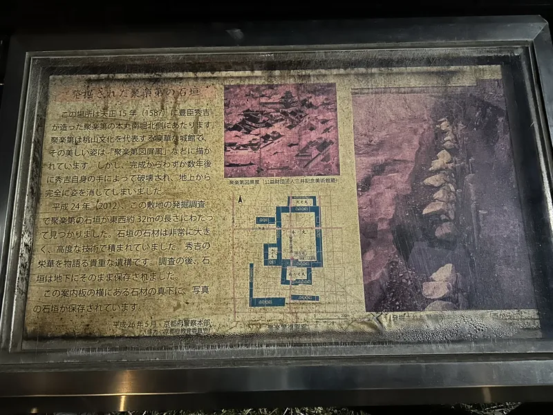
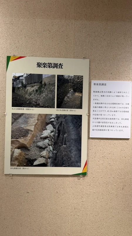
This is a panel rather than a marker, but it stands closest to an actual surviving structure. According to its text, the site lies on the north side of the inner bailey's southern moat, and a 2012 excavation uncovered a stone wall running about 32 metres east to west. The stones were very large and skilfully laid.
You cannot see any of it. After the survey the wall was reburied and preserved in place; the panel states that it lies directly beneath the stone block beside it. Do not mistake the visible masonry around the neighbourhood for Momoyama-period castle walls — almost all of it is modern retaining work.
- The excavation photograph on the panel, which conveys the scale of the stones
- The accompanying plan showing the inner bailey and the southern moat
- The reproduction of the "Jurakudai screen," one of the few images of the palace before demolition
Time needed: about 5 minutes; reading the panel is the whole visit.
| Location | Kamigyo Ward, at the edge of the Kyoto Prefectural Police Headquarters |
|---|---|
| Installed | May 2014, by the Kyoto Prefectural Police |
| Excavation | 2012; stone wall traced about 32 m east to west |
| Current state | Reburied after the survey; not visible from ground level |
② Residence markers: tracing the samurai district
The lords who served Hideyoshi had mansions in the streets around the palace, and stone markers now record where those mansions are thought to have stood. These differ from the moat markers in an important way: many are explicitly labelled "traditional site" or "presumed site." They were placed by local historical societies working from old maps and diaries, not from excavation.
Residence of Uesugi Kagekatsu
Danjo-cho
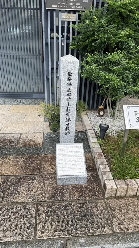
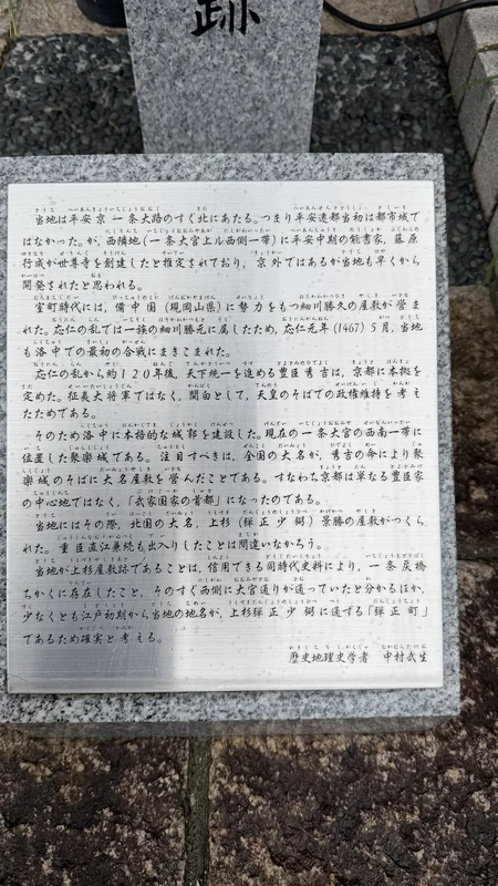
This marker in Danjo-cho records the mansion of Uesugi Kagekatsu, one of the five regents Hideyoshi appointed to govern after his death. A small explanatory plate at its foot sets out how the local society identified the location, drawing on both documents and the surviving place name.
Today the spot is the entrance to a Nishijin textile workshop, and the marker stands beside the gate as an ordinary part of the street. A daimyo's mansion site that never became a park or a monument, absorbed instead into a working neighbourhood — this single stone captures what visiting Jurakudai feels like.
- The explanatory plate at the base, giving the reasoning behind the identification
- The inscription uses "Jurakujo" (Juraku Castle) rather than "Jurakudai"
- A separate marker in Kodo-cho also names Uesugi Kagekatsu; the two are different locations
Tap an image to enlarge
Time needed: about 5 minutes.
| Location | Kamigyo Ward, Danjo-cho |
|---|---|
| Figure | Uesugi Kagekatsu, one of the Council of Five Elders |
| Status | Location identified by a local historical society from documents and place names |
| Admission | Free, outdoors, always accessible |
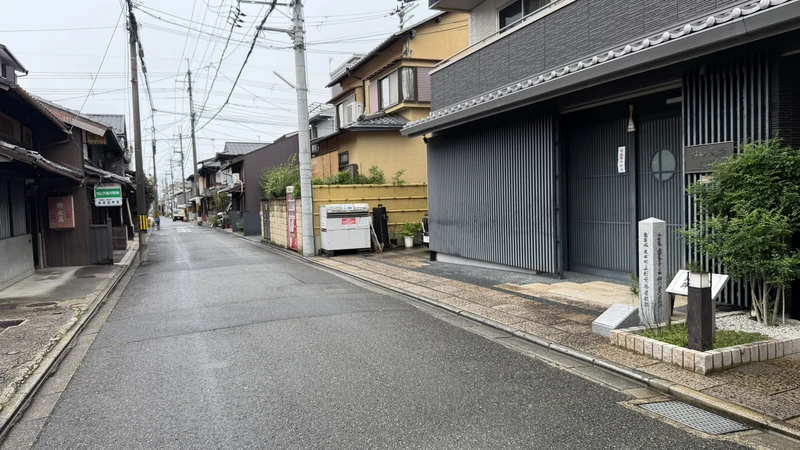
Residence of Kuroda Josui
Near Josui-cho
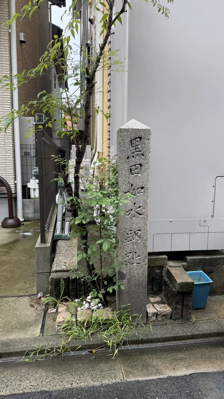
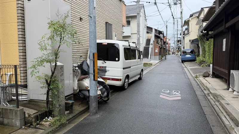
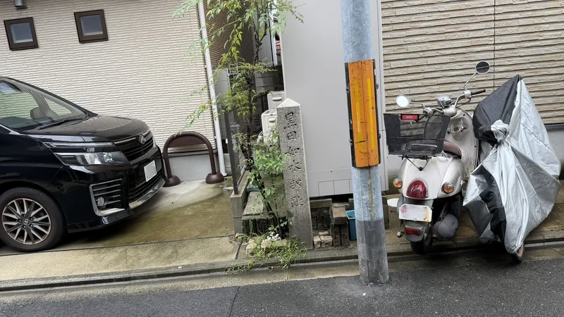
Kuroda Kanbei — better known by his later Buddhist name Josui — was Hideyoshi's most celebrated strategist, and this marker records his mansion. The neighbourhood is still called Josui-cho: the residence has outlived itself as a place name, which is about as durable a memorial as a demolished building gets.
The marker sits at the mouth of a narrow lane between two houses, with no signage to announce it. Without a map you will walk straight past. It was among the stops on an official guided walk held in 2026.
- The place name Josui-cho, preserving the memory of the mansion
- The setting between private houses, typical of these markers
- The stone records a location; nothing of the residence itself survives
Tap an image to enlarge
Time needed: about 5 minutes.
| Location | Kamigyo Ward, near Josui-cho |
|---|---|
| Figure | Kuroda Josui (Kuroda Kanbei Yoshitaka) |
| Status | Identified mansion site; the name survives in the district name |
| Admission | Free, outdoors, always accessible |
Traditional Site of Toyotomi Hidekatsu's Residence
Benten-cho, north of Demizu on Tsuchiyamachi-dori
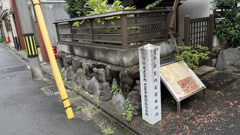
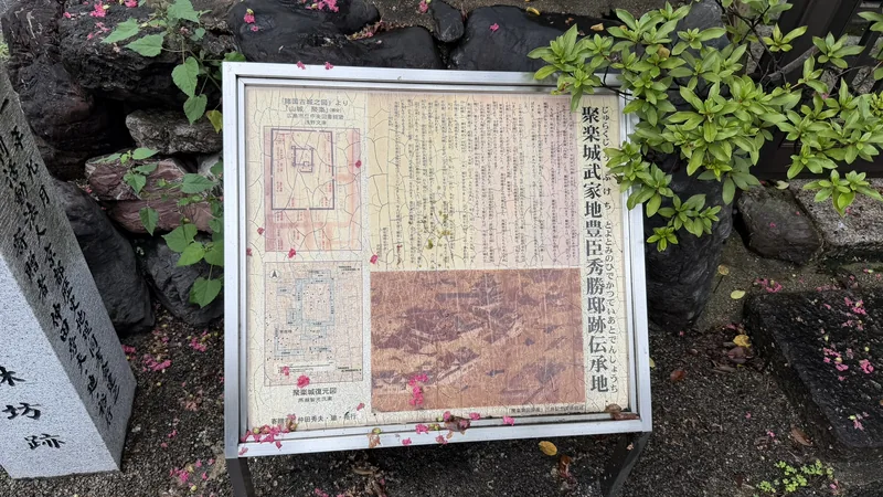
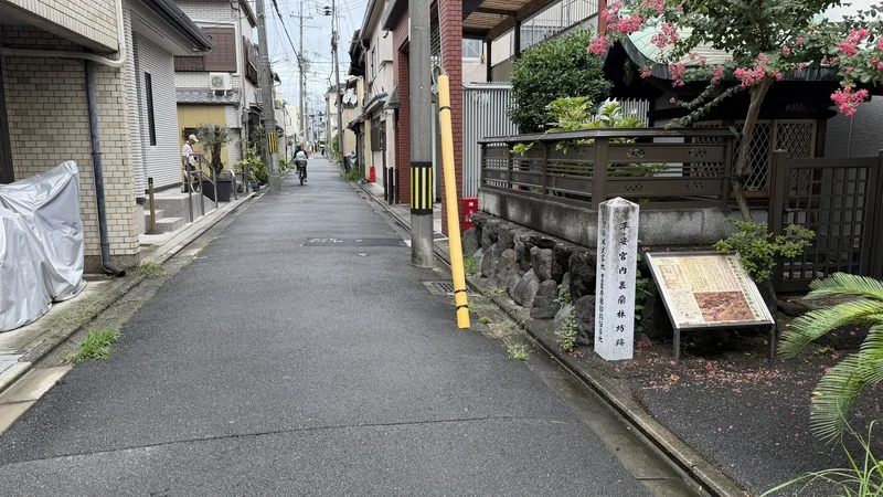
This is the marker people miss. The face turned towards the street is inscribed for the Ranrinbo hall of the Heian palace; the words recording the traditional site of Toyotomi Hidekatsu's residence are around on the side. Walking north to south, that face points away from you, and it is easy to register the stone as a Heian-period marker and keep going.
The Hidekatsu here is Hideyoshi's nephew, who married Go (later known as Sugen'in). He should not be confused with the other Toyotomi Hidekatsu, a son of Oda Nobunaga adopted by Hideyoshi. The location is recorded as a traditional site, not a confirmed one.
- One stone carrying inscriptions from two different eras
- The stone embankment at its foot, showing that the ground here sits higher than the lane
- The adjoining board explaining the Heian palace hall
Tap an image to enlarge
Time needed: about 5 minutes. Step around to the side face to find the inscription.
| Location | Kamigyo Ward, Benten-cho, north of Demizu on Tsuchiyamachi-dori |
|---|---|
| Figure | Toyotomi Hidekatsu, nephew of Hideyoshi and husband of Go |
| Status | Traditional site, not a confirmed location |
| Easy to miss | The Jurakudai text is on the side face; the front is a Heian palace inscription |
Traditional Site of Kato Kiyomasa's Residence
Stone marker with an illustrated panel
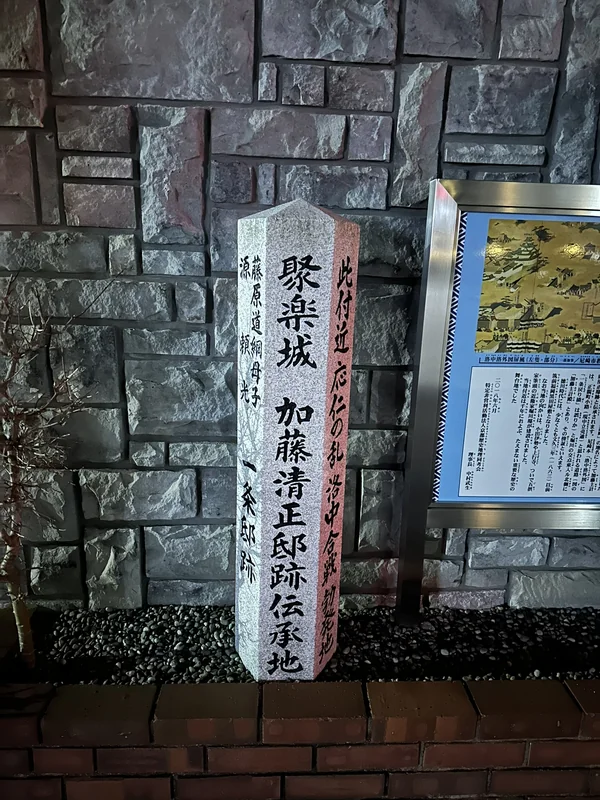
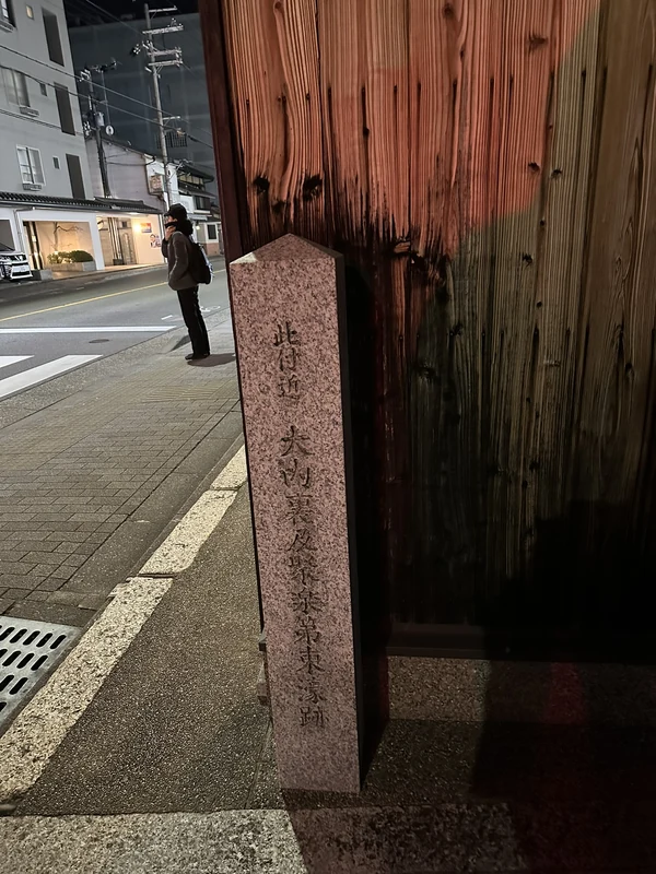
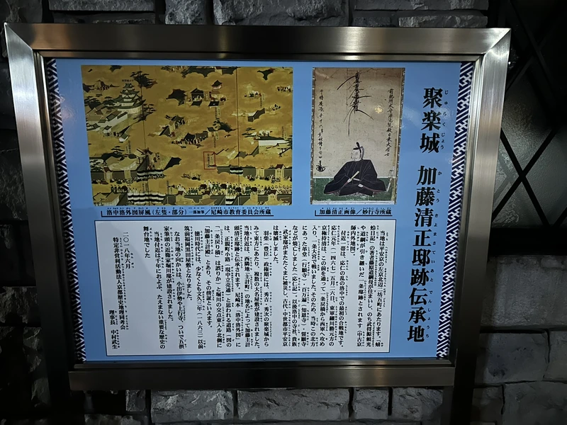
Kato Kiyomasa, one of the "Seven Spears of Shizugatake," is said to have had his mansion here. Beside the marker stands a blue illustrated panel that reproduces the relevant section of a "Scenes in and around Kyoto" screen alongside a portrait of Kiyomasa, with a careful account of how the location was identified. It was erected in August 2018 by a Kyoto historical geography society.
This stone also carries several inscribed faces: the traditional site of Kiyomasa's residence on the front, a note that the vicinity saw fighting during the Onin War on another, and the site of a Heian-period mansion associated with the mother of Fujiwara no Michitsuna and with Minamoto no Yorimitsu on a third. Three eras on one post — Kamigyo Ward's layered history, compressed into a single piece of granite.
- The illustrated panel, showing the relevant detail of the Kyoto screen painting
- The three inscribed faces, spanning the Heian, Muromachi and Momoyama periods
- The society's explanation of which sources were used to fix the location
Time needed: about 10 minutes, longer if you read the panel.
| Location | Kamigyo Ward, Kyoto |
|---|---|
| Figure | Kato Kiyomasa |
| Erected | August 2018, by a Kyoto historical geography society |
| Status | Traditional site, not a confirmed location |
Residence of Tokugawa Ieyasu
Kita-Iseya-cho
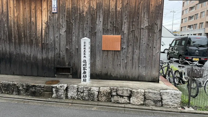
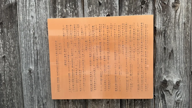
Tokugawa Ieyasu, who would later unify Japan under his own shogunate, is said to have kept a residence in the samurai district around Jurakudai, and this marker records it. It was erected in 2023, making it one of the newer markers in the area. Those who placed it cite old maps and diaries as the basis for the location.
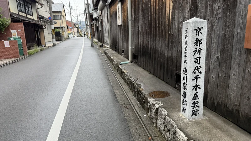
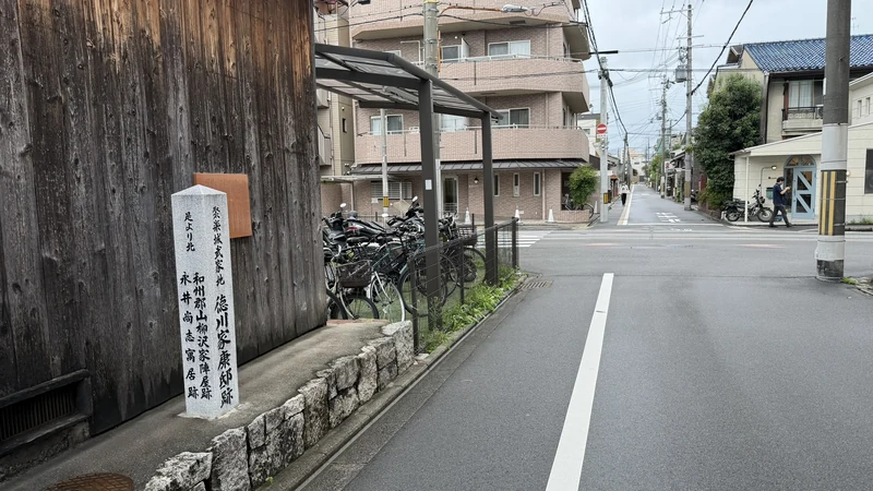
The stone carries more than one inscribed face. One reads "Site of the Senbon Mansion of the Kyoto Shoshidai" (the Tokugawa-era deputy who oversaw Kyoto), and another names a residence of the Yanagisawa family of Koriyama. Together they suggest this plot of land continued in use as a samurai residence well after Ieyasu's own time. The location remains a presumed site rather than one confirmed by excavation.
- The Tokugawa Ieyasu inscription alongside other faces on the same stone, including a reference to the Kyoto Shoshidai's Senbon mansion
- 2023 as the erection date — a comparatively recent addition, not one of the markers on the older official survey maps
- The setting against a wooden machiya wall, in keeping with the other samurai-district markers
Tap an image to enlarge
Time needed: about 5 minutes.
| Location | Kamigyo Ward, Kita-Iseya-cho (north side of the Sasaki Shuzo sake brewery) |
|---|---|
| Figure | Tokugawa Ieyasu |
| Erected | 2023 |
| Status | Presumed site; those who placed it cite old maps and diaries |
Sen no Rikyu's Juraku Residence
Near Seimei Shrine
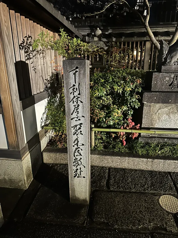
Sen no Rikyu, the tea master who shaped the aesthetics of the age, kept a residence beside Jurakudai, and this marker records it. It is not a remnant of Jurakudai itself, but a clue to the residences of people connected to the palace nearby.
The location says something about the relationship between Hideyoshi and Rikyu. A tea master's house immediately beside the seat of government puts on the map how close the tea ceremony stood to politics in these years. This marker was also among the stops on the 2026 official guided walk.
- The term "Juraku residence," treating Rikyu's house as part of the palace complex
- The short distance from the centre of Jurakudai, which you can walk in a few minutes
- Seimei Shrine nearby, easily combined with this stop
Time needed: about 5 minutes; add 20–30 minutes if you visit Seimei Shrine.
| Location | Kamigyo Ward, near Seimei Shrine |
|---|---|
| Figure | Sen no Rikyu |
| Status | Modern marker recording the residence site |
| Admission | Free, outdoors, always accessible |
③ Markers not covered on this visit
The markers above are not the complete set. The following are worth recording as locations, but the author has not yet confirmed them on the ground. They are listed here for anyone planning a fuller walk. Because they are unverified, their present condition may differ.
| Naoe Kanetsugu and Uesugi Kagekatsu, presumed residence site | Kodo-cho. One stone inscribed on two faces with both names. A different location from the Danjo-cho marker above |
|---|---|
| Site of the Kasasagi Bridge of Juraku Castle | East side of Matsuyamachi-dori north of Demizu, in front of Matsunaga Inari. Erected 1932. The bridge itself does not survive |
| The "Tsuyu no I" well | A traditional site rather than a marker; included in the 2026 official guided walk. Public access not confirmed |
| Former residence of Kimura Shigenari | In front of Guzei-ji Temple. Kimura Shigenari fought in the Siege of Osaka, a generation after Jurakudai stood, so the marker records a later phase of the same neighbourhood. The inscription and the board on site explain the connection |
| North moat wall of the northern bailey; western outer moat | Both were stops on the 2026 official guided walk. Not every point has a stone marker. There are slopes near the western outer moat site |
Map
Naoe Kanetsugu and Uesugi Kagekatsu, presumed residence site
Site of the Kasasagi Bridge of Juraku Castle
The "Tsuyu no I" well
Former residence of Kimura Shigenari
North moat wall of the northern bailey; western outer moat
④ Excavated objects: understanding Jurakudai through its tiles
No amount of looking at stone markers will tell you what Jurakudai was like as a building. The Kyoto City Archaeological Museum fills that gap. Seeing the actual tiles that came out of the ground here is the point at which the palace stops being an abstraction.
Kyoto City Archaeological Museum
Motoisa-cho, Kamigyo Ward
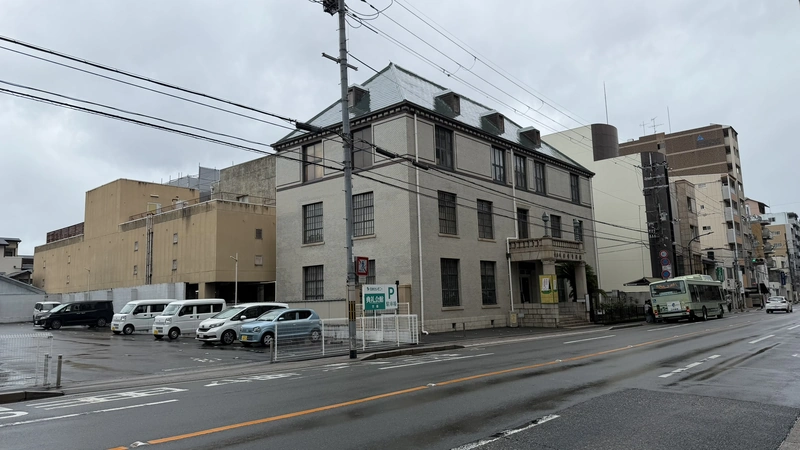
If you start the walk anywhere, start here. Admission is free, and tiles excavated from the Jurakudai site appear in both the permanent and special displays. At the time of visiting, the special exhibition "Hideyoshi's Remaking of Kyoto" was running, tracing his years in the city through finds from Myokenji Castle, Jurakudai, the Kyoto New Castle, Yodo Castle and Fushimi Castle.
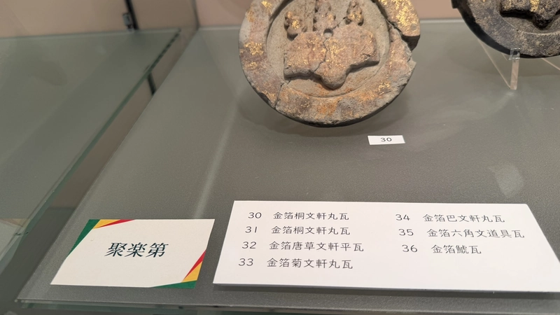
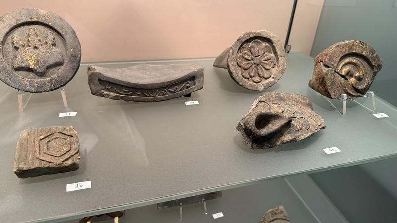
One case is labelled simply "Jurakudai" and holds gold-leafed eaves tiles with paulownia, arabesque, chrysanthemum and comma-swirl designs, a gold-leafed hexagonal fitting tile, and a gold-leafed shachi ornament. Standing close enough to see where the gold leaf has flaked away, it becomes clear that the gold in those screen paintings was not an artist's exaggeration.
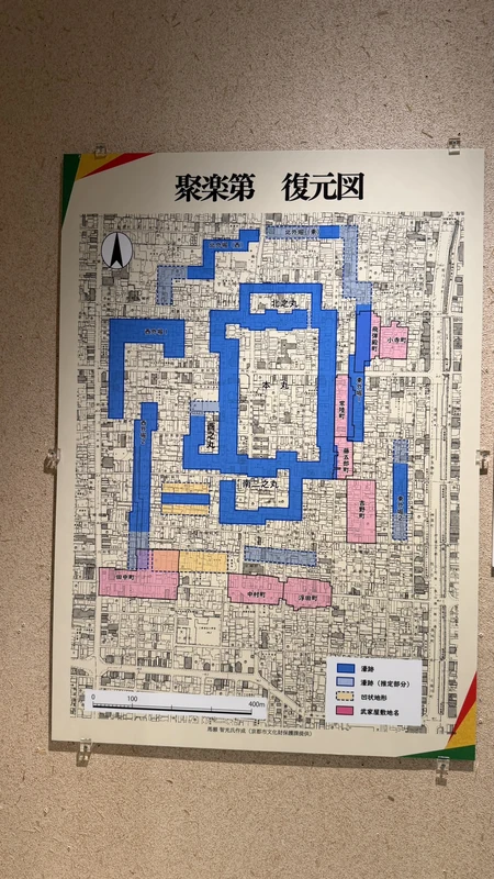
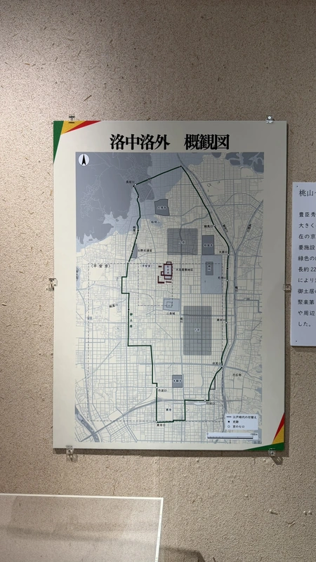
- The reconstruction plan of Jurakudai — a large colour-coded map of the inner bailey, western and northern baileys and the moats. It is the quickest way to see how the markers in this guide relate to the palace
- The gold-leafed tiles — eaves tiles and the shachi ornament
- Excavation photographs showing how the buried stone wall appeared
- Finds from Myokenji Castle, Hideyoshi's Kyoto base before Jurakudai
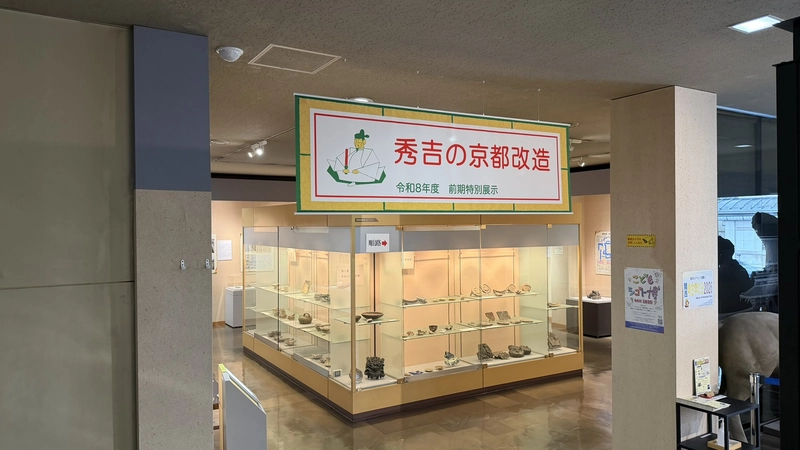
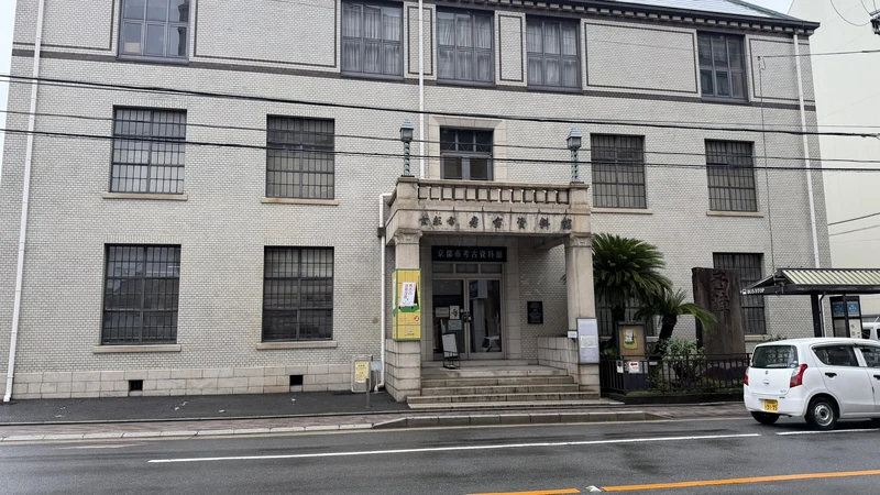
Tap an image to enlarge
Time needed: 40–60 minutes, more if you read everything. Labelling is in Japanese.
| Address | 265-1 Motoisa-cho, Imadegawa-dori Omiya Higashi-iru, Kamigyo Ward, Kyoto |
|---|---|
| Open | 9:00–17:00 (last admission 16:30) |
| Closed | Mondays (open if a public holiday, closed the next weekday); 28 December – 3 January |
| Admission | Free |
| Special exhibition | "Hideyoshi's Remaking of Kyoto," 11 July – 23 November 2026. Displays change after it closes |
| Access | City Bus 9 to "Horikawa-Imadegawa," 2 minutes west; or City Bus 51, 59, 201, 203 to "Imadegawa-Omiya" |
Castle stamps: the Jurakudai gojoin at the Archaeological Museum
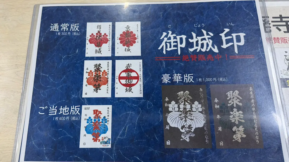
Castle stamps, gojoin, are printed sheets sold at Japanese castle sites, the castle equivalent of the goshuin seals collected at temples and shrines. Jurakudai has its own, sold at the Kyoto City Archaeological Museum. For a site where nothing stands, it is close to the only thing a visitor can take home.
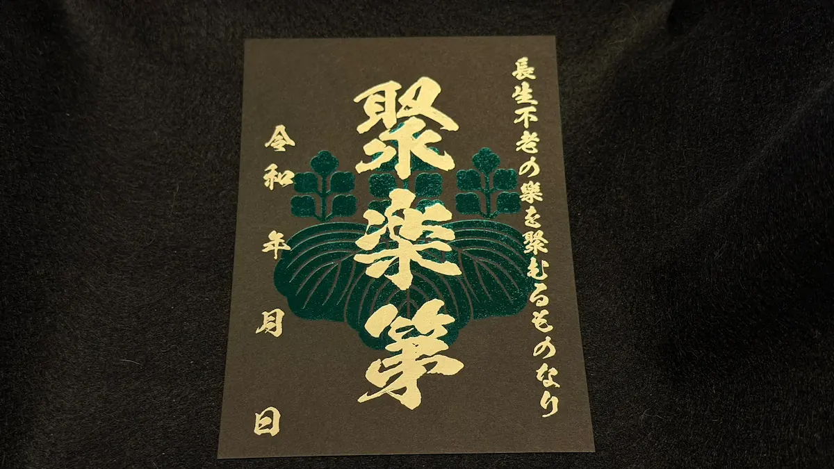
The types and prices are posted on a panel at the museum. At the time of visiting in September 2026 they were as follows.
| Deluxe | Two designs, 1,000 yen each |
|---|---|
| Standard | Four designs, 300 yen each |
| Local edition | One design, 400 yen |
| Where | Kyoto City Archaeological Museum (admission free) |
⑤ Relocation traditions: gates said to come from Jurakudai
Jurakudai was demolished, but several temples preserve a tradition that part of it was moved to them. These are temple traditions and local accounts; in no case is the relocation established by documentary evidence. Note too that all of them stand somewhere other than the Jurakudai site. None can be folded into the walking route described above.
| Myokaku-ji Great Gate (Kamigyo Ward, Kyoto) | Temple tradition holds that Jurakudai's rear gate was moved here in 1663. Other views of its construction date have also been published. Best understood as "a gate said to have been Jurakudai's rear gate" |
|---|---|
| Daitoku-ji Karamon Gate (Kita Ward, Kyoto) | The official site of Daiji-in describes it as a structure from the former Jurakudai. Do not confuse it with the Imperial Messenger Gate or the Sanmon; the same source attributes the Imperial Messenger Gate to the imperial palace and dates the abbot's hall to a donation of 1636 |
| Hiunkaku at Nishi Hongan-ji (Shimogyo Ward, Kyoto) | A well-known relocation tradition, though this is a building rather than a gate. Nishi Hongan-ji's official information states that it is not normally open to the public |
| Jonen-ji Front Gate (Hagi, Yamaguchi Prefecture) | Carries a temple tradition of being Jurakudai's rear gate, but Yamaguchi Prefecture's cultural property notes say there is no supporting official documentation. Far outside Kyoto and not part of any walking route here |
What markers, archaeology and temple traditions can actually tell us
The three kinds of evidence in this guide do not carry equal weight. It is worth separating them.
The firmest is archaeology. A stone wall roughly 32 metres long was recorded on the north side of the inner bailey's southern moat, and gold-leafed tiles were recovered from the eastern moat. These things came out of the ground, and their positions and contents were documented. The wall, however, was reburied and cannot be seen.
Next come the markers and boards. These are modern signposts, based on official survey maps and on research by the societies that erected them. They are reliable as guides to an area, but the position of a stone is not the position of a building. The recurring phrases — "in this vicinity," "traditional site," "presumed site" — are the people who placed them telling you exactly that.
Handle temple traditions most carefully of all. That a temple preserves an account of receiving a structure from Jurakudai is itself a fact. It is not the same fact as the relocation having happened. The existence of a tradition and the verification of its content are two different things, and travel writing about Kyoto routinely runs them together.
One further thing only became apparent on foot: this district is not level. In places the change in height is unmistakable. The precinct of Shorin-ji sits a step below the street; there are slopes around the western outer moat site. The outline of a palace built from moats and earthworks survives in the modern residential grid as a faint tilt in the ground. The stone retaining walls along the lanes are mostly modern, but the fact that they are needed at all is itself a record of the older shape of the land.
A personal ranking based on several visits, most recently in September 2026. It is not the recommended order of any institution or authority.
Free, and the one place where you can see the reconstruction plan and the excavated gold-leafed tiles together. Fix the palace's extent in your mind here and the markers afterwards have meaning. Skip it and the walk risks becoming an exercise in reading stone inscriptions you cannot place.
The ground between these two points is the width of the main enclosure. One without the other gives you no sense of scale. They also fall naturally along the north-to-south route from the museum, so even a short visit can take in both.
Myokaku-ji, Daitoku-ji and Nishi Hongan-ji all stand well away from the Jurakudai site and each has its own access conditions; Hiunkaku is not normally open to the public. Fitting them into the same day means spending most of it in transit. They make more sense as a separate outing.


comment