


Toragozenyama South Route: Six Stops from Yaai Shrine
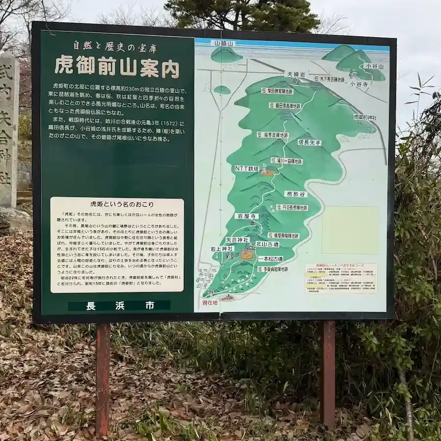
This page covers the southern half of the Toragozenyama walk in the order you meet it. From the trailhead at Yaai Shrine the path climbs onto the ridge and heads north past six sites: the reputed camp of Taga Sadayoshi, Yaai Shrine itself, the reputed camp site of Hachiya Yoritaka, the observation deck, and the reputed camp sites of Niwa Nagahide and Takigawa Kazumasu.
This page covers the southern half of the Toragozenyama walk in the order you meet it. From the trailhead at Yaai Shrine (矢合神社) the path climbs onto the ridge and heads north past six sites: the reputed camp of Taga Sadayoshi, Yaai Shrine itself, the reputed camp site of Hachiya Yoritaka, the observation deck, and the reputed camp sites of Niwa Nagahide and Takigawa Kazumasu, each with a 360° panorama photograph.
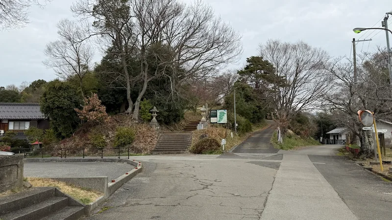
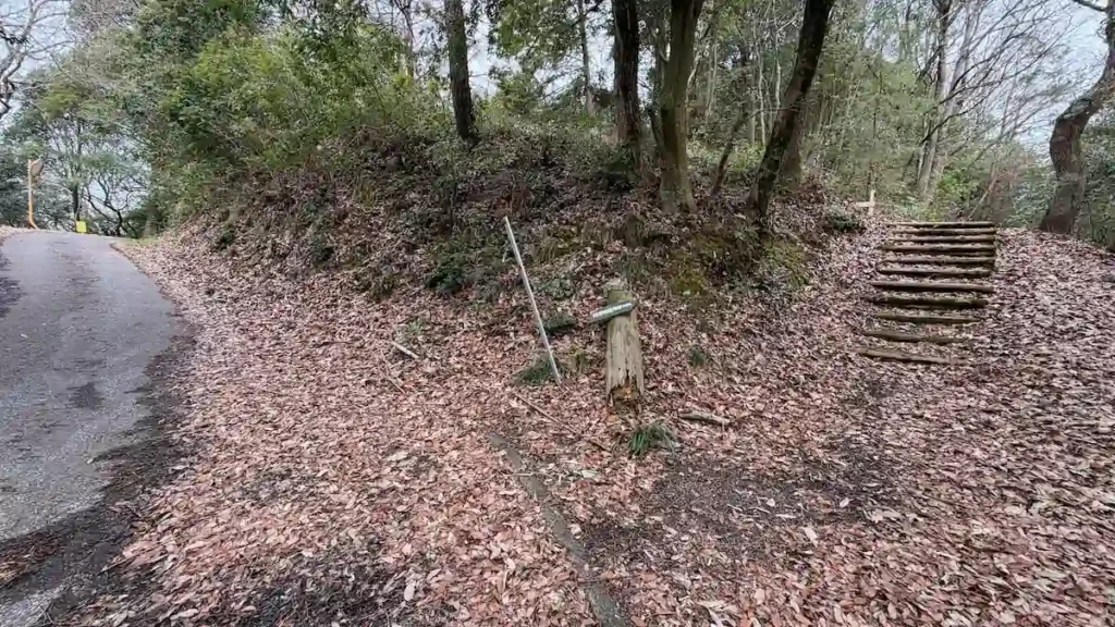
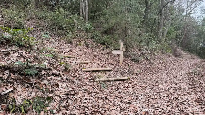
Because I walked the whole ridge myself, the junctions that are easy to get wrong — the one towards the Hachiya Yoritaka camp site above all — are shown here in photographs. Each site also has its data, the time to allow and what there is to look at. For the essentials, access and how to choose your route, see the complete guide to the Toragozenyama Castle ruins.
Tap any photo to enlarge it
The sites, in walking order
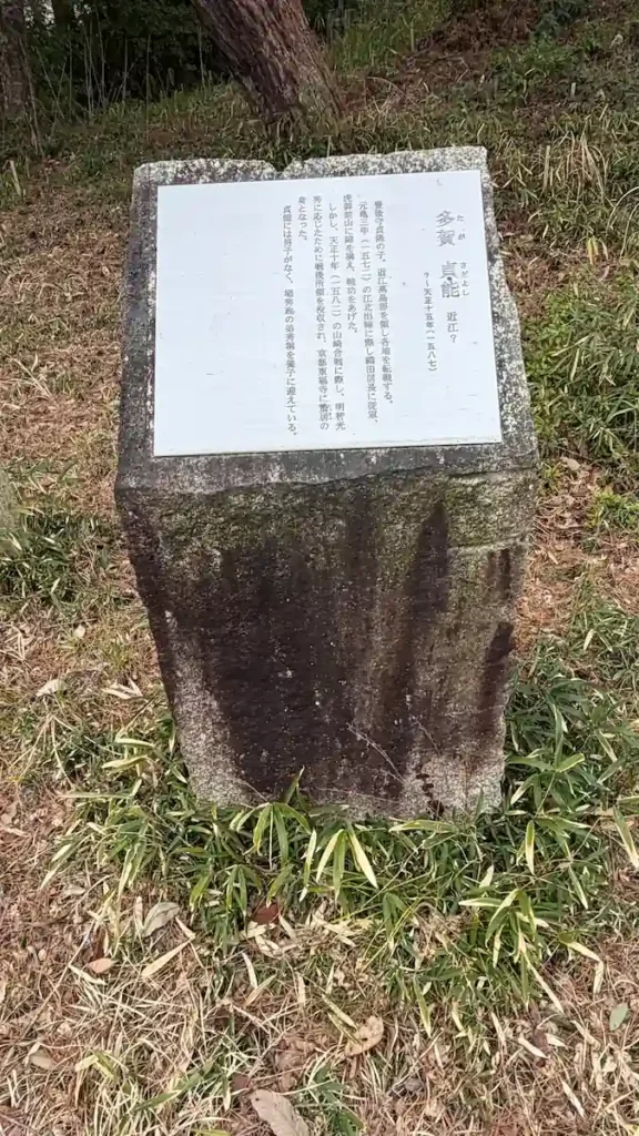
Reputed camp of Taga Sadayoshi (伝 多賀貞能陣所) 🎥 360°
The southern end of the siege line, guarding the way onto the hill
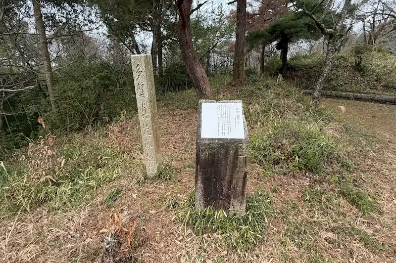
This traditionally identified site sits on Hassozan (八相山), the southern tip of Toragozenyama, and marks the southern end of the Oda army's line of forward positions around Odani Castle. It is counted as one of the enclosures, or kuruwa, of the Toragozenyama fortifications built in 1572, and it is sometimes described as overlapping the whole precinct of the present-day Yaai Shrine. There is not much in the way of conspicuous earthwork here, but the way the ground makes use of an ancient burial mound gives it a defensible feel, and it is the point where you become aware of the southern entrance to the hill.
- The southern enclosure on Hassozan: you can trace on the ground the position that held the southern end of the siege line.
- The Yaai Shrine precinct: a distinctive landscape where a Sengoku-period military camp and a place of local worship overlap.
- Through the seasons: cherry blossom in spring and autumn colour, both enjoyed as part of the walk.
Quick look: about 5 min / At leisure: about 15 min
Drag across the image to look around the site in every direction
Address and access| Address | Nakanocho, Nagahama, Shiga 529-0103 (滋賀県長浜市中野町) |
|---|---|
| Getting there | about 15 minutes on foot (1.2 km) from Torahime Station (虎姫駅, JR-A08) on the JR Hokuriku Main Line |
Historical value: ★★ / Visual appeal: ★ / Experience: ★
Site data| Built | 1572 |
|---|---|
| Built by | Oda Nobunaga |
| Structure and features | An enclosure on Hassozan at the southern tip of Toragozenyama, corresponding to the precinct of Yaai Shrine |
| Repairs and reconstruction | No information available |
| What survives | Survives as part of the Toragozenyama Castle ruins |
| Loss and damage | Substantially levelled by work on the shrine precinct |
| Designation | Part of Toragozenyama, a Nagahama City designated historic site |
| Notes | Head towards Yaai Shrine and turn in on the right-hand side |
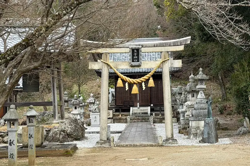
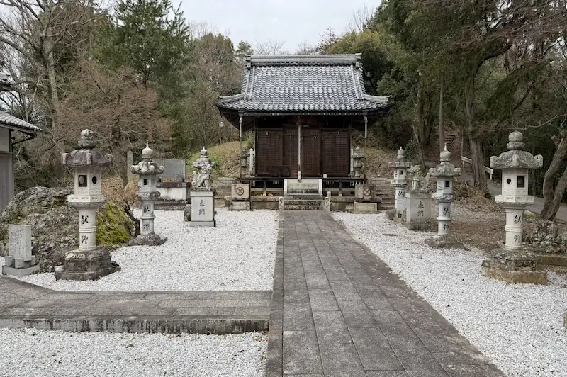
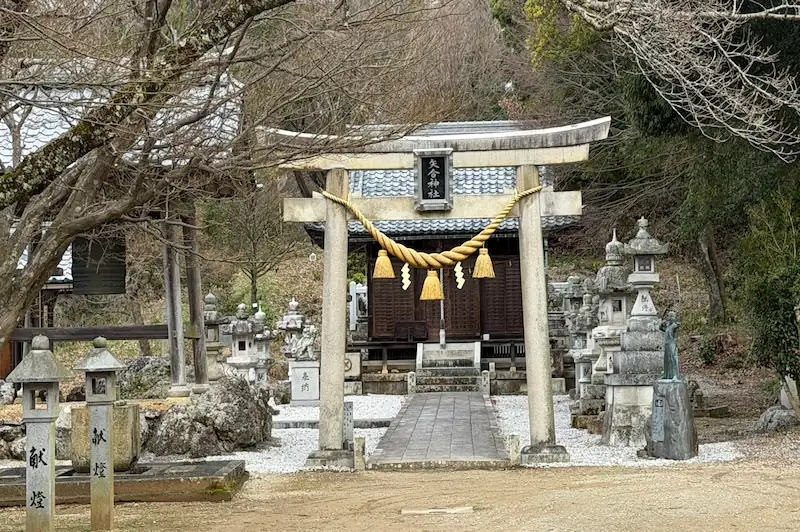
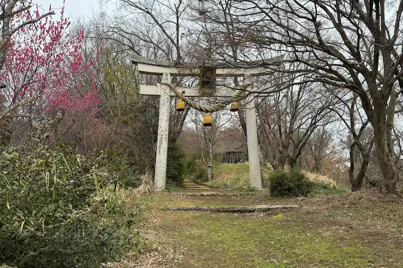
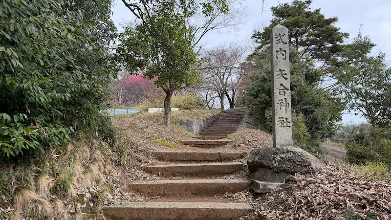
Yaai Shrine (矢合神社) 🎥 360°
A shrine at the gateway to the hill, still standing after the fires of the Sengoku wars
This shrine stands at the trailhead for Toragozenyama, so it is both the way onto the hill and a living place of worship for the district. Its principal deity is given as Ashinadaka-no-kami, and the shrine is said to have been founded in prayer for water in a stretch of country that was poorly served by it. After the fires of the wars of the 1570s, the present shrine hall is recorded as having been rebuilt in 1782.
- A shrine site at the foot of the climb: a place of worship and the entrance to a Sengoku-period site, with an atmosphere all of its own.
- An archer's memory in the shrine's name: the name is said to come from a rite involving bow and arrow combined with the name of Hassozan.
- Through the seasons: the grounds around the shrine are a spot for cherry blossom in spring.
Tap any photo to enlarge it
Quick look: about 10 min / At leisure: about 20 min
Drag across the image to look around the site in every direction
Address and access| Address | 1427 Nakanocho, Nagahama, Shiga 529-0103 (滋賀県長浜市中野町1427) |
|---|---|
| Getting there | about 15 minutes on foot from Torahime Station (虎姫駅, JR-A08) on the JR Hokuriku Main Line |
Historical value: ★★ / Visual appeal: ★★ / Experience: ★
Site data| Built | No information available |
|---|---|
| Built by | No information available |
| Structure and features | A shrine at the Toragozenyama trailhead; its principal deity is Ashinadaka-no-kami |
| Repairs and reconstruction | The present shrine hall was rebuilt in 1782 |
| What survives | The present shrine hall survives |
| Loss and damage | Burned during Nobunaga's campaigns in the 1570s |
| Designation | No information available |
| Notes | The climb onto Toragozenyama passes through the shrine grounds |
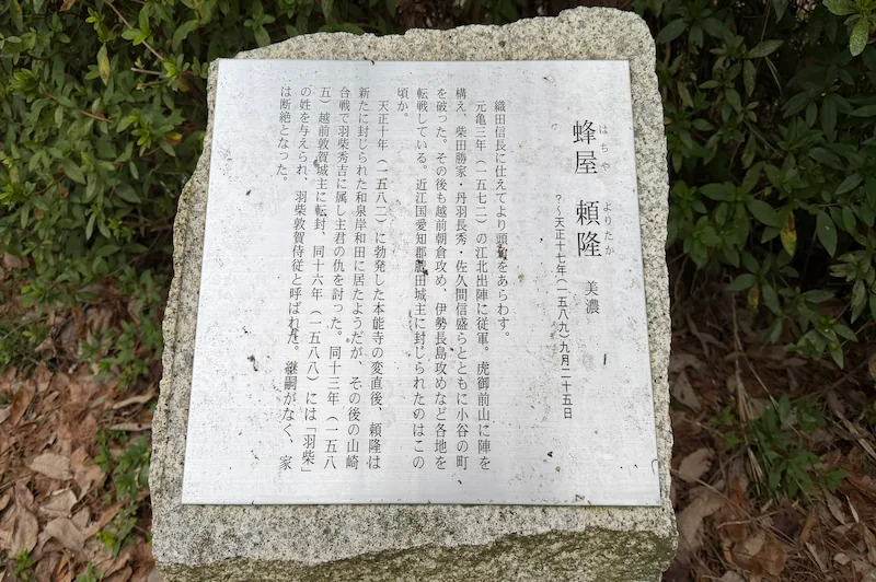
Reputed camp site of Hachiya Yoritaka (伝 蜂屋頼隆陣地跡) 🎥 360°
A keyhole-shaped burial mound turned into a fort, and the first real earthwork on the ridge
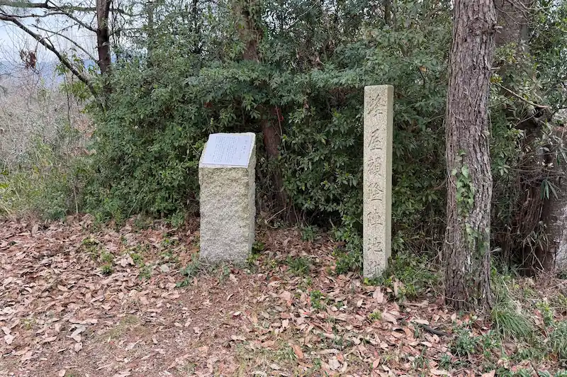
Follow the ridge north from behind the hall of Yaai Shrine and you reach this traditionally identified site, counted among the enclosures of the Toragozenyama fortifications built in 1572. It is handed down as the camp of Hachiya Yoritaka, and what makes it worth the stop is the way it takes in a keyhole-shaped burial mound, together with a fortified gateway backed by a low earthen rampart. Bronze mirrors, body armour and swords have been excavated from the nearby Kitayama burial mound, which shows that this ridge mattered to people here long before the Sengoku period.
- An enclosure built around a keyhole-shaped burial mound: the shape of the ancient mound was put to work as it stood in a sixteenth-century camp.
- The gateway and its straight earthen rampart: defensive structure of the kind you would expect at a forward position.
- Through the seasons: cherry blossom along the path in spring.
Quick look: about 10 min / At leisure: about 20 min
Drag across the image to look around the site in every direction
Address and access| Address | Nakanocho, Nagahama, Shiga 529-0103 (滋賀県長浜市中野町) |
|---|---|
| Getting there | about 5 minutes on foot from Yaai Shrine (see the junction photographs above) |
Historical value: ★★ / Visual appeal: ★★ / Experience: ★★
Site data| Built | 1572 |
|---|---|
| Built by | Oda Nobunaga |
| Structure and features | An enclosure further along the northern ridge, retaining one keyhole-shaped burial mound and a fortified gateway with a low earthen rampart |
| Repairs and reconstruction | No information available |
| What survives | Survives as part of the Toragozenyama site |
| Loss and damage | No information available |
| Designation | Part of the Toragozenyama site, a Nagahama City designated historic site |
| Notes | The area around the Kitayama burial mound is handed down as Hachiya Yoritaka's camp site |
Toragozenyama Observation Deck (虎御前山 展望台) 🎥 360°
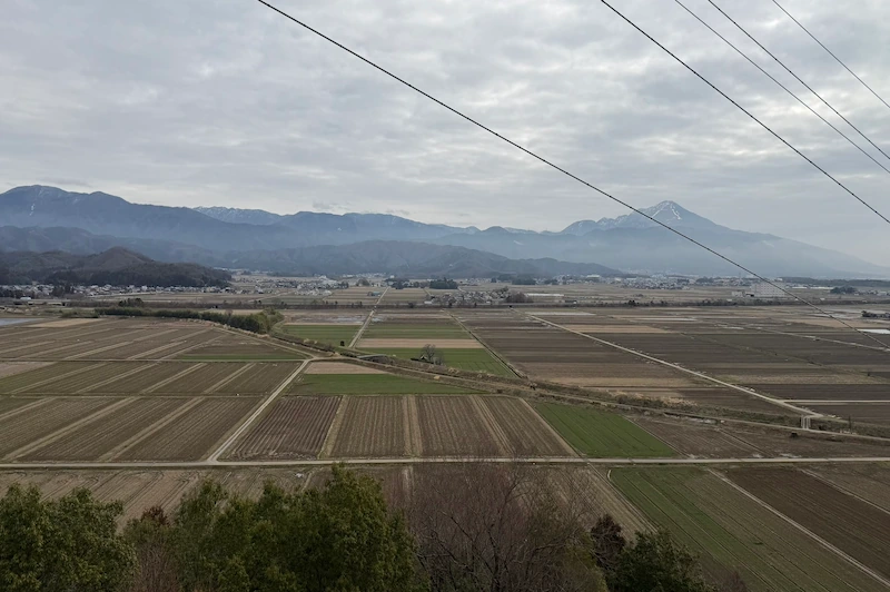
Mount Ibuki and the Kohoku plain, from the staging post of the walk
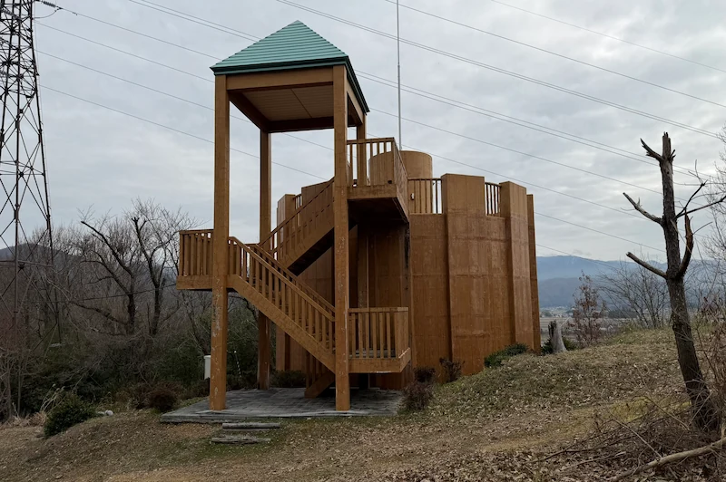
This observation deck sits between the Hachiya Yoritaka and Niwa Nagahide camp sites. It is less a historic site in itself than a place to stop, take in the view and get your bearings partway through the round of camp sites. Looking out towards Mount Ibuki and over the farmland of the Kohoku district, you can size up the rise and fall of the ridge still ahead of you. On a clear day you can also pick out the mountain that carried Odani Castle, which is the moment Nobunaga's reason for placing a forward base on the opposite side of the valley becomes obvious from the landscape itself.
- The view over the Kohoku plain: the point on the walk where the landscape suddenly opens up.
- A staging post between the camp sites: the easiest place to work out how the sites before and after relate to one another.
- Through the seasons: cherry blossom in spring and colour in autumn add something to the walk.
Quick look: about 5 min / At leisure: about 15 min
Drag across the image to look around the site in every direction
Address and access| Address | Nakanocho, Nagahama, Shiga 529-0103 (滋賀県長浜市中野町) |
|---|---|
| Getting there | about 10 minutes on foot north along the ridge from the reputed camp site of Hachiya Yoritaka |
Historical value: ★ / Visual appeal: ★★ / Experience: ★★
Site data| Built | No information available (laid out as an observation deck) |
|---|---|
| Structure and features | An observation deck on the Toragozenyama hiking trail, with a clear outlook towards Mount Ibuki and over the Kohoku plain |
| What survives | Survives as an observation deck |
| Designation | No information available |
| Notes | On the way from the Hachiya Yoritaka camp site towards the Niwa Nagahide camp site |
Reputed camp site of Niwa Nagahide (伝 丹羽長秀陣地跡) 🎥 360°
Levelled, and still holding the scale of a front line
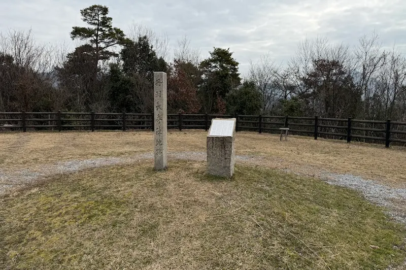
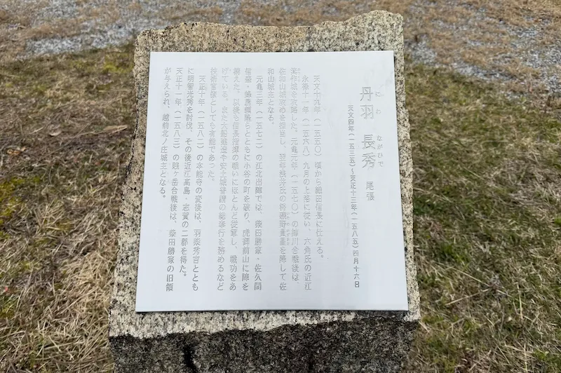
This traditionally identified site is a broad terrace on the Toragozenyama ridge, handed down as the camp of Niwa Nagahide. Its original form was largely lost when huts were put up here for camping, but the sheer extent of flat ground makes it easy to imagine a section of the forward base. What gives the place its meaning is less the earthwork than walking it with the layout of the whole ridge in mind, as one link in the encirclement.
- A near-rectangular terrace: even after alteration, the size of the flat ground conveys the scale of the forward base.
- A ridge path lined with commanders' camps: the encirclement was made up along the length of the whole ridge.
- Through the seasons: cherry blossom brightens the ridge path in spring.
Quick look: about 5 min / At leisure: about 15 min
Drag across the image to look around the site in every direction
Address and access| Address | Nakanocho, Nagahama, Shiga 529-0103 (滋賀県長浜市中野町) |
|---|---|
| Getting there | about 5 minutes on foot north along the ridge from the observation deck |
Historical value: ★★ / Visual appeal: ★ / Experience: ★
Site data| Built | 1572 |
|---|---|
| Built by | Oda Nobunaga |
| Structure and features | A near-rectangular terrace enclosure; the ground has been extensively levelled by later work |
| Repairs and reconstruction | No information available |
| What survives | Survives as a traditionally identified site, though its original form is largely lost |
| Loss and damage | Completely levelled by the construction of camping huts |
| Designation | Part of Toragozenyama, a Nagahama City designated historic site |
| Notes | Walk it thinking about the layout along the ridge rather than the original form, and its value comes through |
Reputed camp site of Takigawa Kazumasu (伝 滝川一益陣地跡) 🎥 360°
A transmission tower and burial mounds side by side, and what the alteration tells you
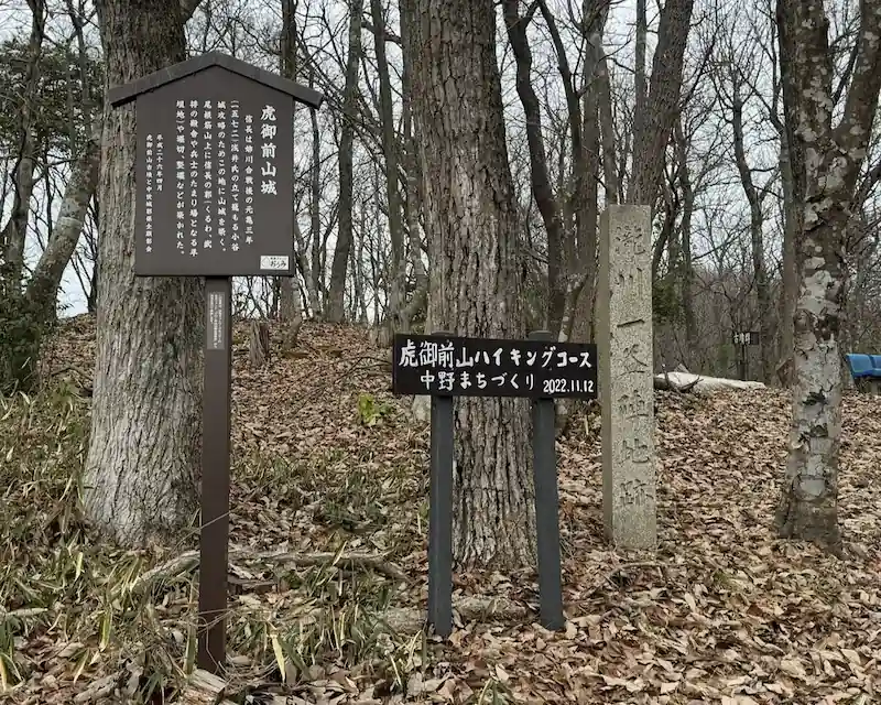
A heavily levelled enclosure, handed down as the camp of Takigawa Kazumasu. A transmission tower stands here now, but three mounds that look like round burial mounds also remain, so you still get the sense of Toragozenyama as a ridge whose ancient graves were put to military use. The earthwork is not in good condition, yet the traces of levelling and later alteration are themselves the story of what has happened to this place. Beyond here, the path leads on to the Hori Hidemasa camp site and the northern half of the ridge.
- Three round-mound rises: striking humps left standing within the levelled ground.
- An altered front-line site: the state of preservation is itself a record of what has happened here.
- Through the seasons: autumn colour along the ridge path.
Quick look: about 5 min / At leisure: about 15 min
Drag across the image to look around the site in every direction
Address and access| Address | Nakanocho, Nagahama, Shiga 529-0103 (滋賀県長浜市中野町) |
|---|---|
| Getting there | about 5 minutes on foot north along the ridge from the reputed camp site of Niwa Nagahide |
Historical value: ★★ / Visual appeal: ★ / Experience: ★
Site data| Built | 1572 |
|---|---|
| Built by | Oda Nobunaga |
| Structure and features | A heavily levelled enclosure, with a transmission tower and three mounds resembling round burial mounds |
| Repairs and reconstruction | No information available |
| What survives | Survives as a traditionally identified site, though the ground has been extensively levelled |
| Loss and damage | Heavily levelled, with a transmission tower now standing on the site |
| Designation | Part of Toragozenyama, a Nagahama City designated historic site |
| Notes | Carry on north from here for the northern area, from the Hori Hidemasa camp site to the viewpoint |
My own order of priority, based on walking the ground. It is not an official Nagahama City recommendation.
An enclosure built around a keyhole-shaped burial mound, with a fortified gateway and a straight earthen rampart still in place. It is the easiest place in the southern half to read how a fortification of shaped earth works.
The point where the view opens out towards Mount Ibuki and over the Kohoku plain, and on a clear day the mountain that held Odani Castle is visible. Good for working out how the camp sites relate to one another.
You pass through it either way, since it is the trailhead itself. The present hall was rebuilt in 1782, and the precinct is said to overlap the Taga Sadayoshi camp.
Completely levelled by the construction of camping huts, so there is almost no earthwork left to read. It is on the ridge path anyway, so noting the extent of flat ground as you pass is enough.
Heavily levelled, with a transmission tower standing on the site. The three round-mound rises do survive, but walking past it costs you nothing in understanding the southern half.
Walking it
Notes from the southern route
What stayed with me most in the southern half was the junction between Yaai Shrine and the Hachiya Yoritaka camp site. A signboard had fallen over, and it is where I very nearly took the wrong path myself. I would strongly suggest looking at the junction photographs on this page before you go.
The Hachiya Yoritaka camp site was the most distinctive space on the ridge, because it is a fort that uses the shape of a keyhole burial mound as it stands. The low rampart and the gateway are relatively easy to read as well, and I came away thinking it is the one place in the southern half where you can really feel how a Japanese fortification built out of shaped earth works.
From the observation deck the farmland of the Kohoku district spreads out and the view is wide open. That was the moment when the reason Nobunaga pitched his camps here became obvious just from looking. At the Niwa Nagahide and Takigawa Kazumasu sites the earthworks have largely gone, but walking them as positions along the ridge still lets you picture how it was.
Frequently asked questions
Yes. There is a short walk that turns back at Yaai Shrine, the trailhead, taking 1 to 1.5 hours there and back. You take in the six southern sites and come down the same way. Yaai Shrine is about 15 minutes on foot from JR Torahime Station.
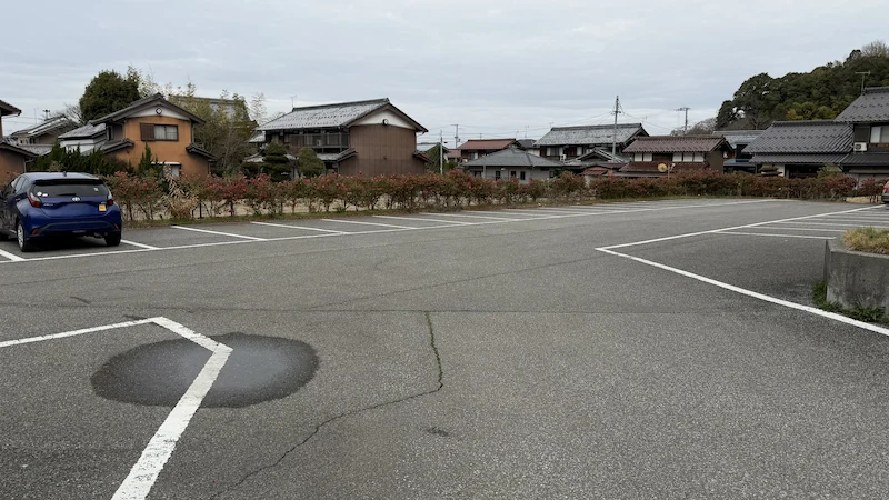
Yaai Shrine has no parking of its own, but the Toragozenyama Park parking lot nearby is free and holds more than ten cars. It is a few steps from the trailhead at Yaai Shrine.
On the way from Yaai Shrine to the Hachiya Yoritaka camp site, the junction behind the shrine hall is the one walkers get wrong. This page shows photographs of it taken on the walk, so it is worth checking them before you set out.
For the next stretch, the northern route through the camps of Nobunaga, Hideyoshi and Shibata Katsuie, see the northern route guide. For the essentials, access and how to choose your route, go to the complete guide to the Toragozenyama Castle ruins.
※ The information here is based on my own visit and on published material, but the state of preservation of the earthworks and the identification of each traditional site are matters on which views differ. When you visit, it is worth reading the material published by the Nagahama City Board of Education and the information boards on site alongside this guide. Times and access details are guides only. This is a mountain path, so please come prepared for the weather and for the walking.
☕ Support This Site
Following the Shogun is built on original fieldwork and on-site research.
If you found this guide useful, your support helps keep it going.

You can also support via QR code


comment