


Toragozenyama North Route: Reputed Camps of Nobunaga, Hideyoshi and Shibata
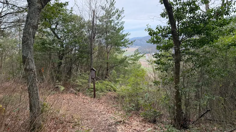
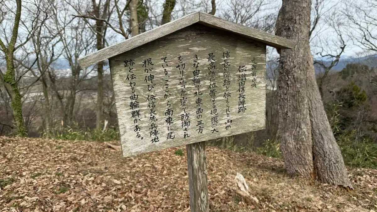
This page covers the central and northern end of the Toragozenyama walk in the order you meet it. At the Oda Nobunaga and Kinoshita Hideyoshi camp sites in particular, the earthen ramparts, traces of ditches and the elongated box-shaped gateway survive in good condition.
This page covers the central and northern end of the Toragozenyama walk in the order you meet it. The earthworks here are among the best preserved on the ridge: at the Oda Nobunaga and Kinoshita Hideyoshi camp sites in particular, the earthen ramparts, traces of ditches and the elongated box-shaped gateway survive in good condition. Along with 360° panorama photographs taken on the walk, the notes explain how to read what you are looking at.
For the southern area, from Yaai Shrine to Takigawa Kazumasu, see the southern route guide. For the essentials and access, see the complete guide to the Toragozenyama Castle ruins.
The sites, in walking order
Reputed camp site of Hori Hidemasa (伝 堀秀政陣地跡) 🎥 360°
Three enclosures divided by trench cuts, the best place on the ridge to read an earthen fortification
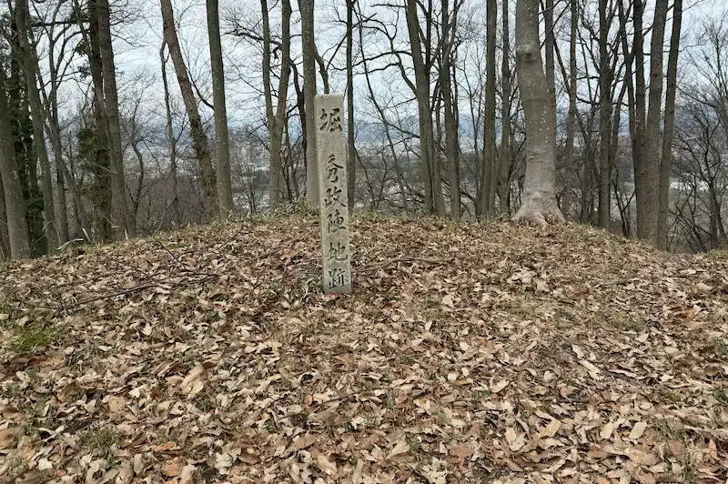
A traditionally identified site close to the heart of Toragozenyama, handed down as the camp of Hori Hidemasa. The draw here is three enclosures divided by trench cuts, together with a raised platform built on an ancient burial mound where a watchtower would have stood, which makes this one of the easier places to follow how a fortification of shaped earth was put together. A stone marker for Nobunaga's headquarters stands on the northernmost enclosure, so you walk it feeling the continuity with the Nobunaga camp site beyond. If you have come up through the southern area, this is where you notice the earthworks suddenly becoming denser.
- The trench cuts dividing three enclosures: the practical layout of Toragozenyama Castle, on the ground.
- A watchtower platform on a burial mound: you can see how an ancient grave mound was converted into a military structure.
- Through the seasons: autumn colour makes the rise and fall of the earth easier to pick out.
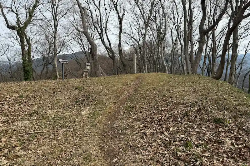
Quick look: about 10 min / At leisure: about 25 min
Drag across the image to look around the site in every direction
Address and access| Address | Nakanocho, Nagahama, Shiga 529-0103 (滋賀県長浜市中野町) |
|---|---|
| Getting there | about 10 minutes on foot north along the ridge from the reputed camp site of Takigawa Kazumasu |
Historical value: ★★★ / Visual appeal: ★★ / Experience: ★★
Site data| Built | 1572 |
|---|---|
| Built by | Oda Nobunaga |
| Structure and features | Three enclosures divided by trench cuts, each with a raised watchtower platform |
| Repairs and reconstruction | No information available |
| What survives | Enclosures, trench cuts and other earthworks survive |
| Loss and damage | No information available |
| Designation | Part of Toragozenyama, a Nagahama City designated historic site |
| Notes | A stone marker for Nobunaga's headquarters stands on the northernmost enclosure |
Reputed camp site of Oda Nobunaga (伝 織田信長陣地跡) 🎥 360°
The command post from which the fall of Odani Castle was directed
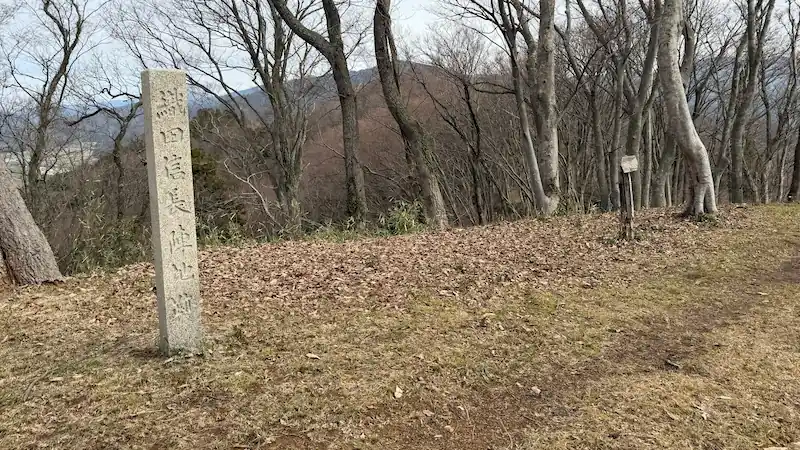
This traditionally identified site is taken to be the heart of Toragozenyama, from which the attack on Odani Castle was directed. The forts on the ridge are recorded as begun on 27 July 1572 and completed on 8 August the same year. Stepped, overlapping enclosures and an elongated box-shaped gateway survive here, so the depth of defence you would expect at the centre of Nobunaga's position is something you can check for yourself on the ground. Some scholars place the headquarters on a different enclosure, and the several markers dotted around the area have the side effect of making the extent of the whole group of enclosures easier to appreciate.
- Stepped, overlapping enclosures: the depth of defence you would expect at the centre of Nobunaga's position.
- The elongated box-shaped gateway: the key feature here, and the one that speaks to real fighting. You can walk right inside it to see how it is put together.
- Through the seasons: cherry blossom in spring and autumn colour add something to the ridge walk.
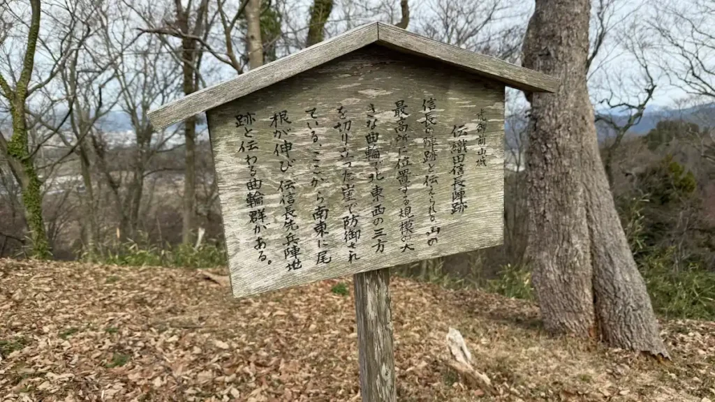
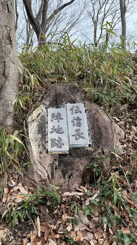
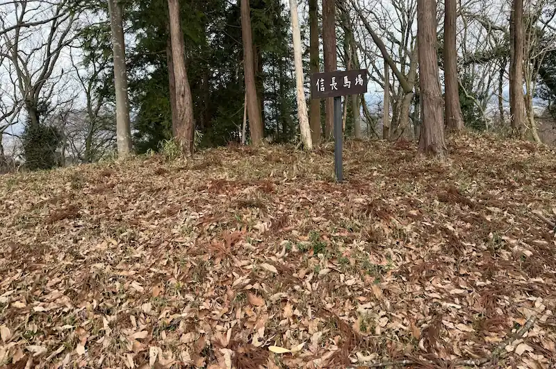
Tap any photo to enlarge it
Quick look: about 15 min / At leisure: about 30 min
Drag across the image to look around the site in every direction
Address and access| Address | Kawake, Kohokucho, Nagahama, Shiga 529-0316 (滋賀県長浜市湖北町河毛) |
|---|---|
| Getting there | about 5 minutes on foot north along the ridge from the reputed camp site of Hori Hidemasa |
Historical value: ★★★ / Visual appeal: ★★★ / Experience: ★★★
Site data| Built | 27 July to 8 August 1572 |
|---|---|
| Built by | Oda Nobunaga |
| Structure and features | A traditionally identified site on the crest of Toragozenyama, with enclosures running in steps and an elongated box-shaped gateway |
| Repairs and reconstruction | No information available |
| What survives | Earthen ramparts, traces of ditches and the gateway survive in good condition |
| Loss and damage | The forts were pulled down after Odani Castle fell, but the shaping of the camp ground remains |
| Designation | Part of Toragozenyama, a Nagahama City designated historic site |
| Notes | Some scholars regard a different enclosure as the more likely site of Nobunaga's headquarters |
Reputed camp site of Kinoshita Hideyoshi (伝 木下秀吉陣地跡) 🎥 360°
The front line held by the future Toyotomi Hideyoshi, with ramparts and ditches surviving well
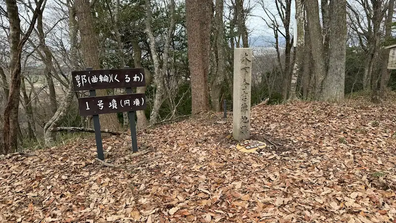
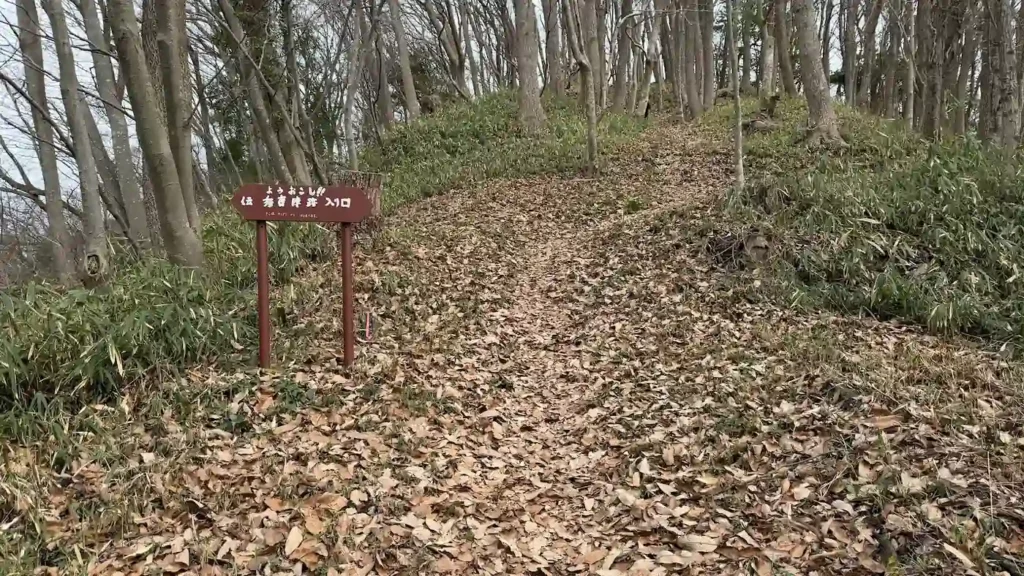
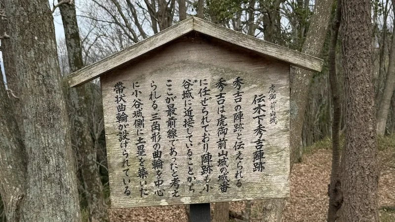
This is the forward section that carries the name of Kinoshita Hideyoshi, the man later known as Toyotomi Hideyoshi. Of everything on Toragozenyama it is described as lying on the side nearest Mount Odani, and as a point where the earthen ramparts and traces of ditches survive well. On 27 August 1573, acting on Nobunaga's orders, Hideyoshi used this as his base to storm the Kyogokumaru enclosure of Odani Castle. He then pushed straight on into the Komaru above it, and that sequence of moves settled the last days of Azai Nagamasa. Standing on the ground where history turned makes this one of the high points of Toragozenyama.
- Earthen ramparts and traces of ditches: an easy place to look at defences built of shaped earth, and to compare them with Nobunaga's camp site.
- The closest approach to Odani Castle: the easiest place to picture the very front of the siege line.
- Through the seasons: cherry blossom in spring and autumn colour give the ridge walk its character.
Tap any photo to enlarge it
Quick look: about 15 min / At leisure: about 30 min
Drag across the image to look around the site in every direction
Address and access| Address | Nakanocho, Nagahama, Shiga 529-0103 (滋賀県長浜市中野町) |
|---|---|
| Getting there | about 5 minutes on foot north along the ridge from the reputed camp site of Oda Nobunaga |
Historical value: ★★★ / Visual appeal: ★★★ / Experience: ★★★
Site data| Built | 1572 |
|---|---|
| Built by | Oda Nobunaga |
| Structure and features | A traditionally identified site on the side nearest Mount Odani, where earthen ramparts and traces of ditches survive well |
| Repairs and reconstruction | No information available |
| What survives | Earthen ramparts and traces of ditches survive well |
| Loss and damage | The forts were pulled down after Odani Castle fell, but the shaping of the ground remains |
| Designation | Part of Toragozenyama, a Nagahama City designated historic site |
| Notes | Kinoshita Hideyoshi is the later Toyotomi Hideyoshi. He used this as his base to take the Kyogokumaru on 27 August 1573. |
Reputed camp site of Shibata Katsuie (伝 柴田勝家陣地跡) 🎥 360°
Closing the northern end of the encirclement, near the end of the ridge walk
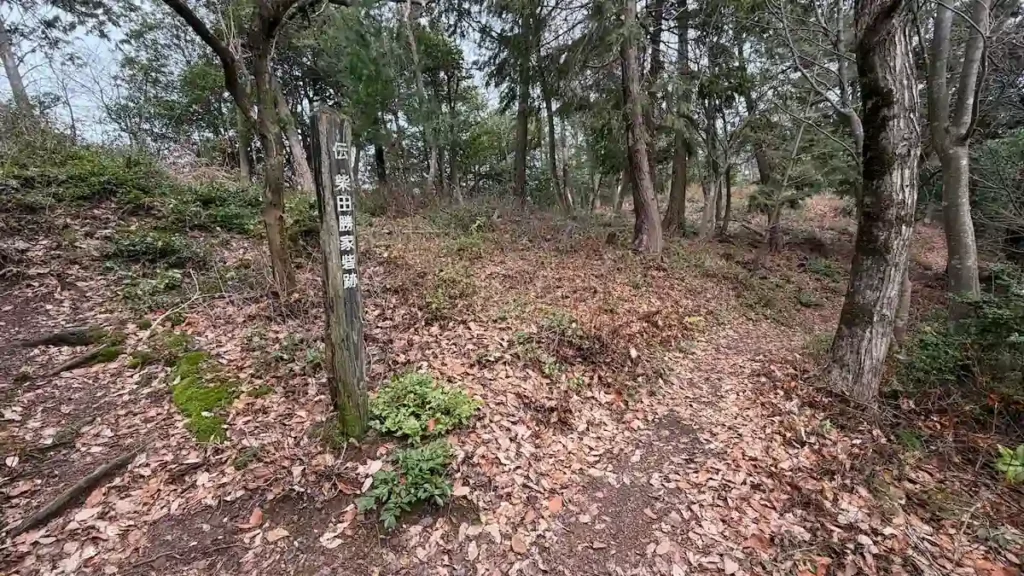
Carry on north along the Toragozenyama traverse and you come to the place handed down as the camp of Shibata Katsuie. It lies further north again than Hideyoshi's camp site, and you walk it as the point that closes off the northern end of Nobunaga's encirclement. There is relatively little detail in the way of surviving earthwork, but reaching it near the end of the traverse is the moment the whole plan falls into place: commanders posted along a single ridge from Yaai Shrine in the south to here in the north.
- The position closing the northern side of the siege line: you can walk it with the layout of the whole of Toragozenyama in mind.
- The quiet end of the ridge path: it still has the feel of the last stop in a line of camps.
- Through the seasons: cherry blossom in spring and autumn colour along the traverse.
Quick look: about 5 min / At leisure: about 15 min
Drag across the image to look around the site in every direction
Address and access| Address | Kawake, Kohokucho, Nagahama, Shiga 529-0316 (滋賀県長浜市湖北町河毛) |
|---|---|
| Getting there | about 5 minutes on foot north along the ridge from the reputed camp site of Kinoshita Hideyoshi |
Historical value: ★★ / Visual appeal: ★ / Experience: ★★
Site data| Built | 1572 |
|---|---|
| Built by | Oda Nobunaga |
| Structure and features | A traditionally identified site on the northern side of Toragozenyama, a camp at the northern end of the siege line. |
| Repairs and reconstruction | No information available |
| What survives | Survives as a traditionally identified site |
| Loss and damage | The forts are said to have been pulled down after Odani Castle fell |
| Designation | Part of Toragozenyama, a Nagahama City designated historic site |
| Notes | The official hiking map places it on the northern side of Hideyoshi's camp site |
Toragozenyama North Viewpoint (虎御前山展望所) 🎥 360°
The shape of the battlefield, seen once you have walked the commanders' camps
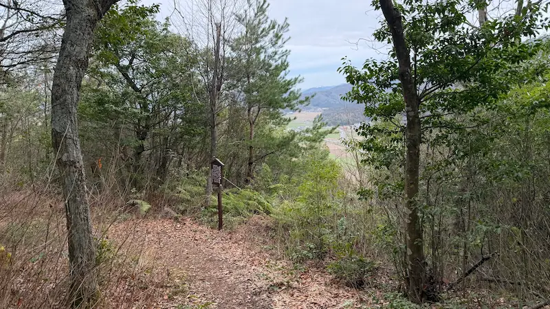
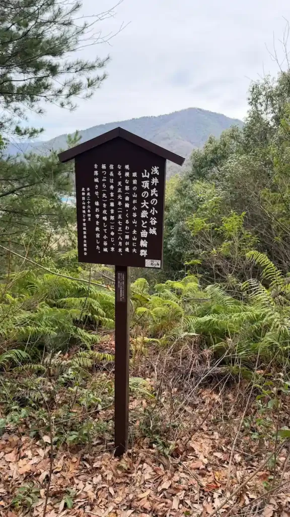
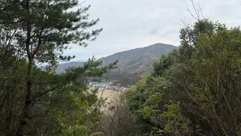
Beyond the Kinoshita Hideyoshi and Shibata Katsuie camp sites, this is where the traverse ends. It is less a place to look at dramatic earthworks than a place to look out at the view once you have walked the line of commanders' positions along the ridge and felt how Toragozenyama worked as a front line. Head north from here and the path becomes the descent towards Kawake Station. That descent includes stretches of continuous steep slope, and calls for particular care after rain.
- The view at the end of a chain of camp sites: the appeal is being able to follow the commanders' positions on foot.
- A point where the shape of the battlefield makes sense: the easiest place to feel that the whole of Toragozenyama functioned as a forward base.
- Through the seasons: cherry blossom in spring and colour in autumn.
Tap any photo to enlarge it
Quick look: about 5 min / At leisure: about 15 min
Drag across the image to look around the site in every direction
Address and access| Address | Odanigunjocho, Nagahama, Shiga 529-0312 (滋賀県長浜市小谷郡上町) |
|---|---|
| Getting there | north along the ridge on foot from the reputed camp site of Shibata Katsuie. At the bottom of the descent, Kawake Station (河毛駅, JR-A07) is about 15 to 20 minutes on foot (1 km). The descent has steep sections, so watch your footing. |
Historical value: ★★ / Visual appeal: ★★ / Experience: ★★
Site data| Built | No information available (laid out as a viewpoint) |
|---|---|
| Structure and features | A viewpoint on the Toragozenyama traverse, beyond the Kinoshita Hideyoshi and Shibata Katsuie camp sites. |
| What survives | Survives as a viewpoint |
| Designation | Within the area of Toragozenyama, a Nagahama City designated historic site |
| Notes | The Toragozenyama hiking trail opened in 2004. Head north from here to descend to Kawake Station. |
My own order of priority, based on walking the ground. It is not an official Nagahama City recommendation.
Stepped, overlapping enclosures and an elongated box-shaped gateway survive, and you can walk right inside the gateway to see how it is built. It is the densest surviving earthwork in the northern half.
On the side nearest Mount Odani, with earthen ramparts and traces of ditches surviving well. This was the base for the assault on the Kyogokumaru on 27 August 1573, so it is ground where the history turned.
Three enclosures divided by trench cuts, each with a raised watchtower platform, which makes the structure of an earthen fortification easy to follow. Worth taking in before Nobunaga's camp if you have the time.
The end of the traverse and the head of the descent to Kawake Station. No dramatic earthwork, but the place to look out over the ground once you have walked the commanders' positions.
Relatively little detail survives in the way of earthwork. It does sit on the path between Hideyoshi's camp site and the viewpoint, so on the full traverse you pass it anyway.
Walking it
Notes from the northern route
Once you are into the northern area, the density of surviving earthwork changes noticeably from the southern half. From the Hori Hidemasa camp site through to Nobunaga's, the relationship between trench cuts, ramparts and enclosures survives well enough to follow with your eyes, and since I had not expected anything this orderly, it took me by surprise on the ground.
The elongated box-shaped gateway at Nobunaga's camp site keeps a remarkably textbook form for a defensive structure built of earth. I would suggest walking right into the gateway and checking the height and angle of the ramparts on either side.
At Hideyoshi's camp site, read the information board and then stand facing the direction of Odani Castle, and you feel how short the range was for the assault of 27 August 1573. Thinking of this place as one of the starting points of the Toyotomi regime was the moment an ordinary mountain path started to look like something else entirely.
The descent from the viewpoint includes stretches of continuous steep slope and is especially slippery after rain, so take care. It is about 1 km to Kawake Station, and at an unhurried pace it took me around 20 minutes.
Frequently asked questions
Both retain earthen ramparts and traces of ditches in comparatively good condition. At Nobunaga's camp site the highlights are the stepped, overlapping enclosures and the elongated box-shaped gateway, while Hideyoshi's camp site lies on the side nearest Odani Castle and is described as a point where the earthen ramparts survive well. If you want to read fortification structure, add the Hori Hidemasa camp site, where three enclosures divided by trench cuts can be picked out.
The descent north from the viewpoint towards Kawake Station includes stretches of continuous steep slope. Footing becomes slippery after rain, so proper walking shoes and some care are needed. Reckon on about 1 km and roughly 15 to 20 minutes on foot.
One option is to walk up to the trailhead from Kawake Station and work southwards from the viewpoint. That said, the official hiking trail is laid out as a traverse from south (Yaai Shrine) to north (the viewpoint), and walking the sites in order from the southern end is the standard way to do it.
For the southern area, from Yaai Shrine to Takigawa Kazumasu, see the southern route guide. For the essentials, access and how to choose your route, see the complete guide to the Toragozenyama Castle ruins.
※ The information here is based on my own visit and on published material, but the state of preservation of the earthworks and the identification of each traditional site are matters on which views differ. When you visit, it is worth reading the material published by the Nagahama City Board of Education and the information boards on site alongside this guide. Times and access details are guides only. This is a mountain path, so please come prepared for the weather and for the walking.
☕ Support This Site
Following the Shogun is built on original fieldwork and on-site research.
If you found this guide useful, your support helps keep it going.

You can also support via QR code


comment