


Koriyama Castle Stone Markers, Part 1: Yanagi-gomon to Omote-mon
At Koriyama Castle, the places where nothing survives are often the most interesting: a single stone marker is enough to bring back the position of a gate or the shape of a masugata, the square walled courtyard that guarded a castle entrance. Part 1 covers fifteen of these markers — from Yanagi-gomon and Hoate-mon, past the Goken-yashiki residences and Kurogane-mon, to the turrets around the Ōte gate — each with on-site photographs and, for eleven of them, a full 360° panorama you can look around from your screen.
- Yanagi-gomon Gate Site (柳御門跡)
- Hoate-mon Gate Site (頬當門跡)
- Goken-yashiki Residence Site (五軒屋敷跡)
- Sakura-gomon Gate Site (桜御門跡)
- Kurogane-mon Gate Site (鉄御門跡)
- Ōte East Corner Turret (追手東隅櫓)
- Ōte Mukai Turret (追手向櫓)
- Kugo-mon Gate Site (久護門跡)
- Tsukimi Turret Site (月見櫓趾)
- Uzumi-mon Gate Site (埋門跡)
- Umaya-mukai Turret Site (御厩向櫓趾)
- Chikurin-mon Gate Site (竹林門跡)
- Chikurin-bashi Bridge Site (竹林橋跡)
- Hitsujisaru Tower Site (坤櫓跡)
- Omote-mon Gate Site (表門跡)
- Getting there & admission
- FAQ
At Koriyama Castle, the places where nothing survives are often the most interesting: a single stone marker is enough to bring back the position of a gate or the shape of a masugata, the square walled courtyard that guarded a castle entrance. Part 1 covers fifteen of these markers — from Yanagi-gomon and Hoate-mon, past the Goken-yashiki residences and Kurogane-mon, to the turrets around the Ōte gate — each with on-site photographs and, for eleven of them, a full 360° panorama you can look around from your screen.
Site by Site
The map below shows all the stone markers at Koriyama Castle. The blue pins are covered in Part 1 and the orange pins in Part 2.
Yanagi-gomon Gate Site (柳御門跡) 🎥 360°
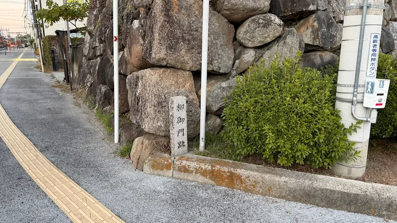
Old painted maps of the castle record a gate called Yanagi-gomon on the south side of the road in front of the Goken-yashiki residences. One theory holds that the castle entrance was a masugata — a square walled courtyard designed to slow and trap attackers — containing two gates, with Yanagi-gomon as the outer gate and Hoate-mon as the inner one.
Hoate-mon Gate Site (頬當門跡) 🎥 360°
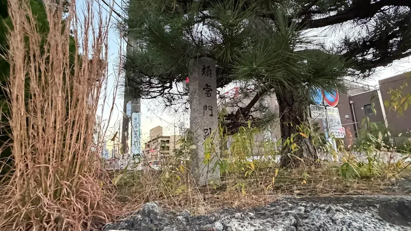
This is described as the inner gate of the Yanagi-gomon masugata courtyard. One explanation of the name compares the masugata as a whole to a samurai helmet, with the inner gate serving much like the hoate, the cheek-and-jaw guard of a helmet.
Goken-yashiki Residence Site (五軒屋敷跡) 🎥 360°
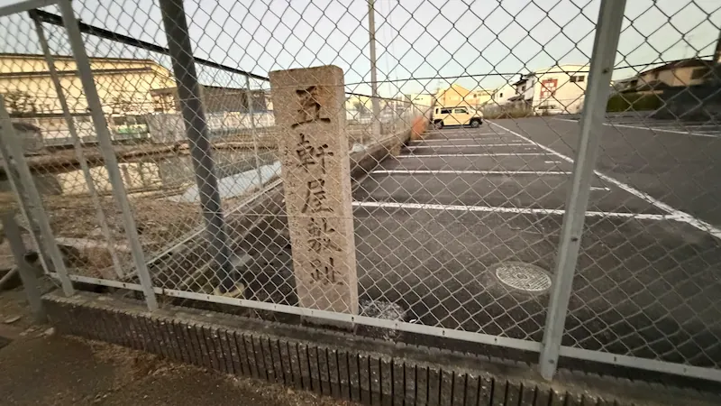
After the Yanagisawa clan was transferred from Kofu to Koriyama in 1724 (Kyoho 9), residences for five senior retainer families of the clan were laid out here — which, one account says, is how the area came to be called Goken-yashiki, literally “the five houses”.
Sakura-gomon Gate Site (桜御門跡) 🎥 360°
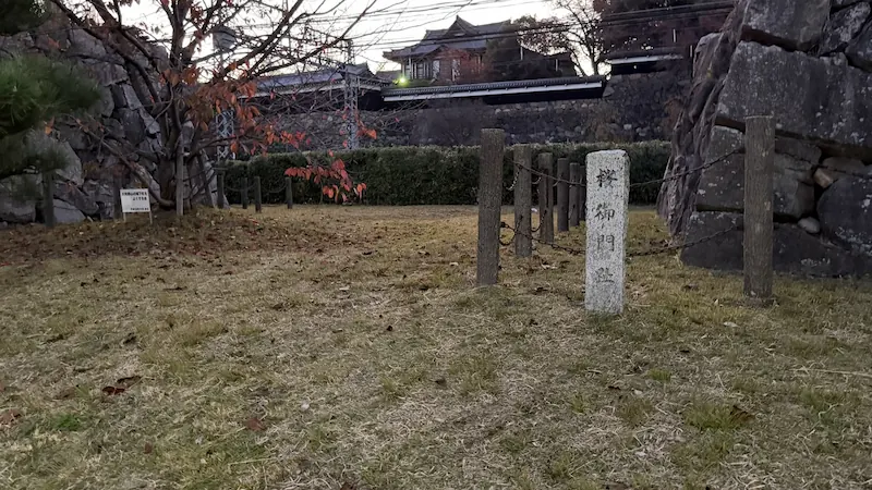
Nara Prefecture’s own introduction to the site records that traces of Sakura-mon remain on the north side of the Goken-yashiki in the sannomaru, the castle’s third enclosure. Old painted maps place two gates along the road in front of the Goken-yashiki residences: Yanagi-gomon to the south and Sakura-gomon to the north.
Kurogane-mon Gate Site (鉄御門跡) 🎥 360°
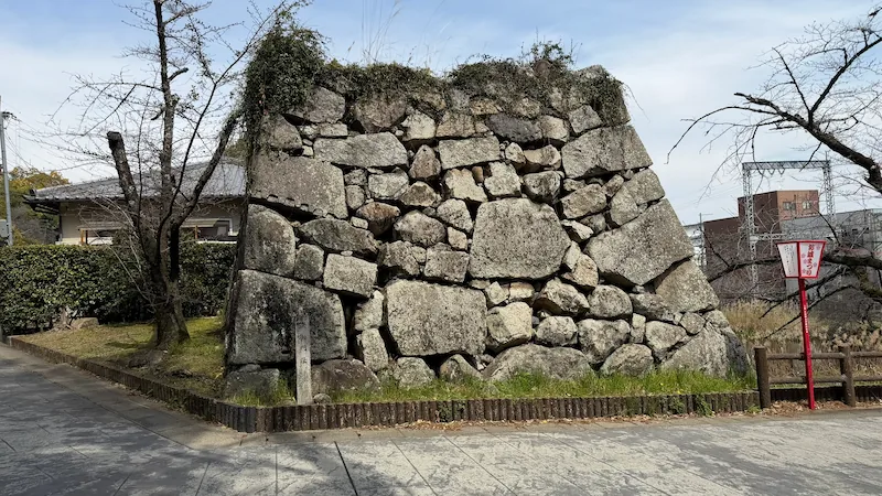
Commentary on the old painted maps explains that Kurogane-mon was the gate controlling access to the honmaru (main enclosure) and ninomaru (second enclosure). The city’s preservation and management plan describes reaching the gate by way of a causeway separating the Goken-yashiki moat from the Hasu-bori, the lotus moat. City-published historical records also carry the theory that Kurogane-mon, Sakura-mon, Nishi-mon and other gates were moved here from Fushimi Castle in Kyoto.
Ōte East Corner Turret (追手東隅櫓)
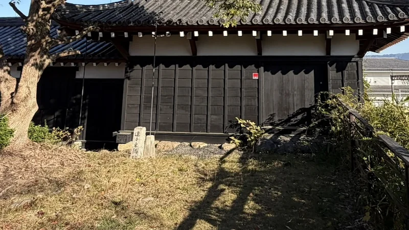
The historic-site map labels this Higashi-sumi-yagura, the East Corner Turret, and places it near the Ōtemon, the castle’s main gate. The same map notes that following the reconstruction of the Ōtemon, the Ōte East Corner Turret, the Ōte Mukai Turret and the Tamon Turret were rebuilt by 1987 (Showa 62).
Ōte Mukai Turret (追手向櫓)
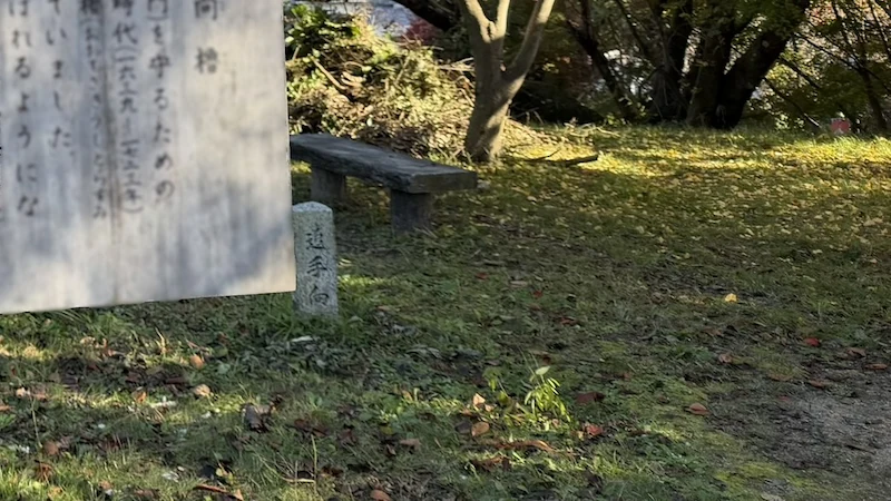
Published accounts quoting the on-site information board, issued in the name of the city board of education, describe the Ōte Mukai Turret as a two-storey turret built to defend the Ōtemon, also known as Bairin-mon. Under the Honda clan it was called Ōtesaki Ushitora-sumi-yagura; after the Yanagisawa clan entered the castle it became known as Ōte Mukai-yagura. The same source records that it was taken down in 1873 (Meiji 6) and reconstructed in 1987 (Showa 62).
Kugo-mon Gate Site (久護門跡) 🎥 360°
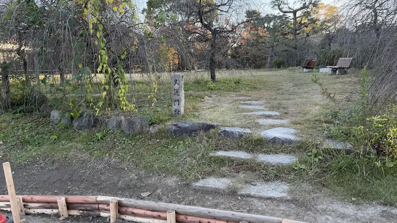
This gate was originally a kabukimon — a plain gate of two posts and a crossbeam, without a roof — and only came to be called Kugo-mon from around the Showa 40s, that is, the mid-1960s to mid-1970s.
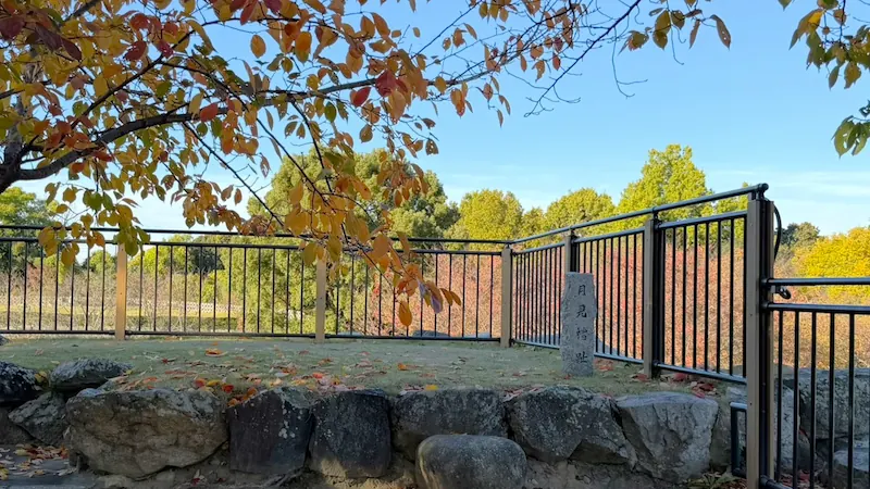
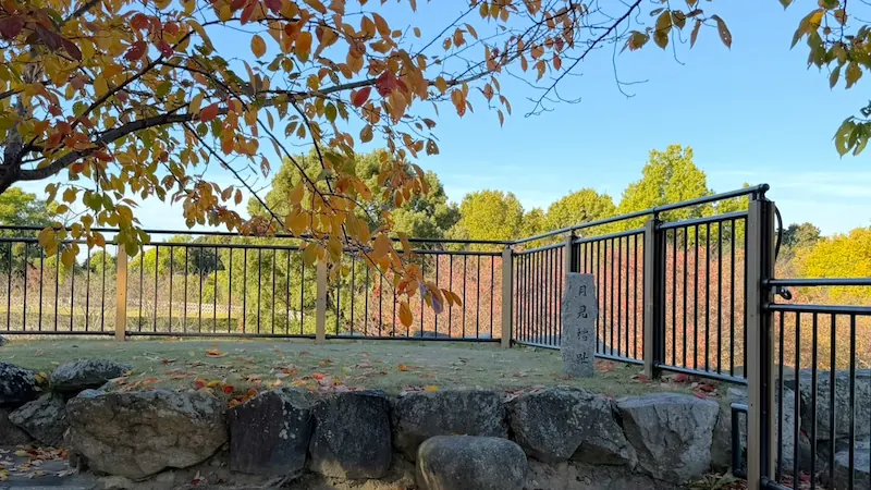
Tsukimi Turret Site (月見櫓趾) 🎥 360°
The city’s preservation and management plan lists Tsukimi-yagura, the moon-viewing turret, among the structures set along the edges of the kuruwa, the castle’s walled enclosures. Its position today is shown on the historic-site map as Tsukimi-yagura-ato.
Uzumi-mon Gate Site (埋門跡) 🎥 360°
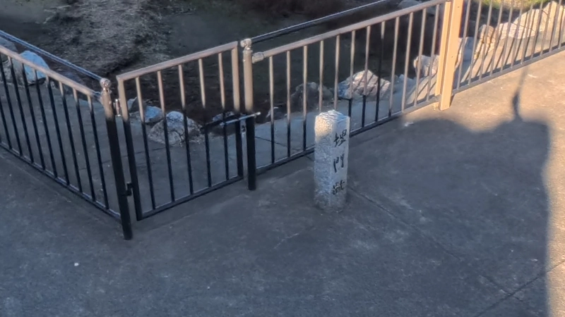
The historic-site map marks the position of Uzumi-mon-ato here.
Umaya-mukai Turret Site (御厩向櫓趾) 🎥 360°
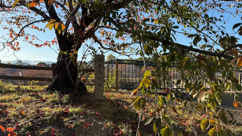
The city’s preservation and management plan lists Umaya-mukai-yagura, the turret facing the stables, among the structures set along the edges of the kuruwa enclosures.
Chikurin-mon Gate Site (竹林門跡) 🎥 360°
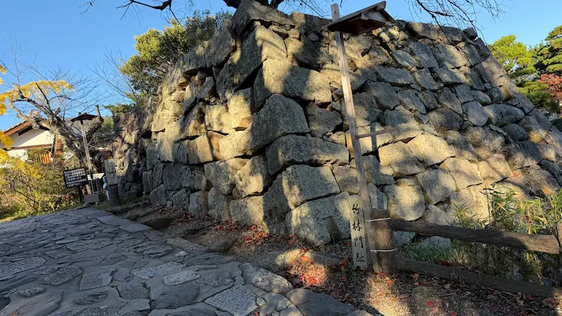
The city’s preservation and management plan lists Chikurin-mon among the structures set along the edges of the kuruwa enclosures, and the historic-site map shows its present position as Chikurin-mon-ato.
Chikurin-bashi Bridge Site (竹林橋跡) 🎥 360°
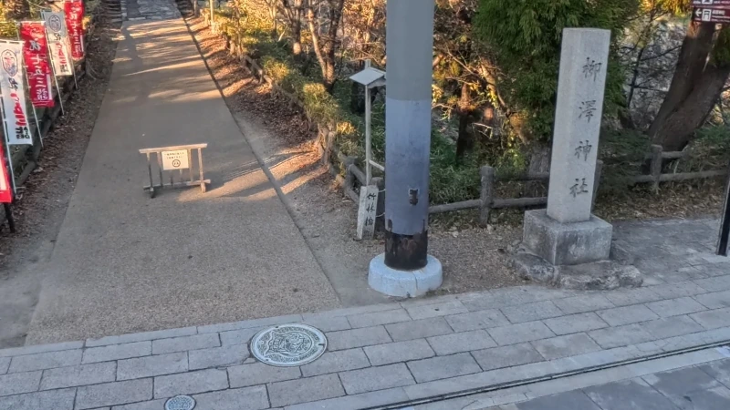
The historic-site map marks the position of Chikurin-bashi-ato, the site of the Chikurin bridge.
Hitsujisaru Tower Site (坤櫓跡)
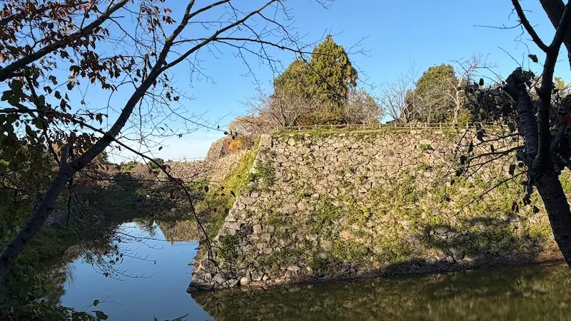
The city’s preservation and management plan lists Hitsujisaru-yagura among the structures set along the edges of the kuruwa enclosures. The historic-site map also shows it as Hitsujisaru-yagura-ato and gives the English name Hitsujisaru Tower Site. (Hitsujisaru is the old compass term for southwest.)
A note on access: when I visited in January 2026, the area around the marker was closed off because of a hornet risk. On a return visit in March 2026 that warning was no longer posted (as of March 2026). Check the notices on site for the current situation.
Omote-mon Gate Site (表門跡)
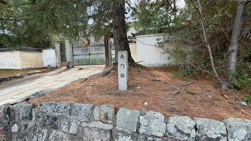
Nara Prefecture’s commentary on the old painted maps, which label the buildings around the Ninomaru Goten — the palace of the second enclosure — includes a gate written as “Omote-mon”.
I do not rank the Koriyama Castle marker sites — they are all sites for castle enthusiasts rather than general sightseeing. The grouping below reflects what this page records about the condition of each site; it is not an official recommended order. Fieldwork: January 2026.
Structures rebuilt by 1987 stand here, so there is an actual building to look at rather than only a stone marker.
From where the markers stand you can follow the masugata layout recorded in the old painted maps, and the position of the gate that controlled access to the honmaru and ninomaru.
Nothing of the structures survives; the historic-site map and the city’s preservation plan record only their positions. Opening the 360° panorama first makes the surrounding ground much easier to read when you get there.
Getting There, Admission & Hours
| Nearest station | Kintetsu Koriyama Station (近鉄郡山駅), Kintetsu Kashihara Line — about a 7-minute walk |
|---|---|
| Second station | JR Koriyama Station (JR郡山駅), JR Yamatoji Line — about a 15-minute walk |
| Two different stations | Kintetsu Koriyama and JR Koriyama are separate stations run by different railway companies. Check which one your route uses before you set out. |
| Where this is | Yamato Koriyama (大和郡山) is a castle town in Nara Prefecture, just south of the city of Nara and within easy reach of both Nara and Osaka. |
| Not to be confused with | Kōriyama (郡山) in Fukushima Prefecture, in northern Japan, is a completely different city. This site is Yamato Koriyama in Nara. |
| Address | Shironai-cho, Yamato Koriyama, Nara Prefecture |
| Admission | The castle grounds (Koriyama Castle Ruins Park) are free |
| Opening hours | The grounds are open 24 hours. The keep platform viewing facility and the Koriyama Castle Information Hall are open 7:00–19:00 from April to September and 7:00–17:00 from October to March |
| Parking | Parking around the castle is limited; public transport is the more reliable option |
| Finding the markers | The markers on this page are scattered across the castle grounds and the streets around them. Open each accordion for the exact location on a map and a 360° panorama of the spot. |
Access, admission and opening hours are based on information published by Yamato Koriyama City and on this site’s own Koriyama Castle guide. Please check the official sources for the latest details.
More of Yamato Koriyama
Frequently Asked Questions
Part 1 covers fifteen markers, from the Yanagi-gomon Gate site to the Omote-mon Gate site. The remaining nine are in Part 2. On the marker map above, the blue pins are Part 1 and the orange pins are Part 2.
Eleven of the fifteen sites in Part 1 have one. Look for the badge next to the site name. The Ōte East Corner Turret, the Ōte Mukai Turret, the Hitsujisaru Tower site and the Omote-mon Gate site do not have panoramas.
Kintetsu Koriyama Station on the Kintetsu Kashihara Line is about a 7-minute walk away, and JR Koriyama Station on the JR Yamatoji Line is about 15 minutes. These are two separate stations run by different railway companies.
The castle grounds (Koriyama Castle Ruins Park) are free and open 24 hours. The keep platform viewing facility and the Koriyama Castle Information Hall are open 7:00–19:00 from April to September and 7:00–17:00 from October to March.
Some structures have been rebuilt. The historic-site map records that after the Ōtemon was reconstructed, the Ōte East Corner Turret, the Ōte Mukai Turret and the Tamon Turret were rebuilt by 1987 (Showa 62). Most of the other sites on this page are marked only by a stone monument.
City-published historical records carry the theory that Kurogane-mon, Sakura-mon, Nishi-mon and other gates were moved here from Fushimi Castle in Kyoto. The Nishi-gomon Gate site appears in Part 2.
One theory holds that the castle entrance was a masugata — a square walled courtyard — with two gates: Yanagi-gomon as the outer gate and Hoate-mon as the inner one.
When I visited in January 2026, the area was closed off because of a hornet risk. On a return visit in March 2026 that warning was no longer posted (as of March 2026). Check the notices on site for the current situation.
Parking around the castle is limited, so public transport is the more reliable option.
☕ Support This Site
Following the Shogun is built on original fieldwork and on-site research.
If you found this guide useful, your support helps keep it going.

You can also support via QR code


comment