


Shizugatake: The Chairlift, the Summit Walk, and the 1583 Battle
Shizugatake (賤ヶ岳) is the mountain where Hideyoshi Hashiba and Katsuie Shibata fought a decisive battle in 1583. A chairlift carries you most of the way up, and the summit area looks out toward two lakes, Lake Biwa and Lake Yogo, each in a different direction. There's no reconstructed castle here — but the terrain itself does a lot of the storytelling.
On this page
- Is It Worth Visiting?
- At a Glance
- Getting from Kinomoto Station to the Lift
- From the Lift to the Summit
- A Battlefield Bigger Than the Summit
- What You Can Actually See Today
- Core Spots in Walking Order
- Reading the Battlefield Through the Terrain
- 2026 Practical Notes
- Nearby Planning & Where to Stay
- FAQ
- Support This Site
Shizugatake (賤ヶ岳) is a mountain northeast of Lake Biwa in Shiga Prefecture, where forces loyal to Hideyoshi Hashiba and Katsuie Shibata fought a decisive battle in 1583 — part of the power struggle that followed Oda Nobunaga's death the year before. A chairlift carries visitors most of the way up, and the summit area looks out toward two lakes, Lake Biwa and Lake Yogo, each in a different direction. Being able to enjoy two lakes from a single summit is a big part of what makes the climb worthwhile.
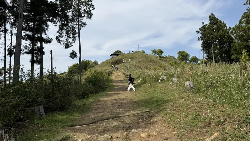
There's no reconstructed castle here, and no stone walls to point to. What tends to catch the eye instead is a set of information panels, a memorial sculpture, and a handful of later-era markers. Historical surveys do document fort-related earthworks at this site, but on this visit, without prior knowledge, they weren't easy to pick out on the ground.
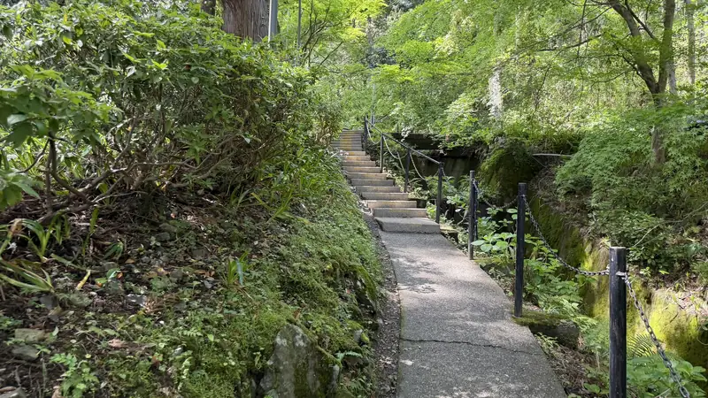
The lift doesn't drop you at the summit itself, either. From the upper station, you still need to walk a stretch of dirt path and a set of log-built steps to reach the summit plaza.
Shizugatake, in other words, isn't primarily a place to see clear castle ruins. It's a place where the terrain itself — the lakes, the ridgelines, the low ground between them — gives you a real sense of how large the battle was.
Is It Worth Visiting?
- Strong fit: readers interested in the Battle of Shizugatake, Hideyoshi, his brother Hidenaga, and Katsuie; anyone who enjoys lake-and-mountain views combined with a short hike; visitors comfortable with an open, single-seat chairlift.
- Conditional: those uneasy with heights or open-air lifts (the chairlift is single-seat with open sides); visitors with limited mobility, since the walk after the lift is on unpaved ground and log steps.
- Might feel underwhelming for: visitors expecting stone walls, a reconstructed keep, or clearly visible moats and earthworks.
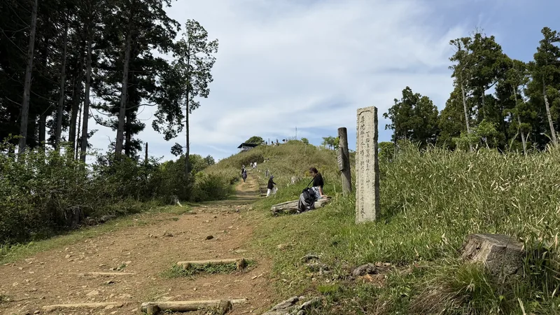
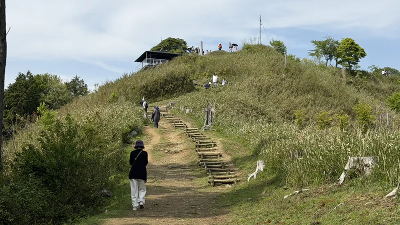
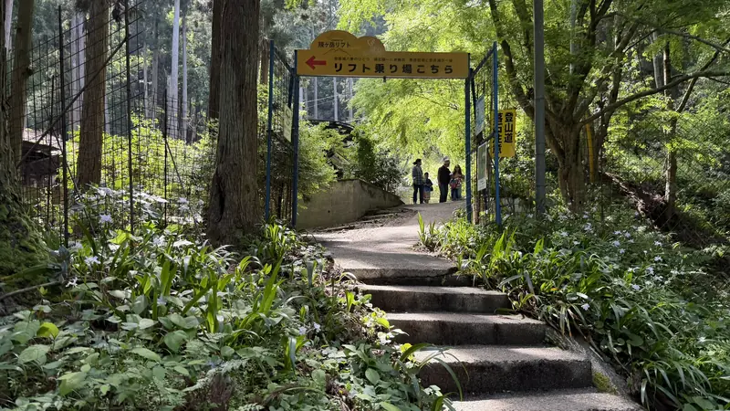
Tap to enlarge — this is the walk after the lift, not the ride itself.
The view of both lakes depends on the weather; on cloudy or hazy days, visibility toward one or both lakes can drop.
For a first visit, it's worth heading to the summit plaza first — checking the markers, the sculpture, and both lake views — before spending time at features like the swing near the upper station.
At a Glance
| Travel time | About 43 minutes measured from Kinomoto Station to the summit plaza (May 2, 2026, using a rental electric bicycle — one example, not a guaranteed standard time) |
|---|---|
| Lift fare | ¥600 one-way / ¥1,100 round trip (adult). Operating hours 9:00–17:00 (confirmed August 2, 2026 — reconfirm officially before your visit) |
| Lift ride time | Official estimate about 6 minutes; measured on May 2, 2026 it took 8 minutes |
| Upper station to summit | Official estimate about 10 minutes; measured on May 2, 2026 it took 8 minutes |
| Summit facilities | Restroom available per official information; no shop or food, so bring your own water and snacks |
| Castle remains | No reconstructed buildings. Fort-related earthworks are documented, but they were hard to identify at a glance without prior knowledge |
| Footwear | Walking shoes recommended (unpaved paths and wooden steps) |
Getting from Kinomoto Station to the Lift
The gateway to Shizugatake is JR Kinomoto Station (木ノ本駅) on the JR Hokuriku Line, north of Lake Biwa in Nagahama, Shiga Prefecture. If you're coming by Shinkansen, Maibara Station is the practical transfer point — it's the nearest Shinkansen stop, and from there it's about a 25-minute ride on the JR Hokuriku Line with no transfer needed to reach Kinomoto.
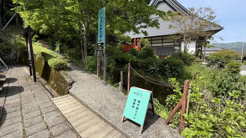
Tap to enlarge. Fares and hours change — check current official information rather than relying on photos.
Getting There
| Nearest station | JR Hokuriku Line, Kinomoto Station (木ノ本駅, A05) |
|---|---|
| Shinkansen gateway | Maibara Station (東海道新幹線米原駅). About 25 minutes to Kinomoto on the JR Hokuriku Line, no transfer |
| From major cities | About 1 hr 30 min from Kyoto Station (direct or with a transfer, depending on the train); about 1 hr 15 min from Nagoya Station via the Tokaido Shinkansen to Maibara, then the JR Hokuriku Line (connections vary) |
| Local difficulty | Moderate — the walk after the lift is on unpaved ground with log steps |
| Recommended transport | Free shuttle bus on weekends, holidays, and August 13–16 during the operating season; on weekdays, a reserved taxi or rental bicycle depending on bus connections |
| By car | About 1.5km / 3 minutes from Kinomoto Interchange |
| Parking | Free, with 26 and 40 spaces in two areas |
| Taxi | About 5 minutes from Kinomoto Station. Taxis don't wait at the station, so booking ahead is safer |
| Local bus | About 15 minutes, plus roughly a 10-minute walk from the Oto stop. Service is infrequent — check the return schedule before you go |
| Free shuttle bus | Departs from Kinomoto Station's west exit. Runs weekends, holidays, and August 13–16 during the operating season (check the official timetable on the day) |
| Rental bicycle | Available at Kinomoto Eki Fureai Station, just outside the station's east exit. On May 2, 2026 the posted rates were ¥500/day standard, ¥1,000/day electric, plus a ¥1,000 deposit — reconfirm current pricing and availability locally |
| Walking | About 40 minutes from the station |
| Lift fare & hours | ¥600 one-way / ¥1,100 round trip (adult), 9:00–17:00 (confirmed August 2, 2026; shorter hours from November, and closures possible in bad weather) |
| Summit walk | About 10 minutes from the upper station (unpaved path and wooden steps; walking shoes recommended) |
| Summit facilities | Restroom available per official information; no shop or food |
There are several ways to get from Kinomoto Station to the lift base station.
- Free shuttle bus: departs from the station's west exit. Runs on weekends, holidays, and August 13–16 during the operating season (check the official timetable on the day).
- Local bus: about 15 minutes, plus roughly a 10-minute walk from the Oto stop. Service is infrequent, so check the return schedule before you go.
- Taxi: about 5 minutes from Kinomoto Station. Taxis don't wait at the station, so booking ahead is safer.
- Rental bicycle: available at Kinomoto Eki Fureai Station, just outside the east exit — the same building also sells what looked like locally grown produce and a range of souvenirs. On May 2, 2026, rates were ¥500/day standard, ¥1,000/day electric, plus a ¥1,000 deposit (reconfirm current stock, hours, and pricing).
- Walking: about 40 minutes from the station.
On May 2, 2026, an electric rental bicycle was used for this ride, and it took 23 minutes from Kinomoto Station to the lift base station. Most of the route has no significant slope, but the final stretch approaching the base station had a noticeably steep section.
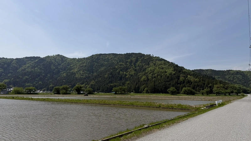
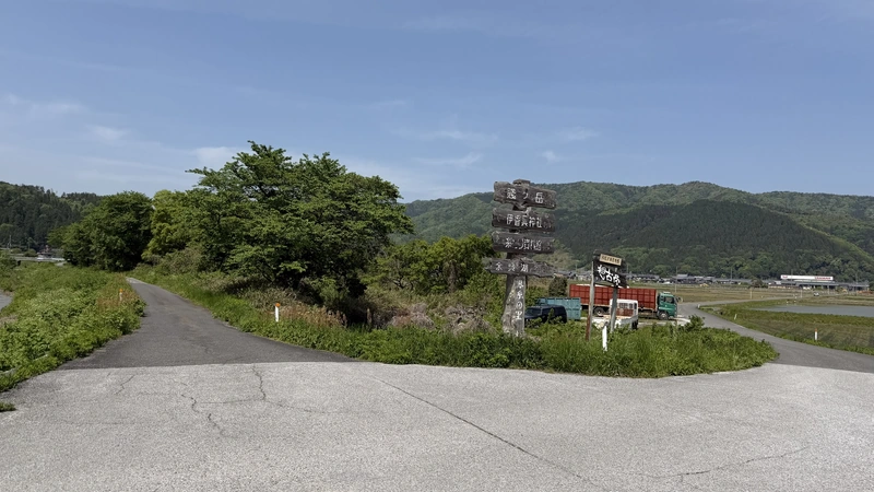
Tap to enlarge — scenes along the ride from Kinomoto Station.
By car, it's about 1.5km / 3 minutes from the Kinomoto Interchange. Parking is free, with 26 and 40 spaces in two areas.
Planning It Without a Car
It can close in bad weather, so check official information before you set out.
It only runs on weekends, holidays, and August 13–16 during the operating season.
Local bus timing, a reserved taxi, and a rental bicycle are all worth weighing against each other.
The bus and shuttle both run on limited schedules, so it's worth deciding how you're getting back before you head up.
Build in time for the walk back, plus the lift, plus your onward connection.
From the Lift to the Summit
23 minutes, measured May 2, 2026. Mostly flat, with a noticeably steep stretch right before the base station.
Official estimate about 6 minutes; measured on the same visit, 8 minutes.
Official estimate about 10 minutes; measured on the same visit, 8 minutes. Unpaved, with a section of log-built steps.
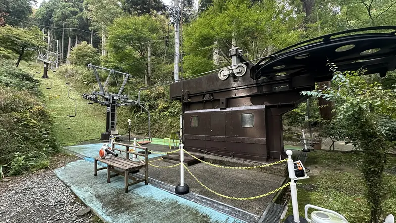
The Shizugatake Lift is a single-seat, open-air chairlift that climbs through the trees. On the May 2, 2026 visit, it felt similar to a lift you'd find at a ski resort. That said, it's a single seat with open sides, so it's worth a second thought if you're uneasy with heights or open-air rides.
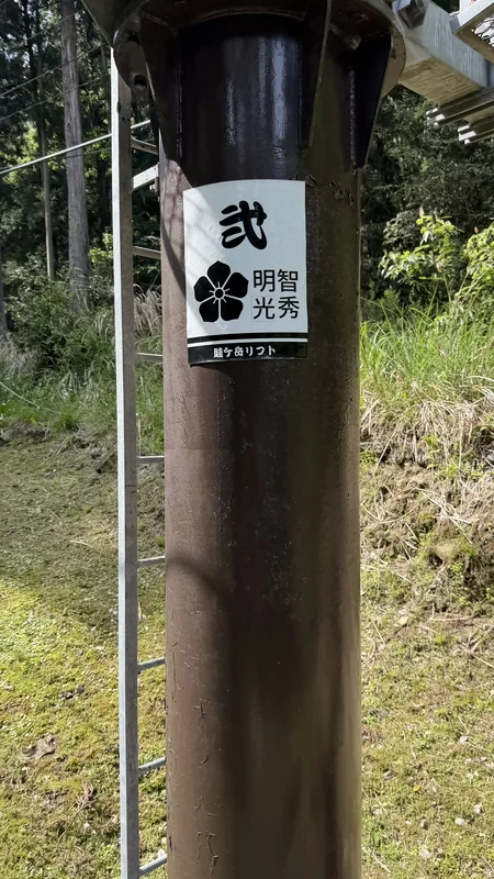
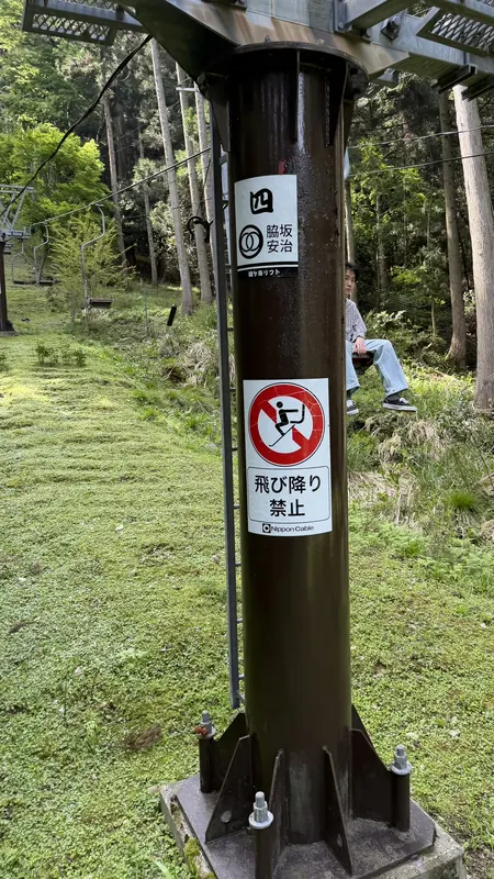
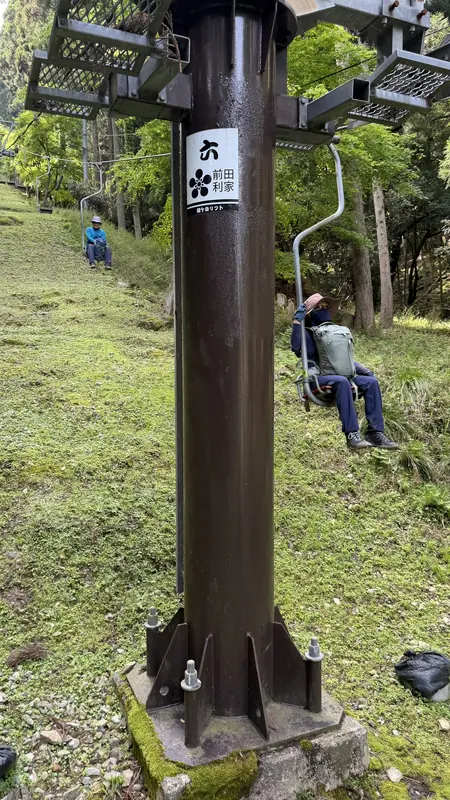
Tap to enlarge — each lift pillar is painted with a different Sengoku-era commander's crest.
The official ride time is about 6 minutes; measured, it took 8 minutes. Both figures are given separately rather than blended together.
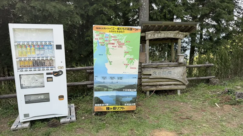
At Shizugatake, the walk doesn't end once you step off the lift: after disembarking, you still cross a stretch of dirt path and wooden steps before reaching the summit, so the total time to the top isn't measured by the lift ride alone.
From the upper station to the summit plaza, the official estimate is about 10 minutes; on the May 2, 2026 visit it took 8 minutes. The path is unpaved, with a section of log-built steps. It didn't feel especially steep on this visit, but it's worth planning for a walk rather than assuming the lift delivers you straight to the top.
Along the way is a feature known as the "scenic swing" — an open swing hung from ropes between trees. On this visit, people were waiting their turn to use it.
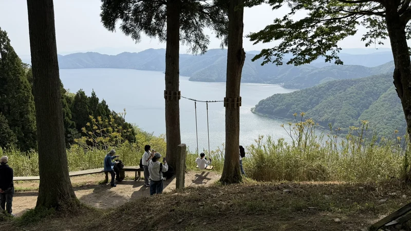
Since the summit is the main destination, it's worth reaching it first rather than lingering at the swing, then stopping there on the way back down.
A Battlefield Bigger Than the Summit
In 1583, forces loyal to Hideyoshi Hashiba and Katsuie Shibata clashed at Shizugatake. The fighting followed the succession struggle that broke out after Oda Nobunaga's death at Honno-ji the year before, in 1582.
Not a battle confined to one summit
The Battle of Shizugatake wasn't fought on this hill alone. Both sides built around 20 fortified camps of varying size across the wider Lake Yogo area, and the fort at the Shizugatake summit was one point within that much larger network. Mount Torogozen (虎御前山), a ridge nearby known for a separate set of encampments Oda Nobunaga, Hideyoshi, and Shibata used during the earlier siege of Odani Castle, is another reminder of how much military activity this stretch of northern Shiga saw during the Sengoku period.
Just before the summit stands a local map known as the "Battle of Shizugatake Diagram."
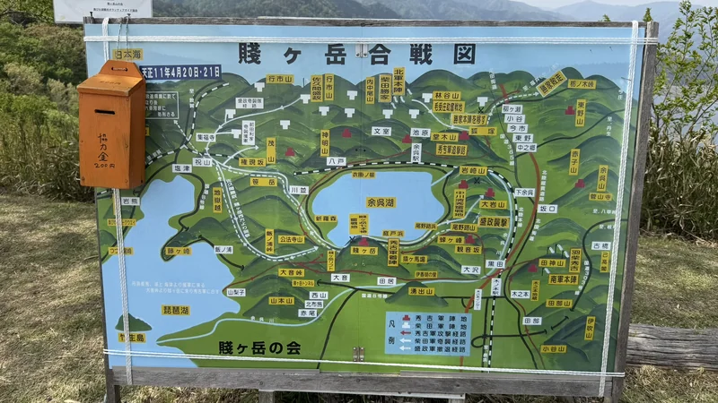
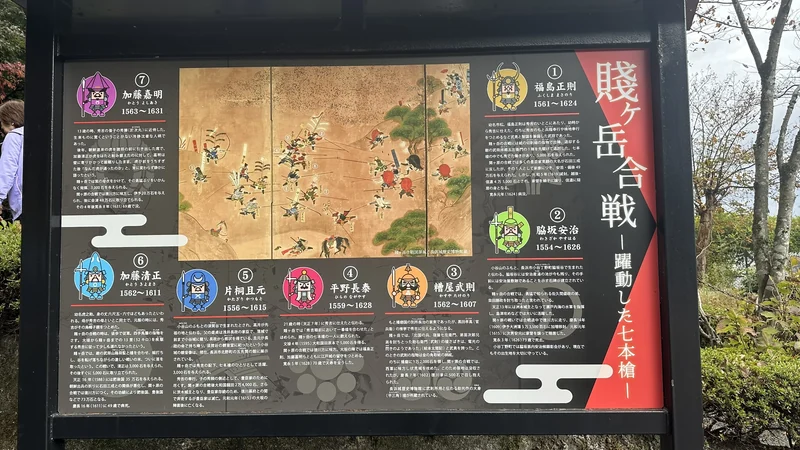
Tap to enlarge.
This diagram conveys a general sense of nearby place names and camp positions; it isn't detailed enough on its own to establish the exact location of individual camps or troop numbers.
If you visit the exhibition hall near Yogo Station beforehand and see how the camps were laid out, standing at the summit afterward makes it easier to picture the wider battlefield — imagining, for instance, that another unit may have held a particular ridge in view. That said, this is an impression drawn from the terrain, and the actual position of any individual commander's camp may not match exactly.
The fuller course of the battle, and the retainers later celebrated as the "Seven Spears of Shizugatake," fall outside the scope of this guide. For more on one of the men behind Hideyoshi's campaign, see our guide to Toyotomi Hidenaga, Hideyoshi's younger half-brother.
What You Can Actually See Today
Standing at the summit, almost nothing can be confidently identified by eye as an original 1583 structure. The summit area has been leveled into flat ground that could resemble the site of a bailey, but whether that flat ground reflects the Sengoku-era terrain or later park development isn't something you can determine on sight alone.
What does stand out clearly are later additions: an information marker, a memorial space, and a commemorative sculpture. These were placed to commemorate the 1583 battle — they aren't part of the original castle buildings or fortifications themselves.
Shizugatake, in other words, isn't a place to look at castle buildings or stone walls. It's a place where the 1583 terrain and these later memorials together help you picture the history that happened there.
Core Spots in Walking Order
The order below follows the route from the base station up.
1. Shizugatake Lift Base Station
Modern facility | Start of the ascent
A modern facility with the lift entrance, fare information, and parking and bicycle areas. This is the starting point for the ascent.
2. Shizugatake Lift
Modern facility | Open, single-seat chairlift
The open, single-seat chairlift takes about 6 minutes officially, 8 minutes measured, to reach the upper station. The ride itself is part of the experience.
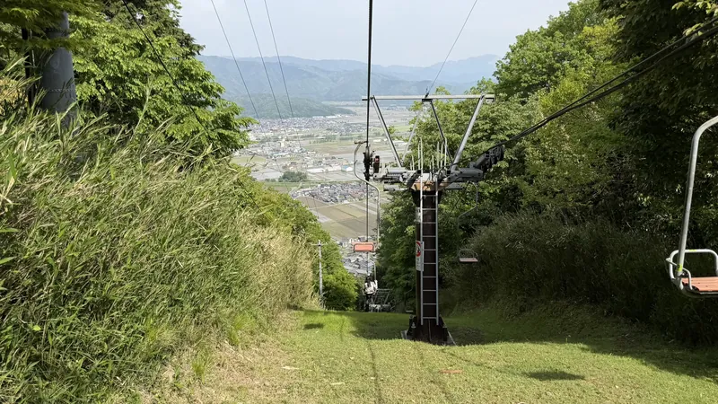
Tap to enlarge — different Sengoku-era commanders' crests decorate each lift pillar.
3. Upper Lift Station Area
Modern facility | Start of the walking section
This is not the summit plaza — it's the start of the walking section. Nearby is a signboard introducing local connections to the NHK historical drama Gō — Himetachi no Sengoku, not a sign about the Shizugatake battlefield itself.
4. Scenic Swing Area
Modern feature | Better on the way back
A modern visitor feature that can be closed in bad weather. It's worth reaching the summit first and treating this as a stop on the way back down.
5. Shizugatake Summit Plaza (Fort Ruins)
1583 fort site + modern landscaping
Present-day terrain combined with modern landscaping. The open plaza brings together the markers, memorial space, sculpture, and viewpoints — and it's also the site traditionally identified as the 1583 Shizugatake fort. No buildings have been reconstructed, and in practice, the fort traces were hard to identify on the ground without prior knowledge. The current flat area shouldn't be assumed to be the original bailey.
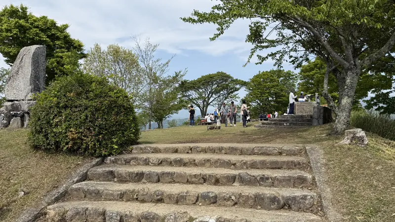
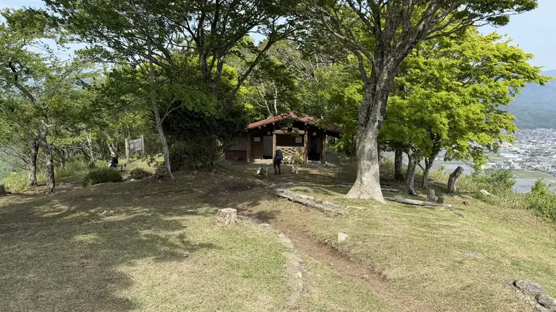
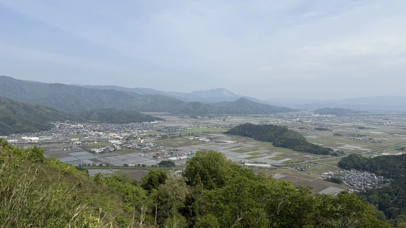
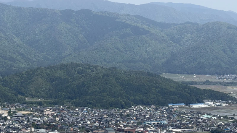
Tap to enlarge.
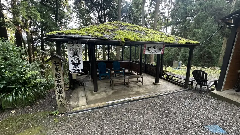
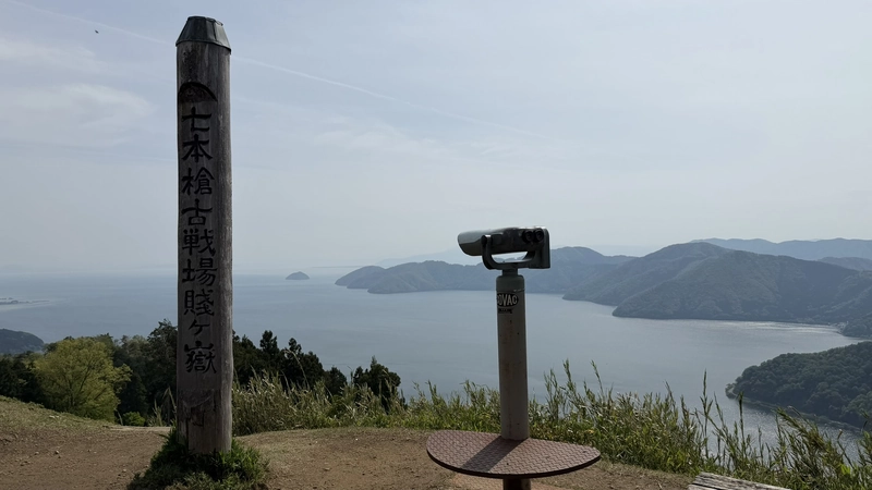
6. "Seven Spears Battlefield, Shizugatake" Wooden Marker
Later-era information marker
A later-era marker standing at a Lake Biwa-side viewpoint, reading "Seven Spears Battlefield, Shizugatake." Within the sources checked for this guide, the year it was erected and by whom could not be identified.
7. Memorial Ground for the Fallen of the Battle of Shizugatake
Later-era memorial space
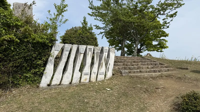
A later-era memorial space. A stone pillar stands beside a flight of steps, apparently marking a place of remembrance for those who died in the battle, though only part of the inscription could be read.
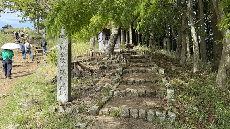
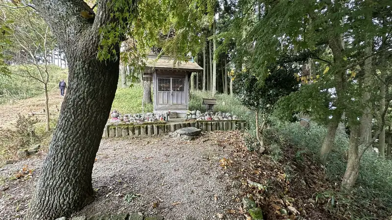
Tap to enlarge.
8. "Historic Site: Seven Spears Battlefield of Shizugatake" Marker
Later-era commemorative marker
A later-era commemorative and information marker, standing next to a modern "SHIZUGATAKE" photo sign — a clear side-by-side of an older memorial marker and a present-day visitor feature.
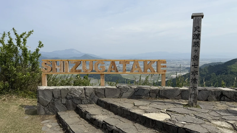
9. Memorial Sculpture, "After the Battle"
Later-era commemorative sculpture
A later-era commemorative sculpture depicting a warrior and a fallen figure. Its official title is "After the Battle." No visitor information found on-site or online identifies it as a specific commander, so this article doesn't name it as Katsuie Shibata or anyone else.
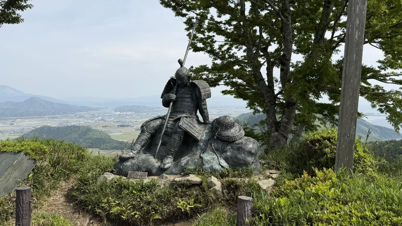
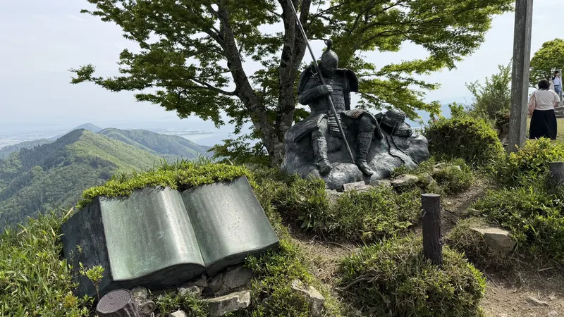
Tap to enlarge (the plaque text isn't legible in this photo).
10. Lake Biwa-Side View
Natural scenery | Facing southwest
Natural scenery. Looking southwest toward Lake Biwa, the ridgeline, and Chikubushima Island. (See "Reading the Battlefield Through the Terrain" below for more.)
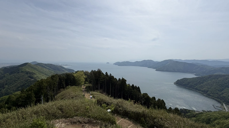
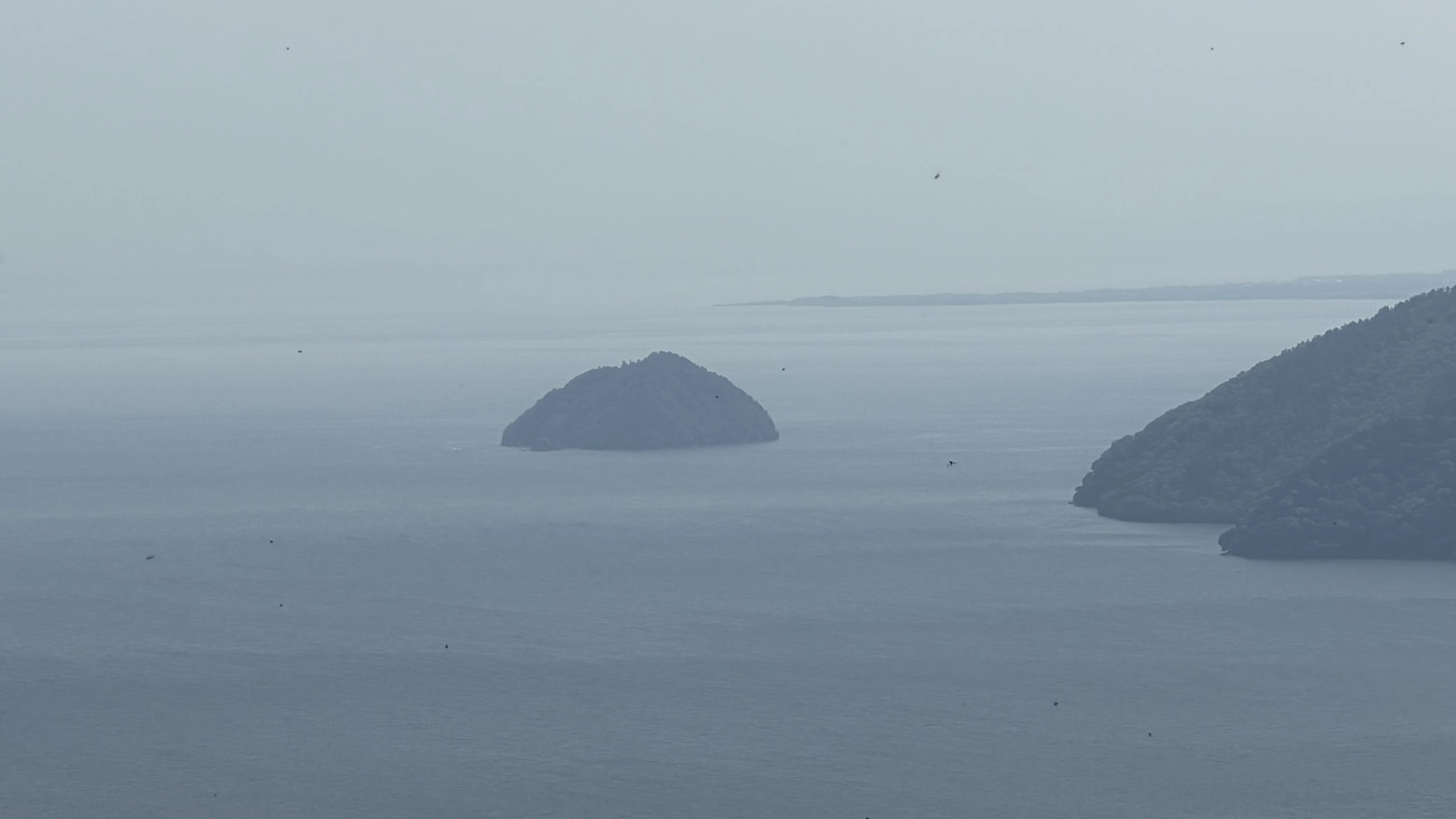
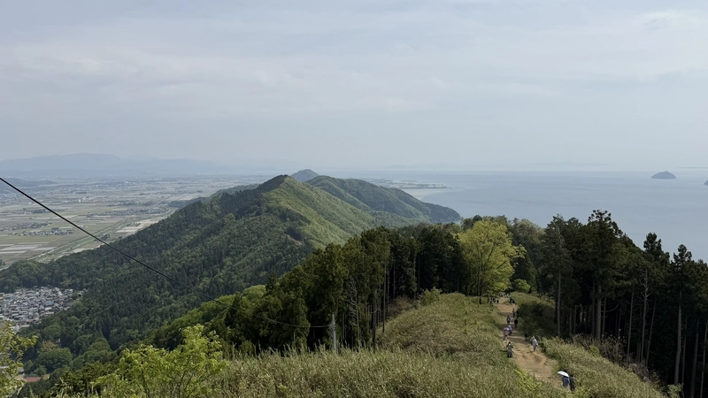
Tap to enlarge — these are terrain photos, not confirmed 1583 fortifications.
11. Lake Yogo-Side View
Natural scenery | Facing north
Natural scenery. Looking north toward Lake Yogo and the surrounding mountains. (See "Reading the Battlefield Through the Terrain" below for more.)
Reading the Battlefield Through the Terrain
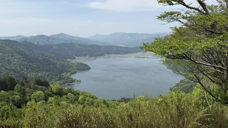
From the summit of Shizugatake, the two lakes, the surrounding ridgelines, and the lowland towns are visible in different directions — and standing there, it's easy to picture how Hideyoshi's and Katsuie's forces fought across a wide stretch of ground, using the differences in elevation to their advantage.
Lake Biwa Side (Southwest)
To the southwest, Lake Biwa opens out below, with Chikubushima Island appearing small on the water (see the photos in Core Spot 10 above). The ridgelines and hiking trails visible from here give a real sense of the elevation differences commanders would have used.
Lake Yogo Side (North)
Looking north, Lake Yogo comes into view — in the opposite direction from Lake Biwa, so you can't take in both lakes from a single glance at one spot. Walking around the plaza and changing your orientation is what lets you see both.
Seeing the two lakes from different directions at the summit makes it clear that Shizugatake wasn't a narrow, self-contained battlefield — it sat within a much wider stretch of terrain, shaped by lakes and mountains. Exactly where each commander's camp stood isn't something you can confirm just by looking, but the elevation differences themselves are something you can feel directly by standing here.
The Blood-Red Waters of Lake Yogo
Local legend holds that after the Battle of Shizugatake, the waters of Lake Yogo turned red with blood. This isn't established as historical fact — it's presented here as a local legend, not a documented event.
2026 Practical Notes
Near Yogo Station (JR余呉駅), about a 20-minute walk away, is an exhibition hall called Shizugatake Sengoku Station, where you can learn about the battle's camp layout before heading up. Kinomoto Station has a separate, unrelated free exhibit, Toyotomi's Great Return Station — the two are easy to mix up, so it's worth noting they're at different stations. Visiting the Shizugatake Sengoku Station before the summit makes the camp layout and the flow of the battle easier to follow.
No photo of a castle card is included here, since one wasn't obtained on this visit. Distribution conditions can change, so check official sources before your visit (information current as of August 2026).
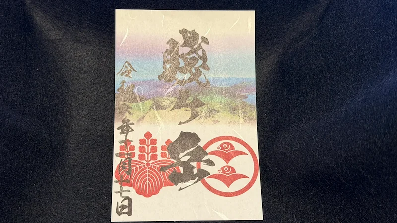
A goshuin-style commemorative stamp for Shizugatake was obtained at the lift boarding area in November 2024. The photo below is a record from that visit — it isn't confirmation that the same stamp is still sold in 2026, so check official sources before you go.
Nearby Planning & Where to Stay
Shizugatake alone works well as a day trip. If you'd also like to see Nagahama Castle and other Sengoku-era sites around northern Lake Biwa, basing yourself near Nagahama Station gives you more breathing room for time and energy — our Nagahama guide covers Nagahama Castle, Chikubushima Island, and the rest of that loop in detail. The Genbao Castle ruins, where Shibata Katsuie is said to have set up his headquarters, the Tagamiyama Fort site associated with Hideyoshi's side, and the wider battlefield around Lake Yogo fall outside the scope of this guide.
For visitors coming a longer distance, Nagahama makes a practical overnight base; Kinomoto itself works if you want an early start the next morning; and for anyone arriving from Tokyo, an overnight stay generally makes more sense than attempting a same-day round trip.
FAQ
No. From the upper lift station to the summit plaza, the official estimate is about 10 minutes (8 minutes measured on May 2, 2026), walking on dirt paths and wooden steps.
No reconstructed buildings. Fort-related earthworks are documented, but they're hard to identify at a glance — what's most visible are later-era markers, a memorial space, and a commemorative sculpture.
Yes, from different sides of the summit — Lake Biwa to the southwest, Lake Yogo to the north. You can't see both from one spot at the same time; walking around the plaza lets you take in both. Visibility depends on the weather.
On weekends, holidays, and August 13–16 during the operating season, use the free shuttle bus from the station's west exit. On weekdays, compare the local bus, a reserved taxi, and a rental bicycle from Kinomoto Eki Fureai Station. Some services run infrequently, so check your return schedule first.
Yes, with an early start. Kyoto is about 1 hour 30 minutes away by train; Nagoya is about 1 hour 15 minutes via the Shinkansen to Maibara and then the JR Hokuriku Line. Plan the last-mile connection from Kinomoto Station and your return trip before you go.
¥600 one-way, ¥1,100 round trip for adults. Operating hours are 9:00–17:00 (confirmed August 2, 2026 — hours shorten from November, and it may close in bad weather, so check official information before you visit).
The lift itself is straightforward, but the walk afterward is on unpaved ground with wooden steps, so it isn't described as barrier-free. Plan accordingly if mobility is a concern.
Its official title is "After the Battle." No visitor information identifies it as a specific commander, so this guide doesn't assign it an identity either.
Castle-card stock and distribution conditions can change, so check official sources before your visit. A goshuin-style stamp was obtained at the lift boarding area in November 2024, but whether the same one is still sold in 2026 hasn't been confirmed.
☕ Support This Site
Following the Shogun is built on first-hand research and site visits. If this guide helped with your trip to Shizugatake, a small contribution is always appreciated.

You can also scan the QR code to support the site.


comment