Hirosaki Castle Grounds Guide|Bridges, Moats, Stone Walls & Honmaru Ruins
Gejo-bashi Bridge, 8 historic bridges, triple-moat layout, Honmaru turret ruins, and Japan's oldest cherry trees — with 360° panoramas throughout.
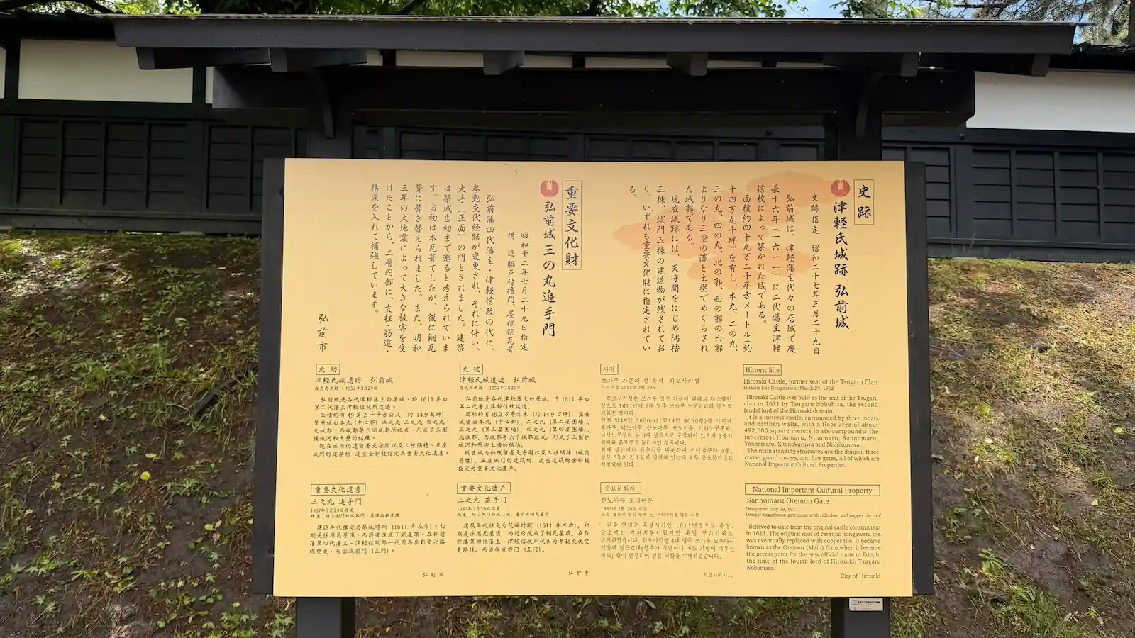
Castle Grounds Overview
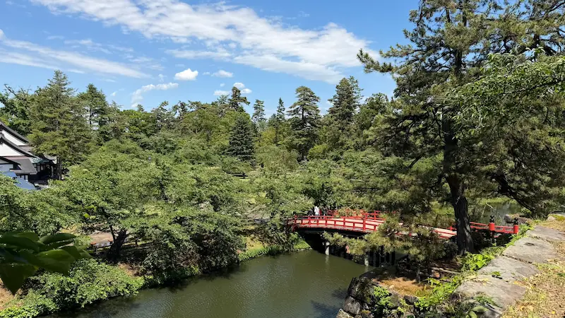
Hirosaki Castle is built on a multi-layered defensive layout centered on triple moats — inner, middle, and outer. The inner and middle moats remain in excellent condition, offering scenic views of stone walls and historic bridges reflected in still water. This page covers bridges, moats, stone walls, the Honmaru turret ruins, and the park's famous cherry trees. For surviving original buildings (keep, turrets, gates), see the Architecture Guide.
🚇 Getting There — Quick Reference
| Nearest station | Hirosaki Station (JR Ou Main Line) |
|---|---|
| From the station | Approx. 30 min on foot / 15 min by bus (Dotemachi loop bus recommended) |
| From Tokyo | Approx. 3 hr by Shinkansen to Shin-Aomori → JR limited express to Hirosaki (total approx. 3.5–4 hr) |
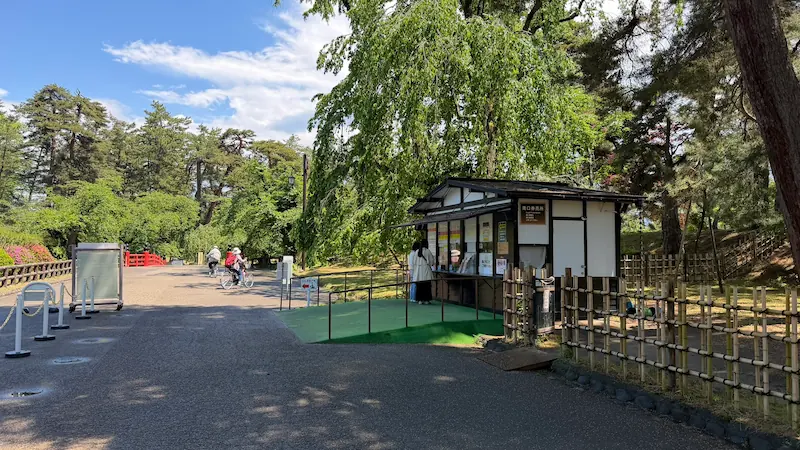
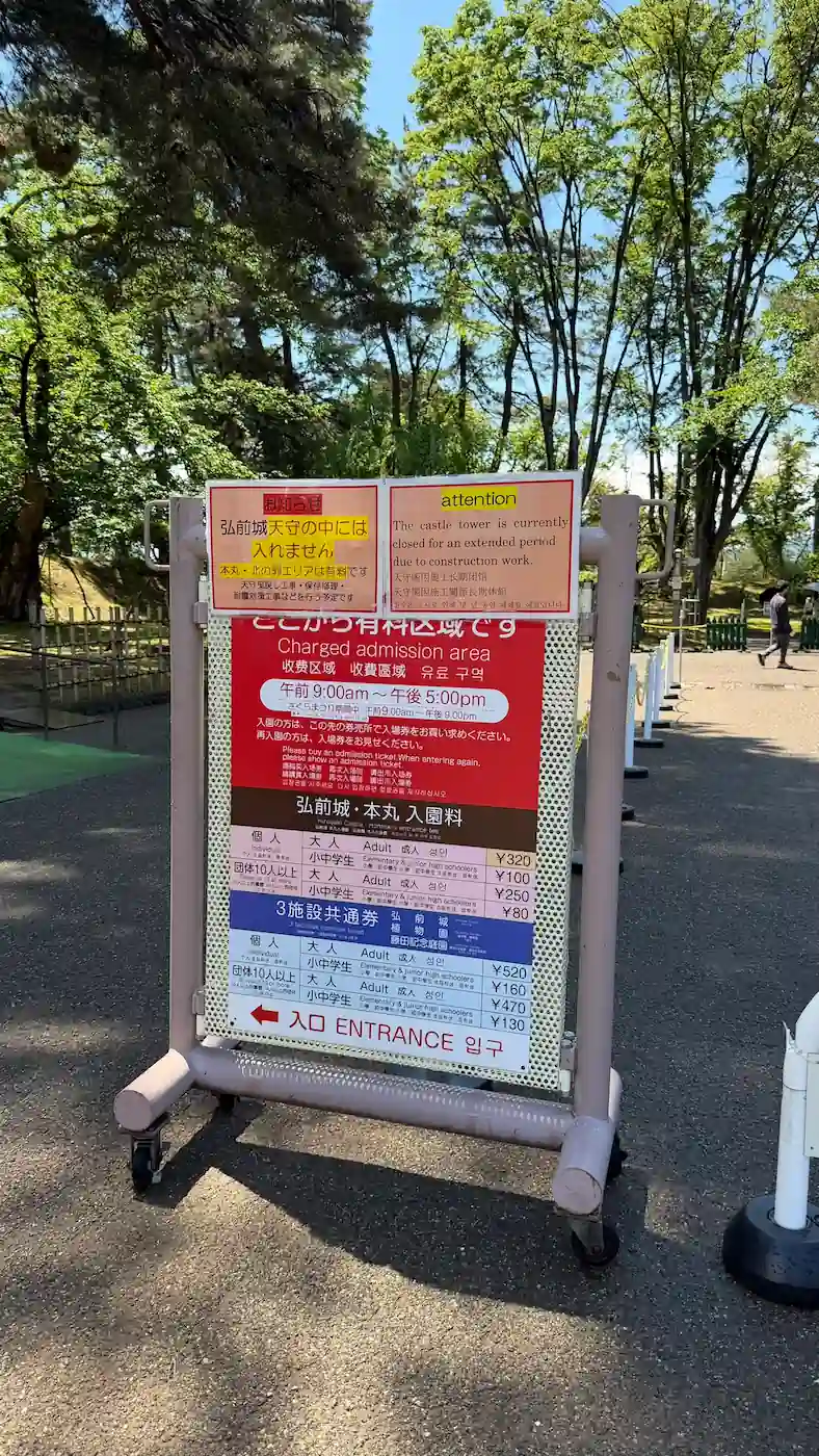
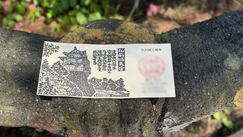
| Admission | Park entry free. Inner enclosure (Honmaru) paid. ※ Please confirm fees on the official site before visiting. |
For full access details, timetables, and FAQ, see the Visit Guide (EN-Page 1).
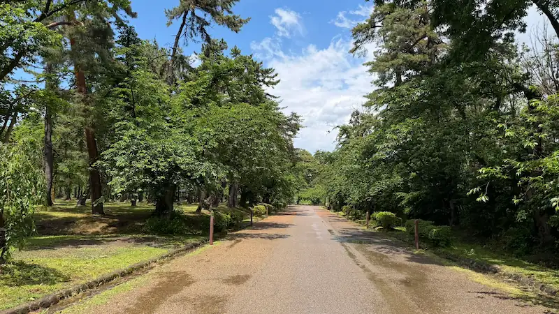
Moats and bridges around Hirosaki Castle (May 2026) / Tap to enlarge
Detailed Spot Guide (Accordions)
Each section below covers a specific area with photos, 360° panoramas, and Google Maps. Open each accordion to explore.
🌉 All 8 Bridges — Individual Details
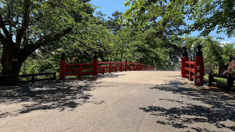
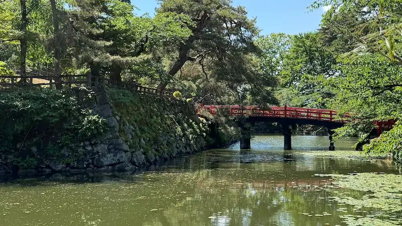
Gejo-bashi Bridge
| Built | Originally c. 1611 — rebuilt in Bunka 8 (1811) with stone walls on both sides; again in 2005 after 33 years |
|---|---|
| Location | Inner moat — connects the Honmaru (Main Bailey) to the Nijomaru |
| Notes | A sign (gejoufuda) once required all samurai to dismount here before entering the Honmaru |
Gejo (下乗) means "dismount." According to tradition, all who crossed this bridge — regardless of rank — were required to dismount their horses before entering the main bailey. The bridge in front of a castle's main keep was treated as sacred ground, and riding into it was considered a breach of etiquette. Today it remains the most iconic bridge at Hirosaki Castle.
Tap to enlarge
Gejo-bashi Bridge location (Google Map)
Sugino Ohashi Bridge
| Built | One of the five original bridges from c. 1611. Wartime removable bridge. |
|---|---|
| Rebuilt | 1821 (Bunsei 4) — replaced with hinoki (cypress) timber; railings and decorative finials added |
| Location | Middle moat — connects the Nijomaru to the Sannomaru |
| Scale | Length 25.97m, width 6.08m — the largest bridge in the park |
The bridge was originally built from cedar (sugi) timber — hence the name. Cedar was chosen because wartime bridges needed to be quickly dismantled or burned to stop enemy advances. In 1821, as the stone walls on both sides of the moat were completed, the bridge was upgraded to cypress (hinoki) with decorative railings, transitioning from a functional wartime structure to a more permanent architectural feature.
Sugino Ohashi Bridge location (Google Map)
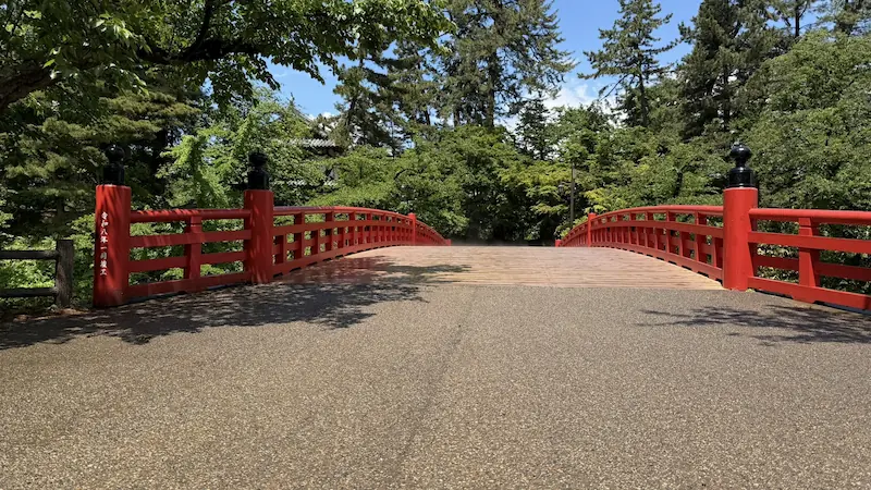
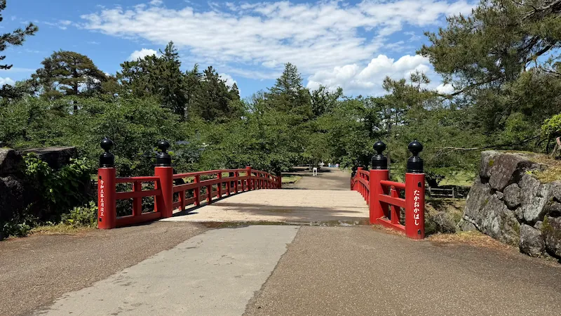
Takaoka-bashi Bridge
| Built | Built by the 4th domain lord, Tsugaru Nobumasa, c. Kanbun era (1660s–70s). Wartime removable bridge. |
|---|---|
| Location | Inner moat, north side of Honmaru — connects Kitanokaku to the Honmaru |
| Name origin | Named after Hirosaki Castle's former name, Takaoka-jō (the castle was known as Takaoka-jō before being renamed "Hirosaki" in 1628) |
According to tradition, the 4th domain lord Tsugaru Nobumasa had this bridge built so he could easily travel between the Honmaru and the Kitanokaku, where his mother's residence was located. The bridge name, Takaoka, preserves the castle's earlier name before it was renamed "Hirosaki" in 1628.
Tap to enlarge
Takaoka-bashi Bridge location (Google Map)
Kamenoko-bashi Bridge
| Built | Domain period — exact date unknown. Wartime removable bridge. |
|---|---|
| Location | Outer moat — connects Kamenokocho (Turtle Shell Town) to the Sannomaru |
| Name origin | Based on shisō sōō (four divine beasts) geomancy — the north was designated "Turtle" territory, giving the area, gate, and bridge the "kame" (turtle) name |
In traditional East Asian geomancy, each cardinal direction is protected by a divine beast: the north is governed by the Black Tortoise (Genbu — depicted as a turtle entwined with a snake). The Tsugaru clan designated the area north of the castle as "Kamenokocho" (Turtle Shell Town), named the north gate Kamenokomon (Turtle Shell Gate), and this bridge follows the same naming tradition.
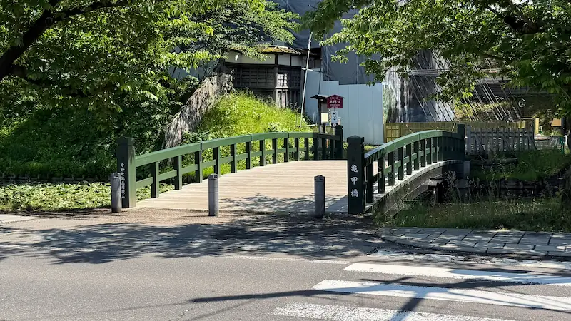
Kamenoko-bashi Bridge location (Google Map)
Yoshita-bashi Bridge
| Built | Domain period — exact date unknown. Wartime removable bridge. |
|---|---|
| Location | Nikai-seki (secondary water channel) — connects the Sannomaru to the Yonnomaru |
| Name origin | Named after the Yoshita Gate (formerly relocated from Oura Castle / Yoshita Castle) |
The Tsugaru clan originated from Oura Castle (also called Yoshita Castle, in present-day Hirosaki). After the clan's founder Tsugaru Tamenobu declared independence, elements of that castle were moved to the new Hirosaki Castle — and the Yoshita Gate brought the name with it. The bridge in front of this gate inherited the same name.
Yoshita-bashi Bridge location (Google Map)
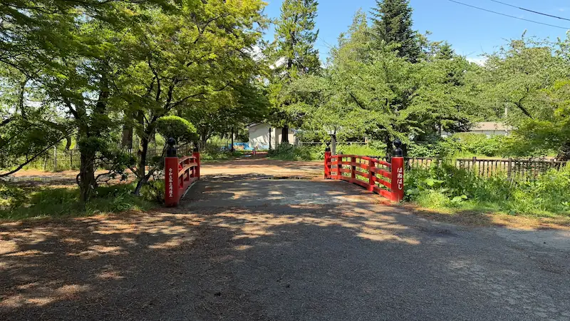
Hane-bashi Bridge
| Built | Attributed to the 4th domain lord Tsugaru Nobumasa, c. Kanbun 11 (1671) |
|---|---|
| Location | Inner moat, north side |
| Notes | Does not appear on historical maps — considered a "hidden bridge" or secret passage |
Hane-bashi is one of Hirosaki Castle's most mysterious bridges. According to local tradition, it was used by the domain lord for secret excursions outside the castle. Historical maps of the castle show the area around the bridge — including workshops and a lacquerware studio — but the bridge itself is omitted. Whether it was deliberately left off to maintain secrecy, or simply did not exist in earlier periods, remains unclear.
Hane-bashi Bridge location (Google Map)
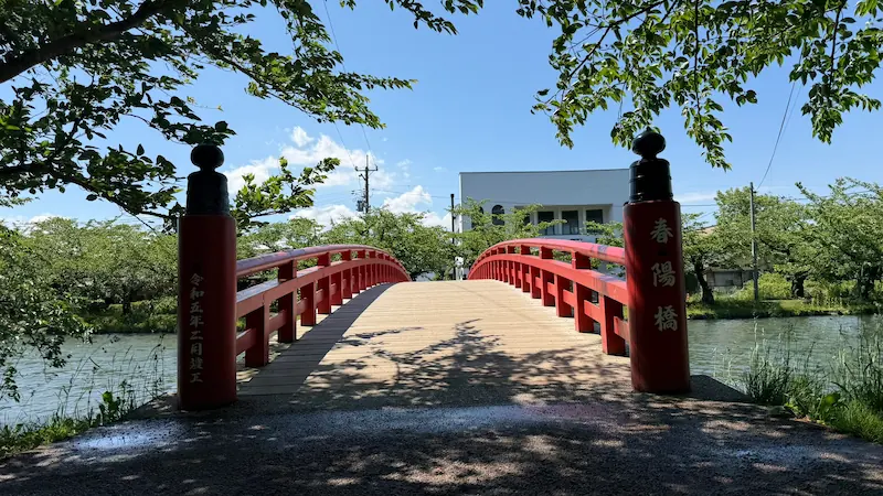
Shunyo-bashi Bridge
| Built | 1932 (Showa 7) — added for the convenience of public access. Not a domain-period bridge. |
|---|---|
| Location | West moat (nishi-bori) — connects the Gojikkoku-machi (city side) to the Nishi-no-Kaku (West Enclosure) |
| Notes | Longest bridge in the park. Famous for cherry blossom viewing over the west moat. |
Shunyo-bashi Bridge is one of the most photographed spots during cherry blossom season. When petals fall from the trees lining the west moat, they form a carpet of pink floating on the water — a phenomenon called hana-ikada (flower raft). The bridge was added in 1932 to allow residents easier access to the park, and its poetic name ("Spring Sun Bridge") was chosen to match the season.
Shunyo-bashi Bridge location (Google Map)
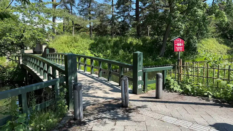
Ichiyo Bridge
| Built | Early–mid Showa period (records vary: c. 1933 or 1943) — added for public convenience. Not a domain-period bridge. |
|---|---|
| Location | Outer moat, north side |
| Name origin | Believed to be named after the "Ichiyō" sake brewery that once stood nearby (one character changed) |
Ichiyo Bridge did not exist in the domain period — it was added in the early to mid-Showa era to improve local access. Its name comes from a sake brewery called "Ichiyō" that was located nearby when the bridge was built. One character of the name was changed to "一陽" (Ichiyo, meaning "one sun") for the bridge. Two historical records differ on the construction year: one states 1933, another 1943.
Ichiyo Bridge location (Google Map)
📜 Stone Walls, Earthworks & Castle Layout
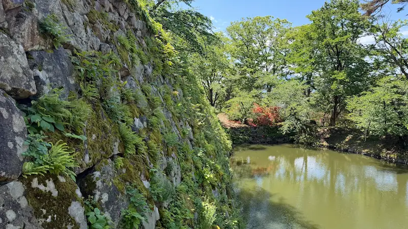
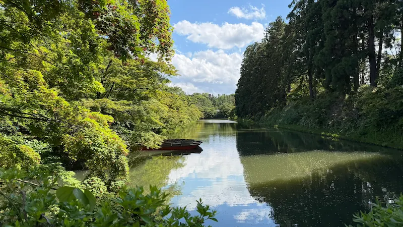
Inner Moat (Uchi-bori)
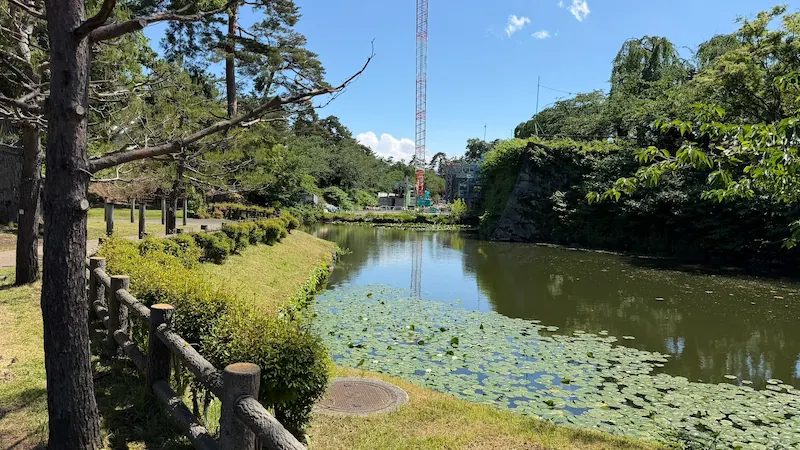
Hirosaki Castle was built with three concentric moats: the inner moat (uchi-bori), middle moat (naka-bori), and outer moat (soto-bori). The inner and middle moats survive in excellent condition. Each moat was crossed only by specific bridges — bridges that could be dismantled in wartime to slow enemy advances. Walking the perimeter of the inner moat gives a clear sense of the castle's scale and defensive logic.
Inner moat location (Google Map)
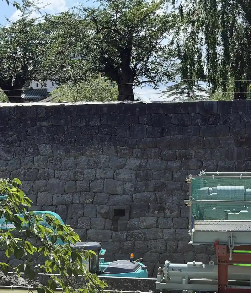
Stone Walls
Hirosaki Castle's stone walls use a technique called sangizumi — alternating long rectangular stones at the corners to create a stable, interlocking structure. This method was widely used in early to mid-Edo period castle construction and is clearly visible at the corners of the walls along the main approach from Otemon Gate toward the Honmaru. Look closely and you'll see how each layer alternates the direction of the long stones.

Tap to enlarge
Earthworks (Dobei / Dorui)
Earthen embankments (dobei / dorui) supplement the stone walls throughout the grounds. They served as secondary defense lines and boundary markers between enclosures. Unlike stone walls, they are less immediately visible but form an integral part of the castle's layered defense system.
Castle Enclosure Layout (Nawabari)
Hirosaki Castle uses a teikakushiki nawabari (trapezoidal enclosure) layout — the Honmaru at the center, surrounded by the Kitanokaku, Nijomaru, Sannomaru, and Nishi-no-Kaku. Each enclosure is separated by moats and earthworks. Walking the grounds, the transition between enclosures becomes naturally clear as you cross each bridge.
📜 Honmaru Ruins — Individual Details
The surviving buildings (keep, turrets, gates) are covered in the Architecture Guide. This section covers the ruins and historic sites within the Honmaru.
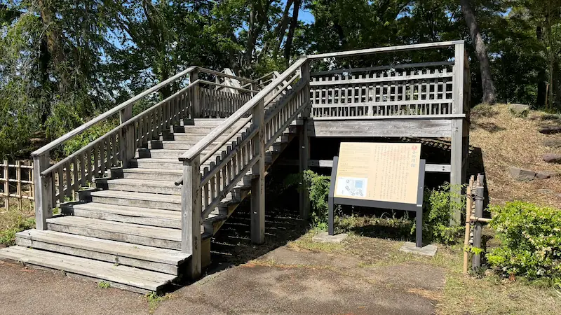
Inuiyagura Turret Site (Northwest)
| Type | Ruins (stone walls remain) |
|---|---|
| Location | Northwest corner of Honmaru (Inui direction) |
| Status | Stone walls visible while walking the Honmaru |
Hirosaki Castle names its turrets, gates, and ruins after the old Japanese compass directions: Inui (northwest), Ne (north), Ushitora (northeast), Tatsumi (southeast), Hitsujisaru (southwest). This system — inherited from Chinese geomancy — makes it easy to understand the spatial structure of the castle once you learn it. The surviving corner turrets in the Nijomaru use the same naming.
Inuiyagura turret site location (Google Map)
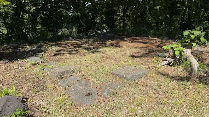
Neyagura Turret Site (North)
| Type | Ruins |
|---|---|
| Location | North side of Honmaru (Ne direction) |
| Status | Viewable while walking the Honmaru route |
In traditional Japanese spatial planning, the north was called kimon (demon gate) and was considered vulnerable to malevolent forces. Castle builders often placed special emphasis on the northeast and north corners. Stone walls remain at this site and traces of the original defensive structure can still be seen.
Tap to enlarge
Neyagura turret site location (Google Map)
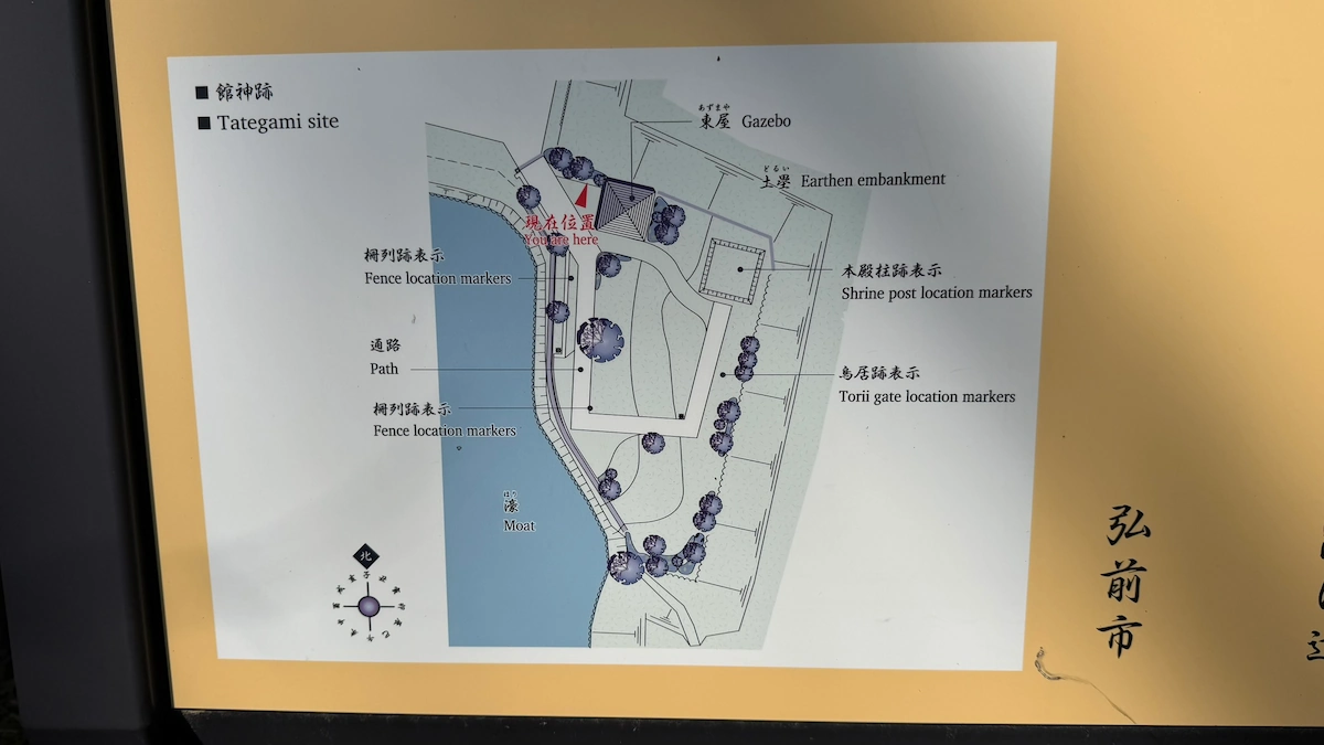
Tachigami Site
| Type | Ruins (castle shrine) |
|---|---|
| Status | Within the Kitanokaku (paid area) — stone foundation markers and display visible |
The Tachigami was the castle's protective shrine. According to tradition, the 2nd domain lord Tsugaru Nobuhira enshrined a wooden image of Toyotomi Hideyoshi here as the object of worship — a remarkable choice given that Hideyoshi had been the great unifier who died in 1598, just before Tokugawa Ieyasu took power. The Tsugaru clan's loyalty to Hideyoshi's memory, preserved quietly within castle walls under the Tokugawa shogunate, speaks to the clan's complex political situation. Archaeological excavations in 1999–2000 confirmed the site's presence, uncovering stone torii foundations, main hall post holes, and fence traces.
Tap to enlarge
Tachigami site location (Google Map)
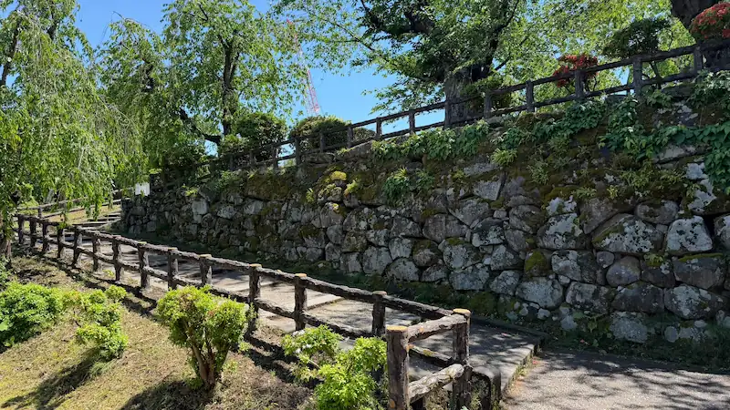
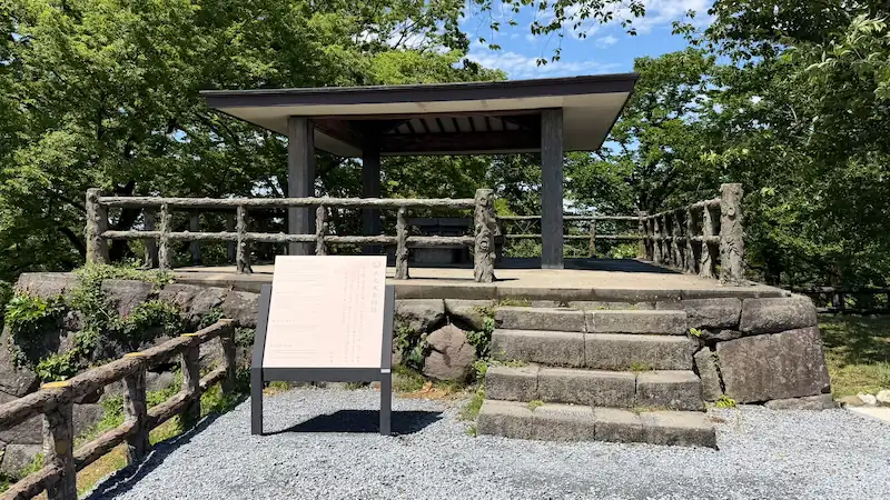
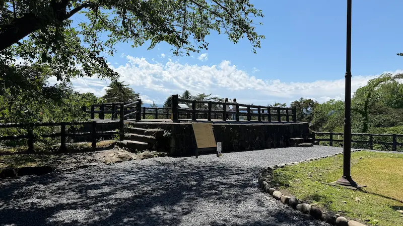
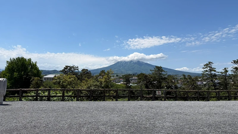
Hitsujisaru Turret Site (Southwest Honmaru)
| Type | Ruins (stone walls remain) |
|---|---|
| Location | Southwest corner of Honmaru (Hitsujisaru direction) |
| Status | Stone walls remain. Outstanding panoramic views from this corner. |
The southwest corner of the Honmaru offers sweeping views across Hirosaki Park and the surrounding mountains. During the author's May 2026 visit, this spot left a particularly strong impression. The stone walls here are well preserved, giving a tangible sense of the original defensive perimeter.
Hitsujisaru turret site location (Google Map)
📜 Facilities
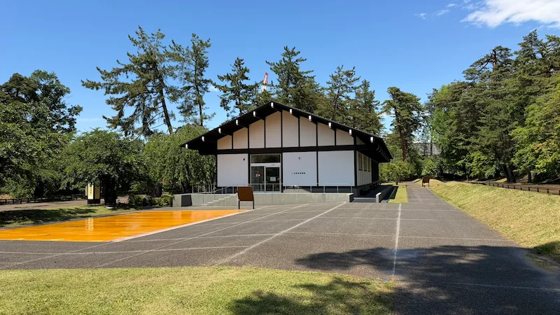
Hirosaki Castle Information Center
| Open | Listed as year-round, 9:00–17:00 as of the May 2026 field check. Please confirm on the official site before visiting. |
|---|---|
| Admission | Free |
| Exhibits | Tsugaru clan history / Hirosaki Castle chronology / Hikiya and hikimodosu mechanics / Tsugaru clan and Nanbu clan relations / Connection with Toyotomi Hideyoshi |
| Stamps & goods | Castle stamp (gojo-in) available as of May 2026 / Japan 100 Famous Castles stamp (availability may change — please check in advance) |
A useful first stop before exploring the grounds, especially for understanding the keep-related stone-wall repair and hikiya context. The hikiya and hikimodosu exhibits explain the mechanics behind the keep's relocation and restoration work.
Information Center location (Google Map)
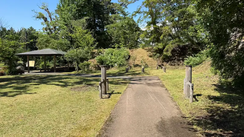
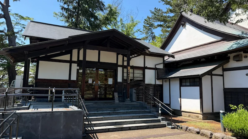
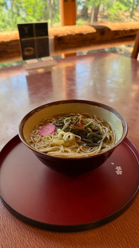
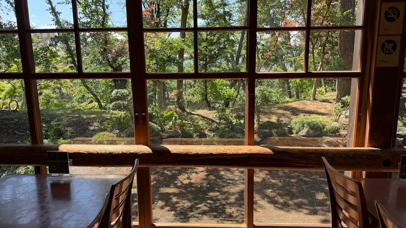
Butokuden Rest Area
A rest area in the park offering light meals and seating. During the author's May 2026 visit, soba noodles were available. A pleasant stop while exploring the grounds.
Tap to enlarge
Butokuden Rest Area location (Google Map)
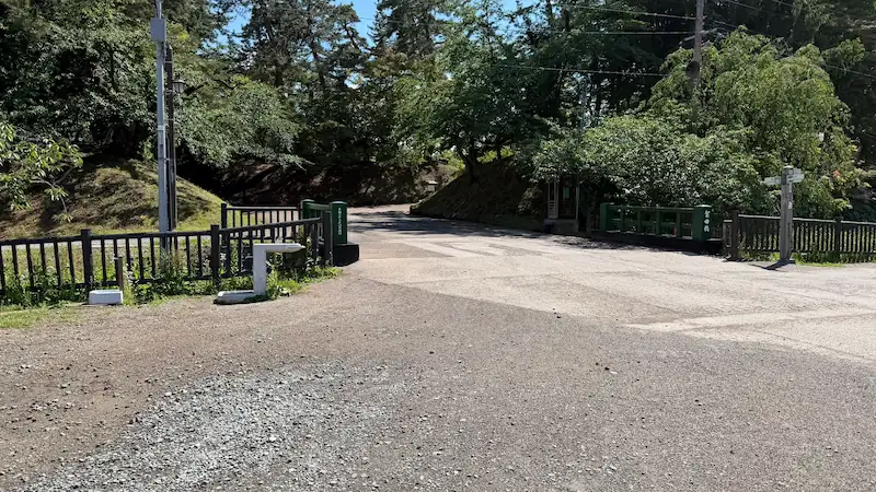
📜 Entrance Area
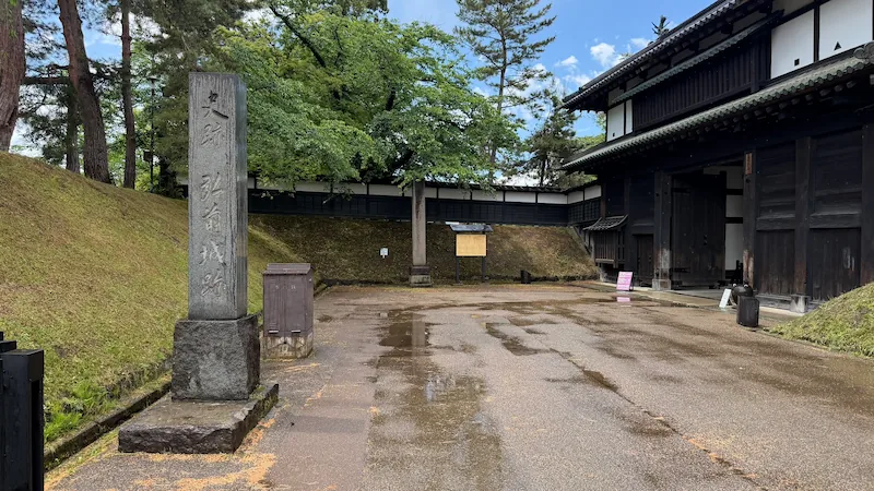
Tap to enlarge
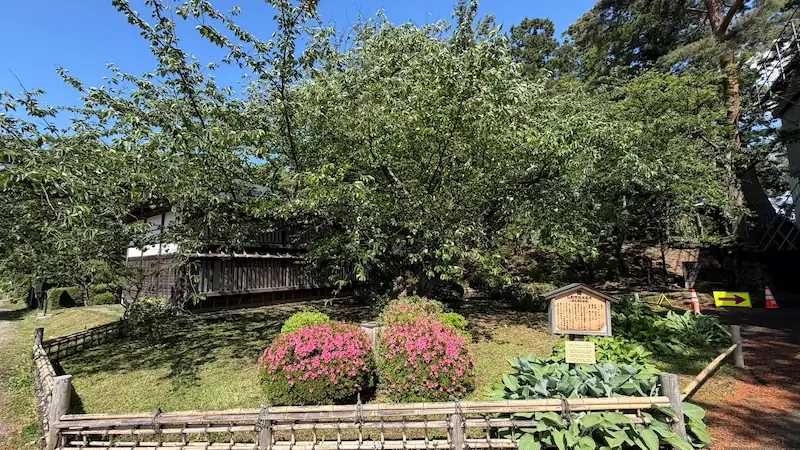
🌸 Cherry Trees & Nature
Hirosaki Park is one of Japan's most celebrated cherry blossom destinations, with approximately 2,600 cherry trees of 52 varieties. Two exceptional trees grow within the castle grounds.
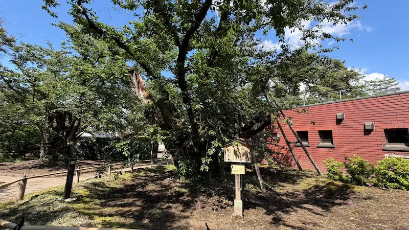
The park contains two record-holding cherry trees. The largest-girth Somei Yoshino in Japan stands in the courtyard of the Green Consultation Center (Midori no Soudan-jo) in the Sannomaru. Measured in October 2023, its trunk circumference is 5.82 meters and height 10 meters — certified by the Ministry of the Environment's national survey. Estimated age: over 125 years.
The oldest Somei Yoshino in Japan (or among the oldest) was planted in 1882 by former Hirosaki domain samurai Kikuchi Tate. Estimated age: over 140 years, trunk circumference 4.43 meters, height 8.5 meters. Designated as an Aomori Prefecture Natural Monument. Peak bloom is typically late April to early May.
Tap to enlarge
Related Pages
☕ Support Following the Shogun
This site is produced through field research across Japan.
If this guide helped you plan your visit, your support keeps the research going.

Scan to support via QR code
comment