
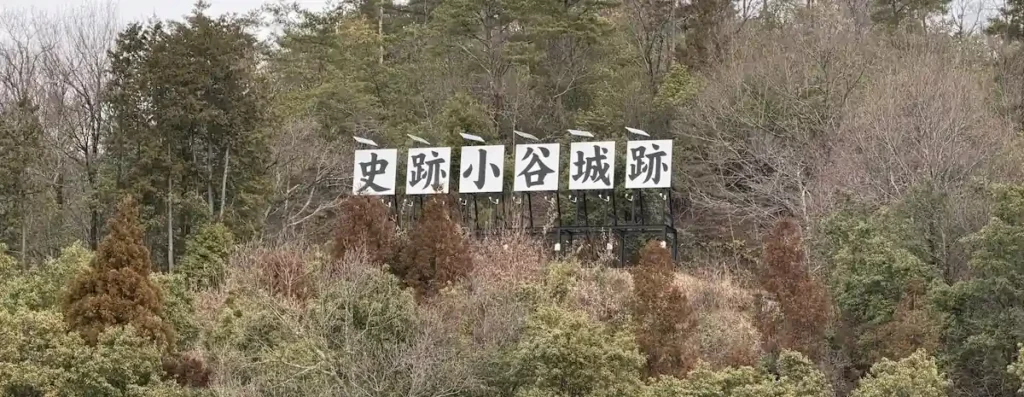
Odani Castle Ruins Complete Guide | Access, Admission, and Estimated Hiking Time
Odani Castle Ruins are one of Japan’s most evocative Sengoku-period mountain castles. This was the stronghold of three generations of the Azai clan and is now protected as a National Historic Site.
Oichi, the younger sister of Oda Nobunaga, married the castle lord Azai Nagamasa here and gave birth to three daughters: Chacha, Hatsu, and Gō. Chacha, later known as Yodo-dono, became the mother of Toyotomi Hideyori. Gō became the legal wife of Tokugawa Hidetada, the second Tokugawa shogun. The fall of Odani Castle changed not only one family’s fate, but the course of the next century of Japanese history.
In 1573, Odani Castle fell under the full assault of Oda Nobunaga’s forces. Hashiba Hideyoshi, later Toyotomi Hideyoshi, distinguished himself by attacking Kyogokumaru and splitting the Honmaru main bailey from Komaru, helping bring about the end of the Azai clan. After Odani fell, Hideyoshi’s path toward becoming lord of Nagahama Castle began to open. The lives of the three Azai sisters also turned sharply from this moment onward.
The mountain-top remains are free to visit. For a round trip to the Honmaru, allow 2 to 3 hours. If you continue to Sannomaru and take time for photos, rest stops, and exploring each bailey, plan on about 4 to 5 hours in total. If you also include the Ōzuku area or Shimizudani valley, treat it as a more serious mountain hike and build in extra time. From JR Kawake Station (JR-A07), it takes about 25 to 30 minutes on foot to reach the Odani Castle Sengoku History Museum, or about 5 minutes by taxi. If traveling by car, use the parking areas near the museum and the Sengoku Guide Station at the foot of the mountain. This site also publishes separate pages with 360° panoramic photos taken on-site at the major spots.
Basic Information for Odani Castle Ruins
| Mountain-top ruins | Free to visit |
|---|---|
| Sengoku History Museum | High school students and older: 350 yen / Elementary and junior high school students: 150 yen / Preschool children: free. Open 9:00–17:00, with final admission at 16:30. Closed Tuesdays; if Tuesday is a national holiday, closed the following day. Closed for New Year holidays from December 28 to January 4. Elementary and junior high school students living in Nagahama City or Maibara City enter free of charge. Photography is not allowed inside the museum. Official page(Japanese only): https://www.eonet.ne.jp/~odanijou-s/ |
| Estimated time | Foot of the mountain to Honmaru round trip: 2–3 hours / Foot of the mountain to Sannomaru round trip: 4–5 hours, including viewing, photography, and breaks |
| Nearest station | JR Kawake Station (JR-A07), Hokuriku Main Line. About 25–30 minutes on foot or about 5 minutes by taxi to the Odani Castle Sengoku History Museum. |
| Parking | Parking is available in front of the Odani Castle Sengoku History Museum and around the Sengoku Guide Station. During peak sightseeing periods, traffic restrictions on the Odaniyama forest road and shuttle-bus service may be introduced. In 2026, private vehicles are announced as prohibited on the Odani forest road on Odani Castle shuttle-bus operation days from Saturday, May 2 to Wednesday / holiday, May 6. Check the latest information on the official Nagahama, Maibara, and Oku-Biwako tourism site before visiting. |
| Toilets / shops on the mountain | None. Prepare at the foot of the mountain before starting the hike. |
| Smart IC | About 3 minutes by car from Odani Castle Smart IC to the main facilities |
| Cultural-property status | National Historic Site |
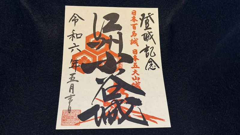
| Castle seal | Sold at the Odani Castle Sengoku History Museum, during admission hours from 9:00 to 16:30. Castle-seal books were also available at the time of visit. Stock and designs may change, so check locally. |
Odani Castle Historical Timeline
- Traditionally said to have been built on Mount Odani by Azai Sukemasa.
- In 1525, the Azai came into conflict with the Rokkaku clan and received support from Asakura forces.
- In 1533, Imai Hidenobu was purged.
- Azai Nagamasa became lord of the castle.
- The Azai allied with Oda Nobunaga, and Nobunaga’s sister Oichi married into the family.
- The main castle area and the Shimizudani residential district were further developed.
- Nobunaga and Hideyoshi launched a full-scale attack.
- Azai Hisamasa died at Komaru, and Azai Nagamasa died at the Akao Residence.
- After the fall, Hideyoshi built Nagahama Castle, and Odani was eventually abandoned.
Choose Your Route
Foot of the Mountain + Main Bailey Route | About 2–3 Hours
Full Route to Sannomaru | About 4–5 Hours
Access Map
From Maibara Station (JR-A12) on the Tokaido Shinkansen, take the JR Hokuriku Main Line to Kawake Station (JR-A07). The ride is about 17 minutes over 5 stops.
From JR Kawake Station (JR-A07), it is about a 30-minute walk, roughly 2.1 km, to the Odani Castle Sengoku History Museum.
Spot Guides by Area
The main sites around Odani Castle Ruins are explained in detail across two area guides. Each guide includes photos, detailed site data, and practical walking tips.
360° Panoramic Photos
360° panoramic photos taken on-site at the major spots are available in two separate pages: Part 1 and Part 2.
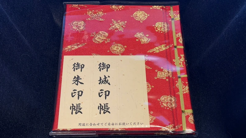
Castle Seal and Castle-Seal Book
The Odani Castle Sengoku History Museum sells both the Odani Castle seal and a castle-seal book. The items below were purchased by the site administrator. Stock and available designs may change, so check the latest information on-site.
Frequently Asked Questions
From Kawake Station (JR-A07), it takes about 30 to 40 minutes on foot, roughly 2.1 to 2.2 km, to reach the museum and Sengoku Guide Station at the foot of the mountain. Aim first for the Odani Castle Sengoku History Museum or the area around the Sengoku Guide Station, also known as Azai Sandai no Sato. If you are driving, Odani Castle Smart IC is nearby, and parking is available near the museum and guide station.
As a rough guide, it takes about 40 minutes one way from the Sengoku Guide Station to the Bansho guardhouse site, about 30 minutes from Bansho to the Honmaru main bailey, and about 20 minutes from the Honmaru to Sannomaru. Allow 2 to 3 hours for a Honmaru round trip, or 4 to 5 hours if you continue to Sannomaru.
The mountain-top castle remains are free to visit. Admission is charged only for the Odani Castle Sengoku History Museum: 350 yen for high school students and older, and 150 yen for elementary and junior high school students. The museum is useful before climbing the mountain. It is open 9:00–17:00, with final admission at 16:30, and is closed on Tuesdays, the following day if Tuesday is a national holiday, and from December 28 to January 4.
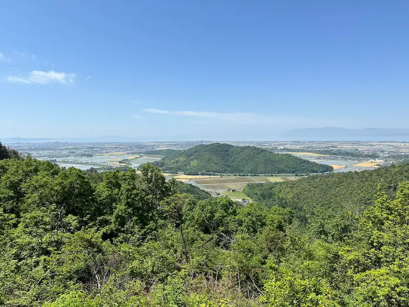
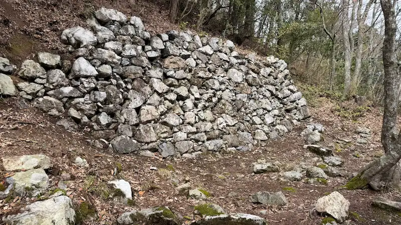
Odani Castle Ruins are a National Historic Site, and original remains such as the Honmaru, Ohiroma, Nakamaru, Kyogokumaru, Sannomaru, and Akao Residence areas survive. Visitors walk through real stone walls, earthworks, dry moats, and bailey landforms. There are no reconstructed buildings; the site is mainly preserved and maintained as historic landscape.
The Akao Residence Site is traditionally regarded as the place where Azai Nagamasa took his own life. It lies below and east of the Honmaru, about 180 meters to the right before the Kurogane Gate Site, and consists of three terraced baileys with a stone monument and information board. His father, Azai Hisamasa, is said to have died earlier at Komaru.
It may be possible to walk the route in light rain, but shoes with non-slip soles are essential because this is a mountain trail. In severe weather, it is better to switch to a museum-focused visit. If stamina is a concern, start from the Sengoku Guide Station and limit the route to Bansho, Ohiroma, and the Honmaru rather than pushing on to Sannomaru.
The Odani Castle seal is sold at the Odani Castle Sengoku History Museum, located at 139 Odanigujocho, Nagahama, Shiga. Visit during opening hours, with admission accepted from 9:00 to 16:30. Castle-seal books were also available at the time of visit. Stock and designs may change, so check locally for the latest information.
Related Pages: Yokoyama Castle
Yokoyama Castle was taken from the Azai side by Nobunaga’s forces, and Hideyoshi later became its lord.

*This article is based on field research and materials such as Nagahama City preservation and management plans. Opening days, fees, and shuttle-bus information may change. Before visiting, check the latest official information from the Nagahama City tourism office or the Odani Castle Sengoku History Museum. There are no shops or toilets on the mountain. Prepare shoes with good grip, rain gear, and drinking water before you set out.
comment