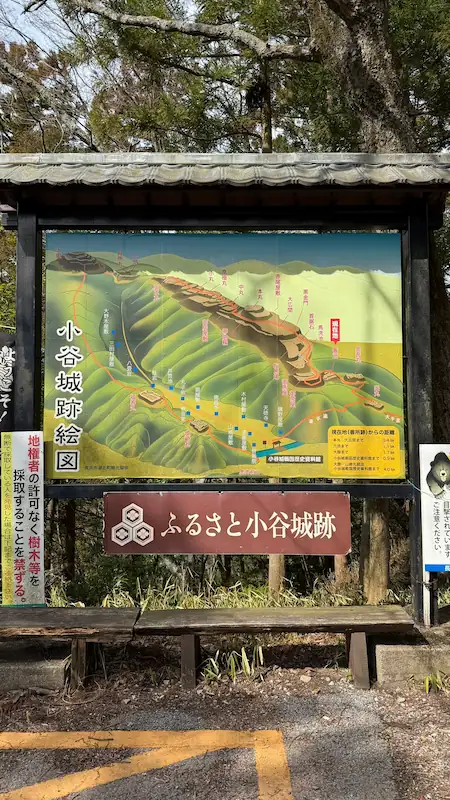
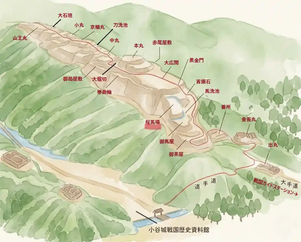
Odani Castle Ruins South Route | Museum, Guide Station, Demaru, Bansho, and Sakurababa
This guide follows the lower and forward-defense area of Odani Castle Ruins in walking order. It introduces 9 sites with photos: Odani Castle Sengoku History Museum, Sengoku Guide Station, Demaru, Kingomaru, Bansho, Ochaya, Oumaya, Uma-arai-ba, and Sakurababa. For basic access information, fees, and route planning, see the Odani Castle Ruins main guide.

Museum and Visitor Facilities
Odani Castle Sengoku History Museum
The best place to prepare before climbing: understand the three generations of the Azai clan and the structure of the castle.
Stopping here before the climb was absolutely worthwhile. The exhibitions focus on the three generations of the Azai clan and on Odani Castle itself, with excavated artifacts, castle drawings, and reconstruction illustrations. Once you understand the relationship between the baileys here, it becomes much easier to recognize where Ohiroma, Honmaru, and Kyogokumaru sit on the mountain. Photography and video recording are not allowed inside the museum.
One of the first things you see is a chronology of the Azai clan. It clearly organizes the flow from Hisamasa to Nagamasa and explains the Genki conflicts through detailed panels. Among the displays, one of the most compelling items is a letter written by Nagamasa himself. The museum also displays documents issued after the fall of the castle, including a Hashiba Hideyoshi order addressed to local peasants and a letter by Hashiba Hidekatsu, allowing visitors to follow what happened to the land and people after Odani fell.
- Three generations of the Azai clan: Timelines and panels clarify the age of Hisamasa and Nagamasa, with primary materials such as Nagamasa’s letter.
- Strong post-fall displays: Documents connected with Hideyoshi and Hidekatsu trace how the Odani area was treated after the war.
- Castle-structure exhibits: Castle drawings and reconstruction illustrations make the mountain layout easier to understand before and after the hike.
- Seasonal tip: Spring and autumn are especially good seasons to combine the museum with a walk up Mount Odani.

Quick visit: about 10 min / Slow visit: about 40 min
🗺 Address: 139 Odanigujocho, Nagahama, Shiga
🚶 Access: About 30 minutes on foot from Kawake Station, roughly 2.1 km. By car, it is easy to reach from the Odani Castle Smart IC direction, and parking is available in front of the museum.
| Hours | 9:00–17:00, with final admission at 16:30 |
|---|---|
| Closed | Tuesdays and New Year holidays; temporary closures may occur during exhibition changes or weather warnings. |
| Admission | High school students and older: 350 yen / Elementary and junior high school students: 150 yen |
| Photography | Photography and video recording are not allowed inside the museum. |
| Parking | Parking available in front of the museum. |
| Cultural status | — Related facility for Odani Castle Ruins. |
- The museum is useful before the climb because it explains not only the remains but also life inside the castle and the battle for Odani.
- Because photography is not allowed inside, the visit is best approached as a focused exhibition experience.
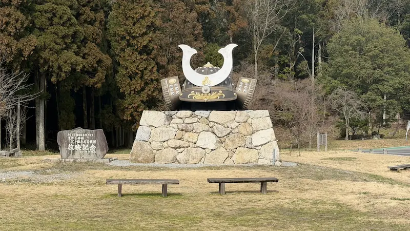
Sengoku Guide Station | Azai Sandai no Sato
Look for the giant helmet monument. This is the place to check route information before climbing.
This visitor-information base stands at the foot of Odani Castle Ruins. The giant helmet monument makes it easy to recognize, and it is a convenient place to check the route and conditions before climbing. During peak sightseeing seasons, it may also serve as a shuttle-bus base. It is located at 757-1 Kohoku-cho Ibe, Nagahama. From JR Kawake Station, it takes about 30 minutes on foot; from Odani Castle Smart IC, about 3 minutes by car. Parking is available for 20 passenger cars.
- Giant helmet monument: A clear landmark at the trailhead and an easy photo spot.
- Route preparation: Checking the order of the baileys here makes it easier to follow the mountain remains in sequence.
- Seasonal tip: In spring and autumn, it is especially useful together with the latest shuttle-bus information.
Quick visit: about 10 min / Slow visit: about 15 min
🗺 Address: 757-1 Kohoku-cho Ibe, Nagahama, Shiga
🚶 Access: About 30 minutes on foot from JR Kawake Station. By car, it is close to Odani Castle Smart IC and has a parking area.
| Opening | Open only during events; check the official website. |
|---|---|
| Parking | 20 passenger cars |
| Access | About 3 minutes by car from Odani Castle Smart IC |
| Alternative name | Azai Sandai no Sato |
- Today it is introduced as the Sengoku Guide Station, while city planning documents position it as the existing facility Azai Sandai no Sato.
- Official tourism information treats it not as an always-open exhibition facility but as a place open during events.
Odani Castle Ruins Spot Guide
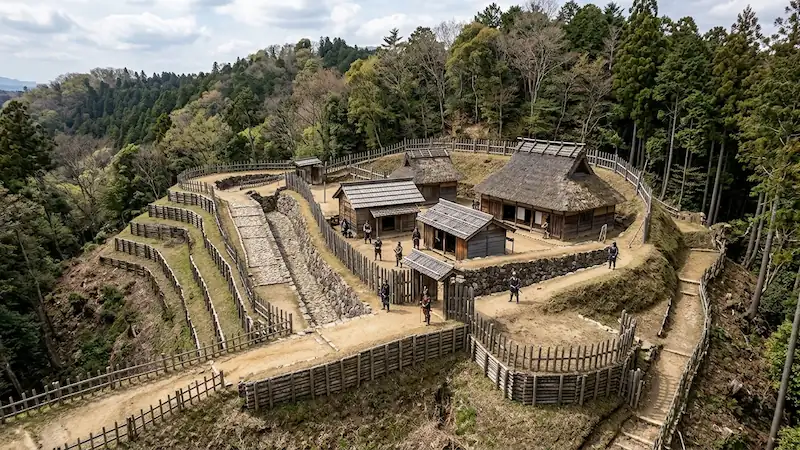
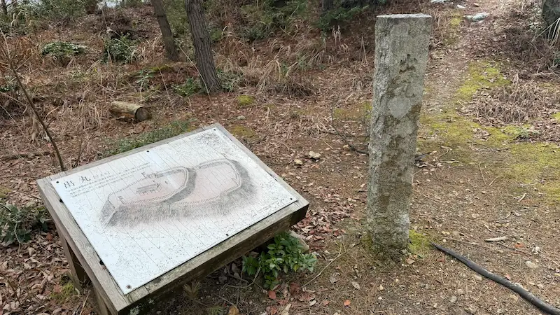
Demaru
An advanced outwork at the tip of the main-bailey ridge, watching over the castle town and functioning as an independent fort.
Demaru is an independent outwork placed at the very front of the main-bailey ridge of Odani Castle. It consists of upper and lower baileys, earthworks, and a dry moat, forming the forward line that watched the castle town, the roads, and movement toward the Shimizudani residential area.
- Two-tiered bailey: The upper and lower levels remain clearly visible, allowing you to read its role as an independent outwork through the landform.
- Defense at the ridge tip: Its position overlooking the castle town and climbing route shows where Odani’s defenses began.
- Seasonal tip: In spring, cherry blossoms and fresh greenery frame the foothills; in autumn, fallen leaves make the mountain-castle terrain easier to see.

Quick visit: about 10 min / Slow visit: about 20 min
📷 View Demaru in 360° panoramic photos
🗺 Address: Odani Castle Ruins, Demaru Site, Kohoku-cho Ibe, Nagahama, Shiga
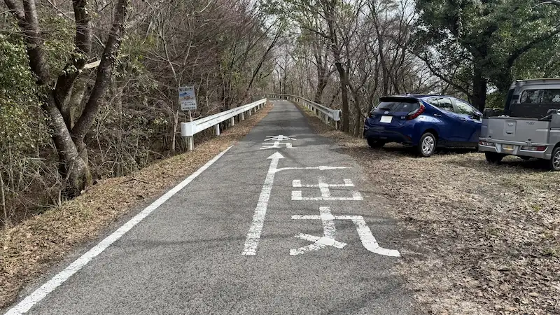
🚶 Access: Follow the road upward from the Sengoku Guide Station side; the entrance appears on the right.
| Date | Unknown |
|---|---|
| Builder | Unknown |
| Features | An independent fort at the front tip of the main-bailey ridge, consisting of upper and lower baileys, earthworks, and a dry moat. |
| Restoration history | No independent restoration or improvement history has been confirmed for Demaru alone. |
| Current state | Baileys, earthworks, and dry moat survive. |
| Damage / loss | Abandoned after the fall of Odani Castle in 1573. |
| Status | Part of the National Historic Site “Odani Castle Ruins.” |
| Notes | The Ote route continues north from Demaru through Kingomaru and Bansho toward the Honmaru. |
- Demaru is thought to have been not merely a lookout, but an independent outwork protecting both the Honmaru ridge group and the Shimizudani residential area.
- Mid-Edo-period drawings of Odani Castle show the Ote route running north from Demaru toward Kingomaru, Bansho, and the Honmaru.
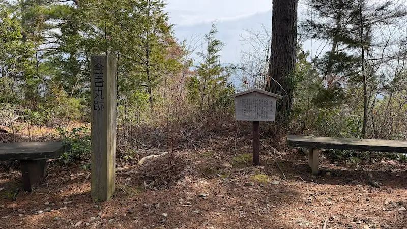
Kingomaru
A bailey whose name preserves the memory of Asakura Kingo Norikage, holding the ridge before the castle core.
Kingomaru is a bailey projecting from the southwestern ridge of Odani Castle’s main area. Its name is traditionally linked to Asakura Kingo Norikage, who is said to have placed his camp here when the Rokkaku attacked Odani Castle in 1525. Its position at the ridge tip reveals the defensive thinking typical of Sengoku-period mountain castles.
- Ridge-tip location: It controls the ridge before the main bailey, showing that Odani’s defensive line began well before the Honmaru.
- Origin of the name: The tradition of Asakura Kingo Norikage’s camp survives directly in the bailey name.
- Seasonal tip: Fresh greenery makes the ridge shape easier to see, while autumn leaves reveal the terrain’s outline.

Quick visit: about 5 min / Slow visit: about 10 min
📷 View Kingomaru in 360° panoramic photos
🗺 Address: Odani Castle Ruins, near Kingomaru, Kohoku-cho Ibe, Nagahama, Shiga
🚶 Access: Continue beyond Demaru to the parking area; proceed farther in and an information map appears.
| Date | Unknown; it existed by 1525. |
|---|---|
| Builder | Unknown |
| Features | A bailey on the southwestern ridge peak south of Bansho, controlling the ridge tip as a defensive position. |
| Restoration history | The timing of improvements specific to Kingomaru is unknown. |
| Current state | The bailey landform remains. |
| Damage / loss | Abandoned after the fall of Odani Castle in 1573. |
| Status | Part of the National Historic Site “Odani Castle Ruins.” |
| Notes | A site preserving an older military memory of Odani Castle through the name of Asakura Kingo Norikage. |
- The name Kingomaru comes not from the Azai but from an Asakura warrior who was involved as a supporting force.
- If you hurry straight to the Honmaru, it is easy to pass this area by, but Kingomaru helps reveal how Odani Castle defended itself in stages along the ridge.
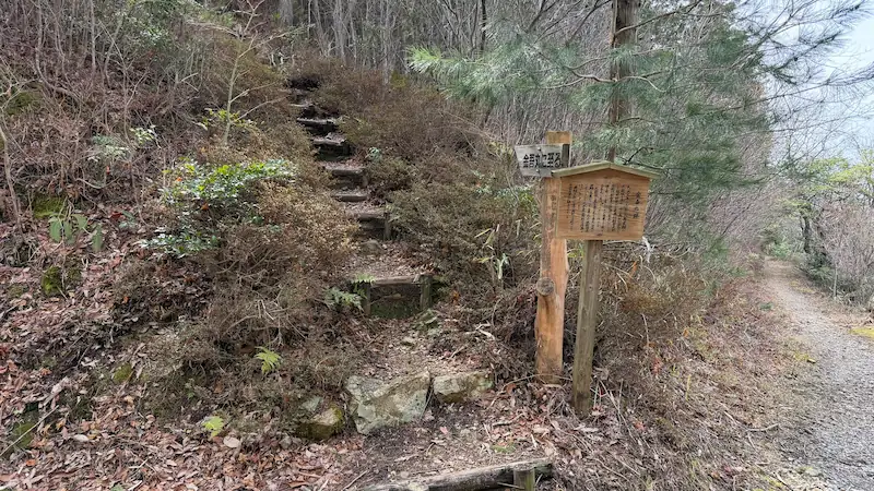
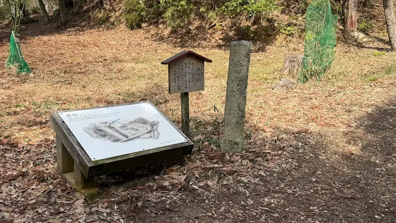
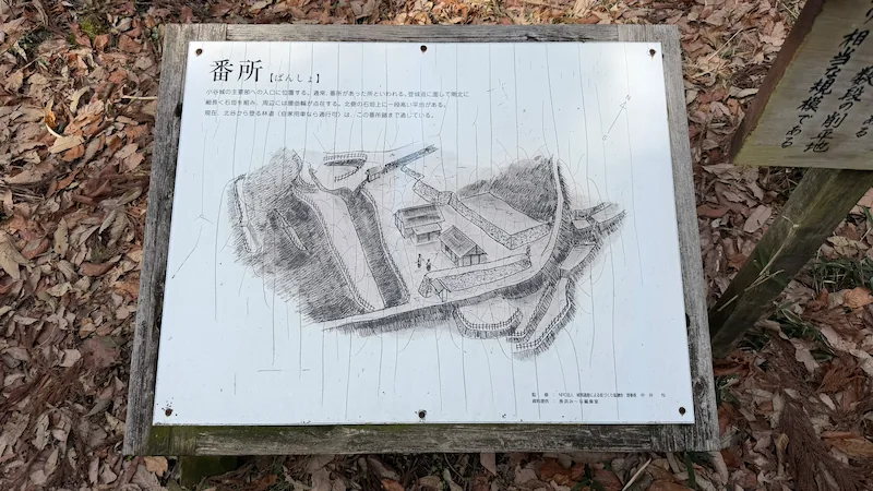
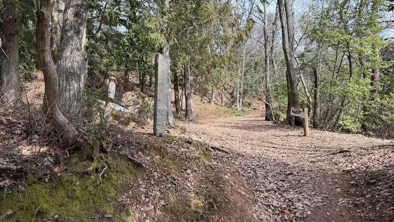
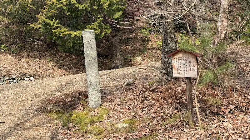
Bansho Guardhouse Site
Where the Ote route and Toragatani route meet — the entrance to the main-bailey area and the first defensive line.
Bansho was the entrance to Odani Castle’s main-bailey area, located where the Ote route and Toragatani route came together. In peacetime, it likely functioned as a place to check people entering the castle. In wartime, it became the first defensive line. The construction makes it clear that Odani was not merely a residence, but a mountain castle designed for real combat.
- Entrance to the main bailey: From here upward, the major baileys continue in sequence and Odani’s full defensive structure begins.
- Bow-shaped earthwork: The curving earthwork that controls the valley side shows Bansho’s military role.
- Seasonal tip: In winter, the earthworks and bailey outlines are easier to observe.

Quick visit: about 3 min / Slow visit: about 10 min
📷 View Bansho in 360° panoramic photos
🗺 Address: Odani Castle Ruins, near Bansho, Kohoku-cho Ibe, Nagahama, Shiga
🚶 Access: About 2 minutes on foot along the path from Kingomaru.
| Date | Unknown |
|---|---|
| Builder | Unknown |
| Features | An important bailey at the endpoint of the climbing route and Toragatani route, with a bow-shaped earthwork on the west and a rubble-filled earthwork on the climbing-route side. |
| Restoration history | A small bronze gorintō pagoda was excavated during environmental improvement works in 1970. |
| Current state | Bailey and earthworks survive. |
| Damage / loss | Abandoned after the fall of Odani Castle in 1573. |
| Status | Part of the National Historic Site “Odani Castle Ruins.” |
| Notes | Located near the current end of the forest road; the continuous main-bailey zone begins above this point. |
- Bansho likely served not only as a checkpoint but also as a front-line security post during a siege.
- During improvement works in 1970, a bronze gorintō only about 2 cm high was discovered.
Ochaya
Despite its gentle name, this was a military zone at the front of the main bailey, with a central earthwork and garden stones at the rear.
Ochaya is a single-level bailey just above Bansho. Its name may suggest a place for rest or hospitality, but in practice it was a highly military space supporting the front of the main bailey. The low earthwork in the center and garden stones at the back show that the place combined both defensive and formal qualities.
- Low earthwork: A low earthwork loosely divides the broad bailey, showing it was not a simple open space.
- Garden-stone traces: Although the area feels strongly military, traces of a garden-like element remain at the rear.
- Seasonal tip: Early summer brings dappled light, while autumn opens the forest floor and makes the size of the bailey easier to sense.
Quick visit: about 3 min / Slow visit: about 10 min
📷 View Ochaya in 360° panoramic photos
🗺 Address: Odani Castle Ruins, near Ochaya, Kohoku-cho Ibe, Nagahama, Shiga
🚶 Access: About 2 minutes on foot from Bansho.
| Date | Unknown |
|---|---|
| Builder | Unknown |
| Features | A single-level bailey immediately above Bansho, with a low earthwork dividing the center and garden stones placed at the rear. |
| Current state | Bailey, earthwork, and garden-stone-like remains survive. |
| Damage / loss | Abandoned after the fall of Odani Castle in 1573. |
| Status | Part of the National Historic Site “Odani Castle Ruins.” |
| Notes | Local signposts show it as 160 m from Bansho and 240 m from the Honmaru. |
- The name Ochaya sounds peaceful, but the site was actually a military position at the front of the main bailey.
- The local distance signs, 160 m from Bansho and 240 m to the Honmaru, are useful for understanding its position in the main-bailey zone.
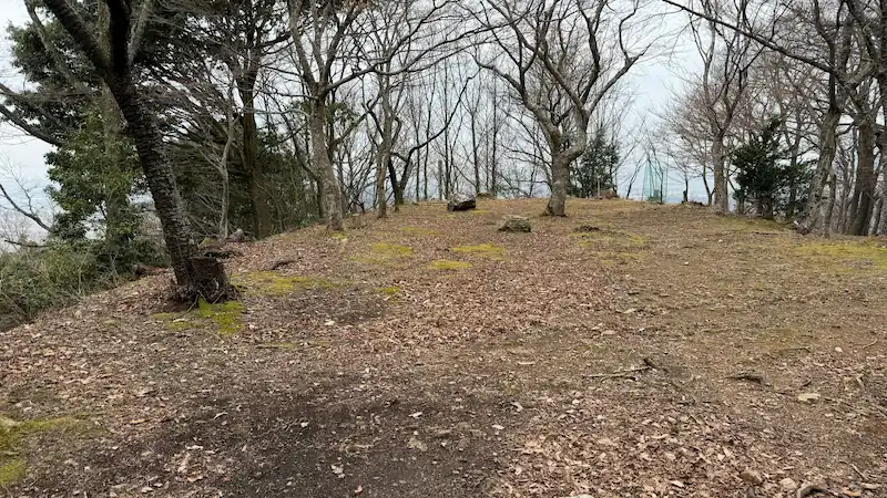
Oumaya
A forward bailey before the Honmaru, surrounded on three sides by high earthworks and opening views toward the northwestern plain.
Oumaya is a bailey above Ochaya, enclosed on three sides by high earthworks. It defended the front of the Honmaru and, during a siege, likely supported the movement of soldiers, horses, and supplies as a forward area.
- High earthworks on three sides: The more substantial construction makes its defensive role before the Honmaru easy to feel.
- Two entrances: Entrances at the northwest and northeast corners show the carefully planned movement routes typical of a mountain castle.
- Seasonal tip: On clear winter days, the view toward the northwestern plain opens up especially well.


Quick visit: about 5 min / Slow visit: about 10 min
📷 View Oumaya in 360° panoramic photos
🗺 Address: Odani Castle Ruins, near Oumaya, Kohoku-cho Ibe, Nagahama, Shiga
🚶 Access: About 3 minutes on foot from Ochaya.
| Date | Unknown |
|---|---|
| Builder | Unknown |
| Features | A bailey enclosed on three sides by high earthworks about 2 m tall, with entrances at the northwest and northeast corners. |
| Current state | Bailey, high earthworks, and entrances remain. |
| Damage / loss | Abandoned after the fall of Odani Castle in 1573. |
| Status | Part of the National Historic Site “Odani Castle Ruins.” |
| Notes | The top of the earthwork offers a good view toward the northwestern plain. |
- Although the name Oumaya suggests a stable, the remains indicate a highly defensive bailey rather than a simple horse stable.
- Nearby Uma-arai Pond helps explain this area as a unit combining water access and defense.
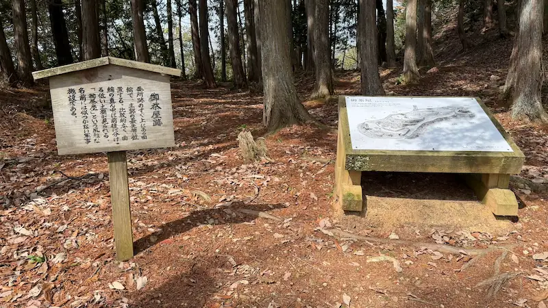
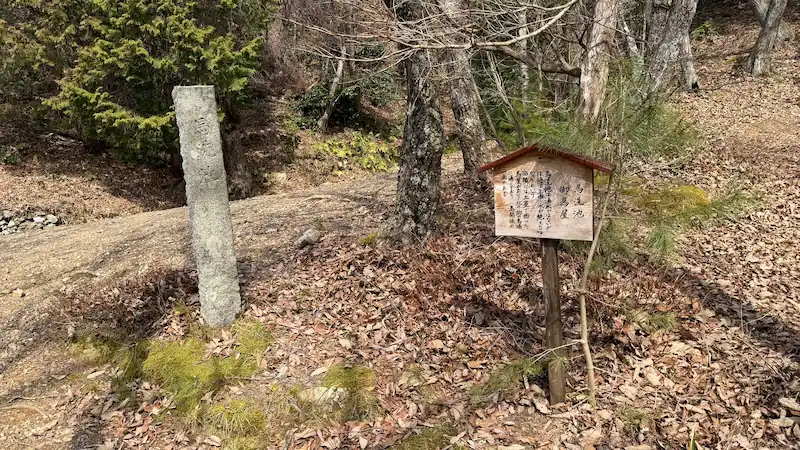
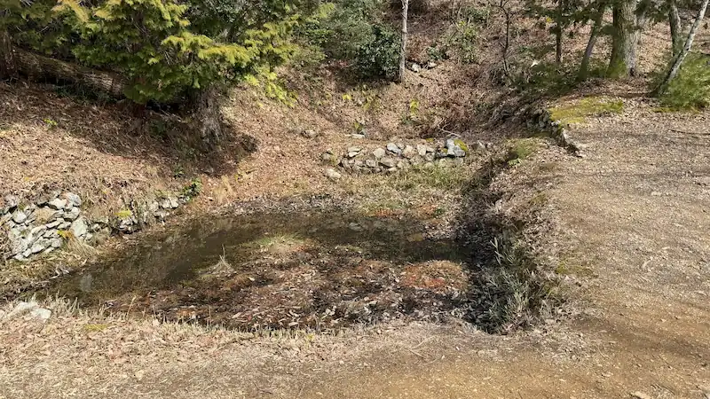
Uma-arai-ba | Uma-arai Pond Site
A stone-lined reservoir cut into the bedrock — a vital water facility for a mountain castle.
Uma-arai-ba, known on-site as Uma-arai Pond Site, is a stone-lined reservoir. It was built beside the northeastern entrance of Oumaya and played the practical role of securing water inside the mountain castle. During a siege, water facilities like this were indispensable.
- Stone-lined pond: Such a well-built water facility on the mountain reveals how thoroughly Odani Castle was prepared.
- Central partition: The stone partition inside the pond shows that it was not just a natural puddle.
- Seasonal tip: In rainy periods, water may remain and the shape of the pond becomes easier to understand.

Quick visit: about 3 min / Slow visit: about 10 min
📷 View Uma-arai-ba / Uma-arai Pond Site in 360° panoramic photos
🗺 Address: Odani Castle Ruins, near Uma-arai-ba, Kohoku-cho Ibe, Nagahama, Shiga
🚶 Access: About 3 minutes on foot from Oumaya.
| Date | Unknown |
|---|---|
| Builder | Unknown |
| Features | A moat-like reservoir beside Oumaya’s northeast entrance. It measures about 9 m north-south and 6.6 m east-west, with small-stone lining on all sides and a stone-wall partition slightly east of center. |
| Current state | Pond remains and stone lining survive. |
| Damage / loss | Abandoned after the fall of Odani Castle in 1573. |
| Status | Part of the National Historic Site “Odani Castle Ruins.” |
| Notes | The on-site name is Uma-arai Pond Site. It may have served not only horses but also the broader water needs of the castle. |
- Despite the name “horse-washing place,” the facility may also have functioned as daily-use and defensive water storage during a siege.
- Its measurements — about 9 m north-south and 6.6 m east-west — are unusually specific for a mountain-castle pond.
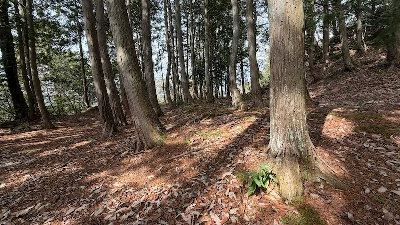
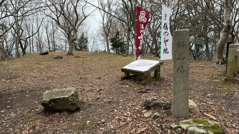
Sakurababa
A two-tiered bailey in front of Ohiroma, with views over the Kohoku Plain and Lake Biwa.
Sakurababa is a two-tiered bailey above Oumaya and in front of Ohiroma. Foundation stones have been confirmed on the western bailey, suggesting a space with both function and status close to the main castle core. From the tip, you can look out over the Kohoku Plain and Lake Biwa. With a memorial tower standing in a quiet corner, it is easy to understand why many visitors pause here.
- Two-tiered bailey: The difference in height between the front and rear sections makes the density of the castle core easier to feel.
- View of the Kohoku Plain: It is one of the more open viewpoints in Odani Castle, helping visitors sense the geography the castle controlled.
- Seasonal tip: In spring, the name Sakurababa comes alive with cherry blossoms; in autumn, the Kohoku landscape opens through the foliage.
Quick visit: about 3 min / Slow visit: about 10 min
📷 View Sakurababa in 360° panoramic photos
🗺 Address: Odani Castle Ruins, near Sakurababa, Kohoku-cho Ibe, Nagahama, Shiga
🚶 Access: About 5 minutes on foot from Uma-arai-ba.
| Date | Unknown; established by the early Sengoku period. |
|---|---|
| Builder | Unknown; developed by the Azai clan. |
| Features | An east-west two-tiered bailey. Building foundation stones have been confirmed on the western side, and the tip offers good views of the plain and Lake Biwa. |
| Current state | Two-tiered bailey, traces of foundation stones, and memorial tower remain. |
| Damage / loss | Abandoned after the fall of Odani Castle in 1573. |
| Status | Part of the National Historic Site “Odani Castle Ruins.” |
| Notes | A viewpoint overlooking the Kohoku Plain and Lake Biwa, located in front of Ohiroma. |
- Because of its view and quiet atmosphere, Sakurababa often feels like a natural pause before entering the deeper main-bailey area.
- The presence of building foundation stones suggests this was more than a scenic open terrace.
Other Odani Castle Related Pages
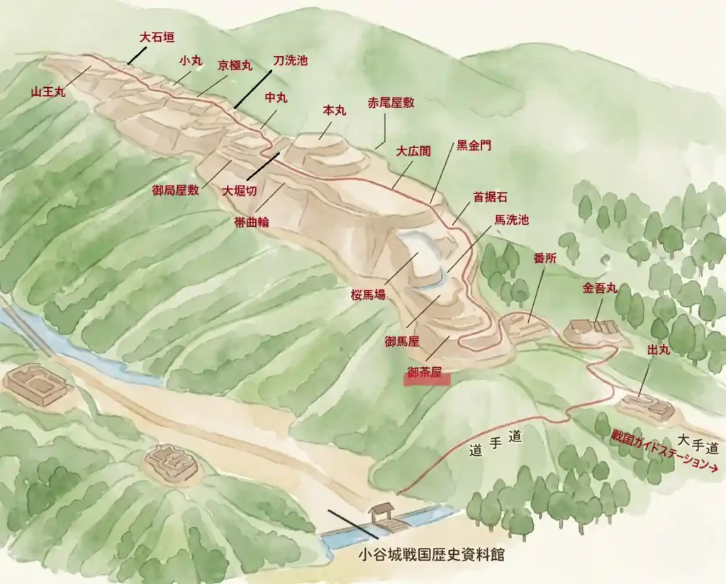
For the main-bailey route from Kubisue-ishi to Sannomaru, see this guide page. The 360° panoramic photos are available in Part 1 and Part 2. For basic information and access, see the Odani Castle Ruins main guide.
*This article is based on field research and materials such as Nagahama City preservation and management plans. Opening days and fees may change. There are no shops or toilets on the mountain. Prepare shoes with good grip, rain gear, and drinking water before setting out.
comment